Denniswalkcamino
Viviendo el sueno
- Time of past OR future Camino
- CF,CP,VDLP,CI,CS,CN
Does anyone have a High-res digital map of Spain? I want to print it out and dot it with where I walked. Thank you
| For 2024 Pilgrims: €50,- donation = 1 year with no ads on the forum + 90% off any 2024 Guide. More here. (Discount code sent to you by Private Message after your donation) |
|---|

Why not buy a paper map or series of paper maps and dot those. You will have to buy large scale maps if you want to go to trail level.Does anyone have a High-res digital map of Spain? I want to print it out and dot it with where I walked. Thank you
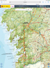
Sounds like a great idea, I will give google earth a try!. thanksDefinitely Iberpix as @Peregrinopaul suggests. Note that there are different layers (“capas”) in addition to the topographic map shown in this thread. I find the current Iberpix version less intuitive than previous ones but there are explanatory videos on YouTube.
Depending on your intended purpose, there is also Google Earth Pro. You can mark points or draw a path and export or print the image. I have done this (printed on paper as well as stored in digital form on iPad) and used it when I wanted to show family or friends where I’ve walked.
Thanks Paul. Appreciate your maps.You could download the IGN topographic map
Iberpix
Iberpix es un visualizador cartográfico publicado por el Centro Nacional de Información Geográfico (CNIG) y el Instituto Geográfico Nacional de España (IGN) que tiene como objetivo la consulta y visualización de mapas y capas de información geográfica.www.ign.es
zoom in to the scale that gives this resolution
View attachment 142286
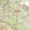
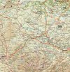
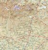
This will give you the CF in six separate sheets, cropped to remove titles etc. They look like this.
View attachment 142287 View attachment 142288 View attachment 142289 View attachment 142290 View attachment 142291
the sixth one being the uncropped one above (Santiago).
Not sure if this is what you’r looking for.
One last idea: National Geographic has a nice map of northern Spain with Frances and Norte routes. I use it for planning and show-and-tell.Thanks everyone for the suggestions.
The east half is on one side and the west on the other side though.One last idea: National Geographic has a nice map of northern Spain with Frances and Norte routes. I use it for planning and show-and-tell.
Maybe buy two and some scotch tape?The east half is on one side and the west on the other side though.
I'm picturing Dennis at a wall completely covered with a map of northern Spain pointing to a little spur off the track of the Camino and saying "And this is the place where I wandered off the trail to rescue a tree that needed watering."Of course, if you recorded your route you could overlay it on the map before printing. It would also show you getting lost and jumping in taxis and busses, so maybe some editing could be needed....

