• For 2024 Pilgrims: €50,- donation = 1 year with no ads on the forum + 90% off any 2024 Guide. More here.
    (Discount code sent to you by Private Message after your donation)
  • ⚠️ Emergency contact in Spain - Dial 112 and AlertCops app. More on this here.

Search 69,459 Camino Questions

Alternative Route down from Portillo San Miguel (Vitoria Gasteiz - La Puebla de Arganzon stage)

roving_rufus

Veteran Member
Time of past OR future Camino
Frances (2013-2015) Portugues (2017-2019) Via Francigena (2018-??) Camino from Ireland (2020-??)
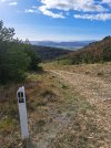
I meant to add this link ages ago - Its on the stage between Vitoria Gasteiz to La Puebla de Arganzon and is the alternative marked route down. It does skip Villanueva de la Oca but it also avoids the steep rocky descent. I walked it Janaury 2023 and it was well marked - (yellow arrows and white posts). Initially it follows a path along the ridge before joining a track beside a gas pipeline and dropping down (initially a little steep)

 
3rd Edition. More content, training & pack guides avoid common mistakes, bed bugs etc
I am struggling to upload photos for some reason - I will try again tomorrow
But yes it's the 2nd set of electric pylons that the route turns downhill but there is a gas pipeline marked with yellow signs that runs alongside the track. It wasn't very steep- a little steep initially (though maybe it was more the damage done by some heavy duty vehicles that is clouding my memory) but then very easy downhill!
@roving_rufus , I did this in 2019, but turned at a power line down from the ridge; in fact there was a fletcha on the pylon. It was not very steep at all. Is this where you went, or was it farther along?
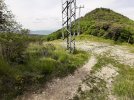
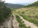
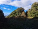
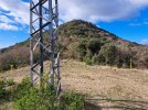
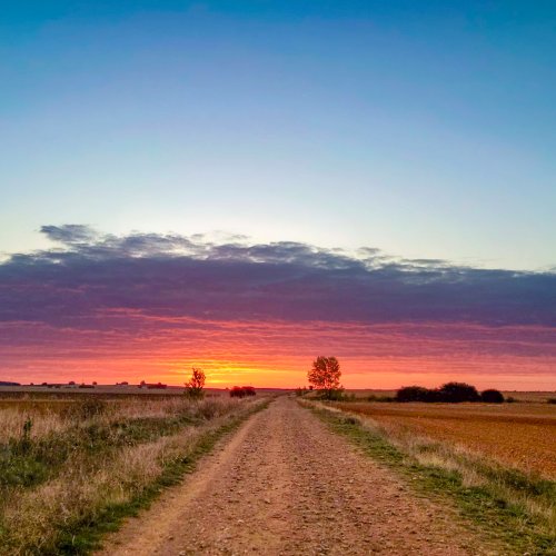
View attachment 151811View attachment 151812
 
3rd Edition. More content, training & pack guides avoid common mistakes, bed bugs etc
Finally think I have the issue figured out to actually upload photos of route

(1) At top of climb turn right on small path through trees - marked by yellow arrows
20230109_120508.jpg

(2) immediately reach electric pylon but keep straight on on a narrow dirt path (this follows tge ridge line). From here there are white poles with camino markers as it is an alternate route.20230109_120559.jpg

(3) in about 750m you will come to a junction at more electric pylons and a buried gas pipeline (yellow markers). Turn left on track downhill along the pipeline- arrows and white marker poles. And admire the views
20230109_122117.jpg

20230109_122152.jpg

(4) stay on main track for 1.5km to a t-junction where you turn left and shortly at crossroads turn right on track. This leads to a road shortly before the motorway and where you rejoin the other route from Villanueva de la Oca
 
It was perfect. My only comment is that the place you turn right to take the cycle route was clearly marked with a yellow X. I wasn’t entirely sure I had reached the pass as the ascent had occasional dips. The clue was that all the tread marks of bikes turned right at the yellow X, and then 10 meters along I could clearly see the relatively new white Camino posts indicating a correct bike path. As several folks in the preceding village had warned me about the “dangerous”descent - looking at me rather pityingly as a solitary, not exactly young pilgrim - I super enjoyed the adventure of the cycling route. Thank you!
 
A selection of Camino Jewellery

❓How to ask a question

How to post a new question on the Camino Forum.

Forum Rules

Forum Rules

Camino Updates on YouTube

Camino Conversations

Most downloaded Resources

This site is run by Ivar at

in Santiago de Compostela.
This site participates in the Amazon Affiliate program, designed to provide a means for Ivar to earn fees by linking to Amazon
Official Camino Passport (Credential) | 2024 Camino Guides
Back
Top