• For 2024 Pilgrims: €50,- donation = 1 year with no ads on the forum + 90% off any 2024 Guide. More here.
    (Discount code sent to you by Private Message after your donation)

Search 69,459 Camino Questions

Camino del Norte GPS

Time of past OR future Camino
Frances 2016, del Norte 2019
We are headed out on the Norte in mid-June. On the Frances we just used the maps in the Brierley guidebook and when we had questions about yellow arrows. So far we have the Cicerone guide, and Camino Places and Gronze apps. On the Norte, we are hoping to do some of the coastal alternatives. I confess that I don't even know what a GPS track is, how it works on one's phone, and how to find them for the Norte. Any basic help appreciated! Thanks.
 
Get a spanish phone number with Airalo. eSim, so no physical SIM card. Easy to use app to add more funds if needed.
The Wise Pilgrim app is recommended. (Other apps are available)

Find a teenager in your extended family or neighbourhood who can spare 10 minutes to download, activate and explain the functions to you. Bribery or threats may be required but keep your head up. We can do things they haven't even thought of yet...
 
Get a spanish phone number with Airalo. eSim, so no physical SIM card. Easy to use app to add more funds if needed.
Haven't found the cell phone type. So app recommendation can be misleading.

As you have no clue about that technical stuff, look for a good hiking map, which can already show the hiking trails or a special guide like wise pilgrim. So you don't need to dive in the technical stuff.

I find OSMAnd (Android) acceptable (almost easy) for a start. Offline maps can be downloaded from within the app and the hiking view shows most trails, supermarkets, albergues and restaurant. It can also route me to the next albergue offline. So I can put the phone in flight mode and save battery / data costs.
"routing" is the answer to the situation "I'm lost! Ho do I get to the next ...".

A track is just a list of coordinates. Most apps show you this as e.g. red line on the map and put some icon for your current position. So you can check if you are on that track or not. The most easiest track is only the coordinates of village A and B. The result wil be a straight line between A and B. Good tracks have several hundred positions and follow all curves of the way.
The coordinates will be usually collected in the same apps that you use to view them. Some people walk the trail and share it on wikiloc.com and other sharing platforms, others just plan their next trip and "paint" these tracks with some tools and store it also. "Paintings" can be beautiful, but not all come close to reality.
 
Thanks for the replies. I have the Wise Pilgrim app for the Norte (now called Wisely) and can use those maps. I am talking about downloading GPS tracks for alternative coastal deviations on the Norte.
 
St James' Way - Self-guided 4-7 day Walking Packages, Reading to Southampton, 110 kms
Haven't found the cell phone type. So app recommendation can be misleading.

As you have no clue about that technical stuff, look for a good hiking map, which can already show the hiking trails or a special guide like wise pilgrim. So you don't need to dive in the technical stuff.

I find OSMAnd (Android) acceptable (almost easy) for a start. Offline maps can be downloaded from within the app and the hiking view shows most trails, supermarkets, albergues and restaurant. It can also route me to the next albergue offline. So I can put the phone in flight mode and save battery / data costs.
"routing" is the answer to the situation "I'm lost! Ho do I get to the next ...".

A track is just a list of coordinates. Most apps show you this as e.g. red line on the map and put some icon for your current position. So you can check if you are on that track or not. The most easiest track is only the coordinates of village A and B. The result wil be a straight line between A and B. Good tracks have several hundred positions and follow all curves of the way.
The coordinates will be usually collected in the same apps that you use to view them. Some people walk the trail and share it on wikiloc.com and other sharing platforms, others just plan their next trip and "paint" these tracks with some tools and store it also. "Paintings" can be beautiful, but not all come close to reality.
Thanks, I am competent at using the Wise Pilgrim app, have it already. Is there an OSMAnd app for Iphone?
 
I have the Wise Pilgrim app. I am interested in downloading GPS tracks for alternantive coastal routes for the Norte which several folks have mentioned...
 
Hi Holly,

You can find a PDF summary, and GPS tracks for certain sections, on this thread.
 
The one from Galicia (the round) and the one from Castilla & Leon. Individually numbered and made by the same people that make the ones you see on your walk.
Thanks so much, I have the PDF, just wondering do you join Wikilocks and then download these "tracks" to your app? That is the part I am confused about.

Oh dear, we're not being very helpful, are we? 😂

I'm afraid I really don't know... All I know is that you don't need to plan much to take the shoreline alternatives - you can just assume that often, but not always, there's a path that goes along the shoreline as opposed to the road. Laurie's PDF should be sufficient, it just tells you where you have options. The paths themselves aren't hidden, they're usually just the local trails along the shoreline between the smaller towns.

But maybe someone on here will have more helpful advice on downloading the tracks. Sorry!
 
For the tracks, you can find them in www.rayyrosa.com. The site is in Spanish, but you can use google for translation. Also, in rayyrosa, you will find how to download the tracks to your mobile. Anyway, that advice to find a teenager with 10 minutes of free time would be best.! 😂

If you want to find the track for a specific alternative, you can also try wikiloc. I would say that they have tracks for most of the routes in the Camino.

Buen Camino & Ultreia!!
 
Join our full-service guided tour of the Basque Country and let us pamper you!
The ViewRanger app is good and often used by hikers. You can download routes for all kinds of walks/hikes/cycles for free (or for €€). The base map is free based on OSM openstreetmap. You can search and find routes to download with ViewRanger. You can follow routes on map or use them more as guideline and take different route options.

The first 15 Camino Norte stages are there in ViewRanger for free. I am doing part of this Camino in June and will be using these routes to help me find the way! :)

You can also see ViewRanger routes on internet and edit/prepare your own hiking routes.

e.g. 01-Irun-San Sebastian (27.1 km)
25.22 km
e.g. 03-Zarautz-Deba (22.6 km) Jean-François Maes
https://my.viewranger.com/route/details/MTM5MTAyMA==

Bring a battery booster and don't just rely on the phone map so that you can navigate in case phone has a problem!
 
Hi all,

We have fresh versions of gpx tracks for the Norte and Primitivo available for free download here: https://www.cicerone.co.uk/the-camino-del-norte-and-camino-primitivo-third

Just scroll down to the "downloads" tab. You'll have to create a free account with Cicerone to access them, but they're all synced up with the new third edition of the guide. I'll be walking the Norte (to Villaviciosa) and Primitivo again beginning late this month and will update anything that has changed in early August.

Dave
 
We are headed out on the Norte in mid-June. On the Frances we just used the maps in the Brierley guidebook and when we had questions about yellow arrows. So far we have the Cicerone guide, and Camino Places and Gronze apps. On the Norte, we are hoping to do some of the coastal alternatives. I confess that I don't even know what a GPS track is, how it works on one's phone, and how to find them for the Norte. Any basic help appreciated! Thanks.

There are several apps (both for Adroid and IOS) you can use. You can also use a .gpx track to download into your phone. The website of Ray and Rosa offers a free download ('track completo del camino del norte'):

On wikiloc.com you can also find the individual tracks of all the stages (also free downloads):
 
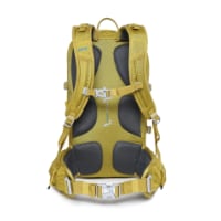
Technical backpack for day trips with backpack cover and internal compartment for the hydration bladder. Ideal daypack for excursions where we need a medium capacity backpack. The back with Air Flow System creates large air channels that will keep our back as cool as possible.

€83,-

Most read last week in this forum

Everyone talks about the wonderful café con leche, but what if tea is more to your liking? Can you even get tea along the Camino (Frances)? I don’t drink coffee but my morning cup of tea is...
Hey all. I haven't been on the forum for quite sometime (years probably). I walked the Camino Frances in 2016 and to say it was life changing for me is an understatement. On day 3, at the café at...
When you stop at a bar for a beer, wine, coffee or bite to eat, and sit at a table, is it expected that you will return your dirty dishes up to the bar before you leave? I alway do, as it seems...
I am just back from a few weeks on the Via the la Plata. Since 2015 I have been nearly every year in Spain walking caminoroutes I loved the café con leches. This year I did not like them as much...
Let me preface this by saying please understand I am not picking on anybody, I fully understand that mistakes happen and how. Been there, done that. I have been astonished to see so many lost...
Hi! I just want to know if anyone had any success (or trouble conversely on that matter) using your Visa Debit Card with 6-digit PIN when withdrawing Euros in ATMs in France and Spain? Just want...

❓How to ask a question

How to post a new question on the Camino Forum.

Similar threads

Forum Rules

Forum Rules

Camino Updates on YouTube

Camino Conversations

Most downloaded Resources

This site is run by Ivar at

in Santiago de Compostela.
This site participates in the Amazon Affiliate program, designed to provide a means for Ivar to earn fees by linking to Amazon
Official Camino Passport (Credential) | 2024 Camino Guides
Back
Top