- Time of past OR future Camino
- First: Camino Francés 2002; most recent: Norte/Primitivo 2019
Admittedly, the walk from Santander to Boo de Piélagos isn't the most exciting part of the Norte. It's inland and paved pretty much the whole way.
Well, there's an alternative. And it's really fun. There are no waymarks, but it's possible to follow the coast all the way around, following footpaths much of the way. Admittedly, it's much longer, spanning some ~31km between Santander and Boo (as opposed to the 13-14km via the direct route, but if you want coastal footpath, this delivers.
One of the immediate advantages of this approach is that it allows you to really see Santander. Many pilgrims arrive at the ferry dock, march to the cathedral and albergue, and see little more than the surrounding area. However, this route leads you east from the dock, following the bay and then passing the closest beach to the center, the Playa de Peligros. Cut inland just before the Península de la Magdalena (unless you have the time to make a quick loop, which is highly recommended!) and proceed past the bigger Playa del Sardinero. It's possible to follow the beach through this next stretch, or to follow first a coastal promenade and later the sidewalk. Near the end of the beach, there's a roundabout. Go straight north out of the roundabout, joining a staircase that will lead you up to a pedestrian walkway on the bluff, passing around public gardens, a golf course, and the Playa de Mataleñas. From there, you have a short stretch on a paved road, turning right onto it in front of some public restrooms, before forking right through a gate a short time later and crossing a field towards some steps leading up to the Faro de Cabo Mayor (lighthouse). At this point, you're 7.3km from the Santander ferry dock.
As you wrap around the lighthouse, fork right onto a footpath just before the parking lot for the adjacent cafe. From here, you're on a great coastal walkway. You'll briefly join pavement behind a soccer field, but then you'll fork offroad again, passing a small coastal shrine soon after. Roughly 4km from the lighthouse, you'll pass by the Instituto Español de Oceanografia, along with some other houses. The trail becomes less clear in this area, and quite rocky in places, but just hold to the coastline and the trail will return before too long, leading you past the Centro de Interpretación del Litoral La Maruca. After walking through a parking lot comes a trickier navigational stretch: turn left through a park, climbing steps uphill. You'll keep straight on a minor road, passing between two bars (they don't open early). Take the first right, and then fork right again soon after. This will descend to a pedestrian bridge over the river, after which you'll continue to follow this minor road uphill. Take the second right (the first paved option), and this will push you back out to the coast, wrapping around the Punta Pinquel.
Eventually, that trail comes to a T, where you have to scramble up an embankment onto a dirt road. Turning right leads you to a dead end (unless you're prepared for a bit of a scramble and some property rights violations), so turn left and fork right soon after, on a trail likely to be a bit overgrown. This leads you straight to a cemetery. You're road-bound for the next stretch, proceeding behind the cemetery, past a camping, and then out to the parking lot for the Ermita de la Virgen del Mar. The ermita is perched on a lovely spot, there's a beach, and there are a couple of bars, including the British Imperial-style Bambara Tavern. This is roughly 18.5km from Santander (distances are approximate because I need to tidy up my gps tracks before nailing them down with precision). Incidentally, in the summer a bus runs between here and the city center, so it would also be possible to do this as a day-trip.
Follow a dirt road out the northwest corner of the parking lot and after some initial wiggliness the route proceeds in roughly a straight line. It's a dirt road for a bit, then paved, then a dirt road again and finally a foot path. Just before you intersect a new housing community and a stone road, fork right onto another dirt road. Soon after you'll join a nice coastal walkway that will lead down to a pedestrian bridge and into Urbanización La Concha. Turn left through a park and then loop around a beach, passing by a couple of bars along a road, as well as Posada La Morena, where it would be possible to spend the night. Follow the road as it loops around the beach. Just before a fence begins on your left, turn left and climb straight up the hill, along a minor footpath and over a rock face. It's steep at first, but mellows out soon after when you're rewarded with great views--you can see all the way back to the lighthouse and much of what's ahead. You'll follow a good dirt road through this stretch. As you approach the striking Isla del Castro, though, fork right onto a smaller footpath.
This next stretch is tricky. Soon after passing by a beach access point, turn left uphill then immediately after fork right. Join a dirt road and then soon after fork right on a footpath following the cliff's edge. The next km is a fantastic walk along a cliff with fantastic views. As you approach Liencres and the Playa del Portio, you'll need to turn left off the trail and descend to a paved road, which you'll follow into town. After curving inland on the road, take the first right and then turn left at a T. At the next T, turn right, following signs for the Senda Ciclabe (the center of Liencres is to your left, with restaurants and hotels). Half a km later, fork left. You'll see a sign for Urbanización Somacueva, but that's the only marker of any kind. Fork right when this road splits and then KSO as it becomes a dirt road. A km later, the dirt road splits. Fork right and then fork right again onto a footpath if you want to remain near the coast. Alternately, fork left and then turn right on a paved road (restricted use--walkers/bikers) if you're tired and want something a little easier. Regardless of which approach you take, you'll emerge in the parking lot for the Playa de Liencres and the Parque Natural Dunas. There are a couple of bars here and a fountain at the parking lot entrance/exit (for cars).
To continue, proceed out the far side of the parking lot and join the minor highway. Fortunately, there's a pedestrian trail in the trees on the left side of the highway, so you can enjoy a pleasant walk there. 1.5km later, turn right onto a busier highway, which you'll follow for just under 2km into Boo. While it's a highway with some quick car traffic, it also offers great views of the dunes and the coast, so it's not so bad!
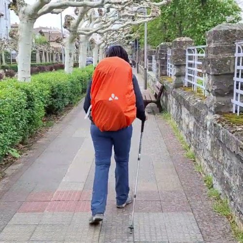
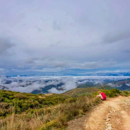
All in all, a thoroughly enjoyable walk! We'll have a gps track and map available later on, but I wanted to post this now for anyone who's passing through soon and wants an offroad alternative. (I was inspired by this track, which gets you part of the way, though I didn't follow it precisely.) I uploaded some pics of the route here.
Well, there's an alternative. And it's really fun. There are no waymarks, but it's possible to follow the coast all the way around, following footpaths much of the way. Admittedly, it's much longer, spanning some ~31km between Santander and Boo (as opposed to the 13-14km via the direct route, but if you want coastal footpath, this delivers.
One of the immediate advantages of this approach is that it allows you to really see Santander. Many pilgrims arrive at the ferry dock, march to the cathedral and albergue, and see little more than the surrounding area. However, this route leads you east from the dock, following the bay and then passing the closest beach to the center, the Playa de Peligros. Cut inland just before the Península de la Magdalena (unless you have the time to make a quick loop, which is highly recommended!) and proceed past the bigger Playa del Sardinero. It's possible to follow the beach through this next stretch, or to follow first a coastal promenade and later the sidewalk. Near the end of the beach, there's a roundabout. Go straight north out of the roundabout, joining a staircase that will lead you up to a pedestrian walkway on the bluff, passing around public gardens, a golf course, and the Playa de Mataleñas. From there, you have a short stretch on a paved road, turning right onto it in front of some public restrooms, before forking right through a gate a short time later and crossing a field towards some steps leading up to the Faro de Cabo Mayor (lighthouse). At this point, you're 7.3km from the Santander ferry dock.
As you wrap around the lighthouse, fork right onto a footpath just before the parking lot for the adjacent cafe. From here, you're on a great coastal walkway. You'll briefly join pavement behind a soccer field, but then you'll fork offroad again, passing a small coastal shrine soon after. Roughly 4km from the lighthouse, you'll pass by the Instituto Español de Oceanografia, along with some other houses. The trail becomes less clear in this area, and quite rocky in places, but just hold to the coastline and the trail will return before too long, leading you past the Centro de Interpretación del Litoral La Maruca. After walking through a parking lot comes a trickier navigational stretch: turn left through a park, climbing steps uphill. You'll keep straight on a minor road, passing between two bars (they don't open early). Take the first right, and then fork right again soon after. This will descend to a pedestrian bridge over the river, after which you'll continue to follow this minor road uphill. Take the second right (the first paved option), and this will push you back out to the coast, wrapping around the Punta Pinquel.
Eventually, that trail comes to a T, where you have to scramble up an embankment onto a dirt road. Turning right leads you to a dead end (unless you're prepared for a bit of a scramble and some property rights violations), so turn left and fork right soon after, on a trail likely to be a bit overgrown. This leads you straight to a cemetery. You're road-bound for the next stretch, proceeding behind the cemetery, past a camping, and then out to the parking lot for the Ermita de la Virgen del Mar. The ermita is perched on a lovely spot, there's a beach, and there are a couple of bars, including the British Imperial-style Bambara Tavern. This is roughly 18.5km from Santander (distances are approximate because I need to tidy up my gps tracks before nailing them down with precision). Incidentally, in the summer a bus runs between here and the city center, so it would also be possible to do this as a day-trip.
Follow a dirt road out the northwest corner of the parking lot and after some initial wiggliness the route proceeds in roughly a straight line. It's a dirt road for a bit, then paved, then a dirt road again and finally a foot path. Just before you intersect a new housing community and a stone road, fork right onto another dirt road. Soon after you'll join a nice coastal walkway that will lead down to a pedestrian bridge and into Urbanización La Concha. Turn left through a park and then loop around a beach, passing by a couple of bars along a road, as well as Posada La Morena, where it would be possible to spend the night. Follow the road as it loops around the beach. Just before a fence begins on your left, turn left and climb straight up the hill, along a minor footpath and over a rock face. It's steep at first, but mellows out soon after when you're rewarded with great views--you can see all the way back to the lighthouse and much of what's ahead. You'll follow a good dirt road through this stretch. As you approach the striking Isla del Castro, though, fork right onto a smaller footpath.
This next stretch is tricky. Soon after passing by a beach access point, turn left uphill then immediately after fork right. Join a dirt road and then soon after fork right on a footpath following the cliff's edge. The next km is a fantastic walk along a cliff with fantastic views. As you approach Liencres and the Playa del Portio, you'll need to turn left off the trail and descend to a paved road, which you'll follow into town. After curving inland on the road, take the first right and then turn left at a T. At the next T, turn right, following signs for the Senda Ciclabe (the center of Liencres is to your left, with restaurants and hotels). Half a km later, fork left. You'll see a sign for Urbanización Somacueva, but that's the only marker of any kind. Fork right when this road splits and then KSO as it becomes a dirt road. A km later, the dirt road splits. Fork right and then fork right again onto a footpath if you want to remain near the coast. Alternately, fork left and then turn right on a paved road (restricted use--walkers/bikers) if you're tired and want something a little easier. Regardless of which approach you take, you'll emerge in the parking lot for the Playa de Liencres and the Parque Natural Dunas. There are a couple of bars here and a fountain at the parking lot entrance/exit (for cars).
To continue, proceed out the far side of the parking lot and join the minor highway. Fortunately, there's a pedestrian trail in the trees on the left side of the highway, so you can enjoy a pleasant walk there. 1.5km later, turn right onto a busier highway, which you'll follow for just under 2km into Boo. While it's a highway with some quick car traffic, it also offers great views of the dunes and the coast, so it's not so bad!
All in all, a thoroughly enjoyable walk! We'll have a gps track and map available later on, but I wanted to post this now for anyone who's passing through soon and wants an offroad alternative. (I was inspired by this track, which gets you part of the way, though I didn't follow it precisely.) I uploaded some pics of the route here.


 I am in Santillana del M now. Nice little quirky town but mainly for tourist. Very hot today 27 was not expecting that.


 can't believe no one takes this path