• For 2024 Pilgrims: €50,- donation = 1 year with no ads on the forum + 90% off any 2024 Guide. More here.
    (Discount code sent to you by Private Message after your donation)
  • ⚠️ Emergency contact in Spain - Dial 112 and AlertCops app. More on this here.

Search 69,459 Camino Questions

Questions about the Vía Serrana

peregrina2000

Moderator
Staff member
I’m starting to look more closely at Via Serrana. There are great resources on the forum, and I am digging in. I will put all my questions in this thread and try to make clear which stages I’m talking about.

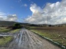
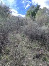
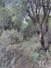
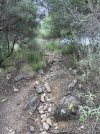
Day 1, La Línea to San Martín. Looks like it involves some acrobatics.

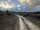
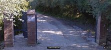
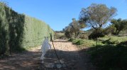
Everyone talks about climbing over the closed gate. Based on the pictures I see, I bet it will be a challenge for those of us in our 70s. Any tips on managing that, other than bringing wire cutters to go through the wire fence on the side? :p

The other potential challenge is figuring out what to do if the Río Hozgarganta is too high and impassable, as it was for @Umwandert. This is about 4-5 km before San Martín, I think. How high is too high to be impassable, do you think? I have read that it is slippery and I know that we’ll make a decision on the spot, but if you’ve successfully crossed it with water, can you estimate the height of the water?

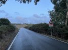
There seem to be two options if we decide not to cross. Both involve going back to “where the chain prevents vehicle entry.” Then if you turn right (with your back to the river, you have a 9-km detour on the road. That’s what @Umwandert did, I think. The other is a shorter option - at the chain, head to the left (again with back facing the river) and cross the Puente Colgante de San Martín. Pictures here.

I am pretty sure I would not enjoy this crossing, but it looks like its structural integrity is in tact and that it would not be dangerous. Also, it seems high enough that it would not flood unless conditions were truly catastrophic.

Has anyone walked on the Puente Colgante de San Martín?

The author of this youtube didn’t climb over the gate (at about 6:25) but added serveral kms by going on the road. But he did cross the river though the flow looks non-trivial. (at about 9:15)
 
Last edited:
€2,-/day will present your project to thousands of visitors each day. All interested in the Camino de Santiago.
The 2024 Camino guides will be coming out little by little. Here is a collection of the ones that are out so far.
We just finished the VdlP in SdC yesterday after walking the Via Serrana in mid- to late September. Although I remember a whole lot of gates, I don't recall a single one that didn't open. So we never climbed a gate or a fence (except for a very bad day into Coripe resulting from getting off the Via Serrana route).

We had no problems with water crossings, but Spain was in drought then, so our experience may not have been typical.

As an aside, I can't count how many times we've told Spaniards that we started in La Linea de la Concepcion and they have corrected us that we really started in Cadiz. We haven't seen north of Sevilla a single map of Camino routes that includes the Via Serana. I think virtually nobody in Spain who doesn't live on the Via Serrana route has heard of it. Just sort of funny. At the Pilgrims Office in SdC yesterday, they just took our word that our route added 240 km to the VdlP (we've seen various distances), and they added it for the distance certificate.
 
So we never climbed a gate or a fence (except for a very bad day into Coripe resulting from getting off the Via Serrana route).
Thanks. This is so funny. In addition to jungleboy, the youtube video I’ve looked at also reports that it is closed. Maybe you found a way to open it that others have missed? If you have time, would you look at this picture to see if it jogs your memory?
 
A selection of Camino Jewellery
I remember some gates with multiple means of securing them, and at least a couple like the photo with colored rope/string used in securing them. We managed to get through them all without climbing any. I can't swear I remember that particular gate.

My notes show that we went through eight gates that first day - four what I would consider livestock gates (barbed wire, no hinge) and four with hinges. I have nothing about having to climb any gate.

We did get lost just outside of La Linea and didn't walk some of the first 2 km or just outside of the city. But from then on we followed the trail. When we had trouble, we followed GPS tracks that the Dutch Confraternity has posted on their website.
 
Thank you @peregrina2000 for this thread. I think this is the gate in question:

IMG_8181.jpg

It is not really high, I didn't find it difficult to overcome (also I didn't understand why it was locked, there were no animals behind it). On day 3 of the Via Serrana there was a much bigger closed gate to overcome (I think that's where the reports of landowners refusing passage come from).

As for the flooded passage, jungleboy, who had been there just two weeks before me, hadn't reported any problems, but when I reached the Rio Hozgarganta it looked quite dramatic:

IMG_8202.jpg


Of course I did not attempt to cross it. If anyone has a picture of this place in normal weather conditions I would love to see it. Unfortunately I did not know about the small suspension bridge to the east, which seems perfectly passable even in such conditions.

I really can't recommend my solution, the 9-km detour to the west. The first hour is on a remote dirt track, the second hour on a paved country road without shoulder and quite some traffic. A big disadvantage when you walk into dawn. I attach a few pics of this route. I ended up walking in complete darkness and was rescued by a resident of San Martin (a former pilgrim) who stopped his car and drove me to the village.

Here is my report of the first day of the Via Serrana. Yes, there are some challenges, but it is a lovely and recommendable camino! I would love to walk it again (next time in reverse).
 

Attachments

  • IMG_8205.jpg
    IMG_8205.jpg
    501.8 KB · Views: 43
  • IMG_8206.jpg
    IMG_8206.jpg
    470.2 KB · Views: 23
  • IMG_8212.jpg
    IMG_8212.jpg
    362 KB · Views: 25
Last edited:
Thanks for your explanations, @Umwandert . Now I think I can reconcile the various accounts.
It is not really high, I didn't find it difficult to overcome
Yes, it looks do-able for spry septuagenarians. It has those very convenient cross pieces.
Unfortunately I did not know about the small suspension bridge to the east,
Definitely a much better alternative than 9 km, in part with traffic!
 
Down bag (90/10 duvet) of 700 fills with 180 g (6.34 ounces) of filling. Mummy-shaped structure, ideal when you are looking for lightness with great heating performance.

€149,-
Yes, the gate was very securelay tied/locked. I’m quite sure there was room to slither under but I chose to go over. I’m only 5’3” and managed fine. As you see in Umwandert’s pic, on the right side there’s a horizontal bar that perfect for a step.

I walked up to the “river” crossing and decided that it wasn’t deep but fast-moving so did the walk around to the puente. It is a bit crumbly and bounces a great deal so you have to walk “softly”. It was a bit of an adventure! Luckily once you cross and head up to the road, you end up further down from where the river crossing was so you do make up a bit of extra mileage incurred if you have to backtrack to the bridge. If I was to go there again, I’d head straight for the bridge. As noted in the map shared by debsgetsout, the red line is the camino, while the blue line is the shortcut to the bridge….IMG_1193.jpeg
 
Day 2 - San Martín to Jimena de la Frontera

There have been many discussions about the impassable brambles on this stage, a few kms before the train station (Los Ángeles). Until I saw @debigetsout’s map, I was relying on google maps, which shows the road option as being 10 kms longer! Scrolling in, I do see a minor road, Calle Manilva, which makes that quite a bit shorter. I had mistakenly assumed that the Calle Manilva was the same route as the walking path (which goes through the Cañada Real Manilva), but they are two different places, I think. So that looks like a non-issue, thanks @debigetsout!

The map below shows the google maps option, which is very much longer than Debi’s option

IMG_1758.png

Debi’s map is below:

IMG_1759.jpeg

The youtube video at about 3 minutes shows some footage of the brambles. He went back to the road after fighting his way for a while. I remember that @jungleboy said he was sometimes in the clearing on the other side of the fence separating the camino from other property, and I think this video shows how he got there, maybe through a fence. But I think the better option is to take the option from @debigetsout.
 
Last edited:
€2,-/day will present your project to thousands of visitors each day. All interested in the Camino de Santiago.
That video matches my recollection of that stretch. I made it through eventually but there was a lot of walking through brambles, going over and under fences etc without a proper path, so it was not exactly enjoyable.
Thanks, @jungleboy. That confirms my sense that it would be a better idea not to even try to penetrate the brambles (which the youtube guys calls “masaje de espinas”) and just to stick to the road. Another problem solved!
 
Day 3 - Jimena de la Frontera - El Colmenar

On day 3 of the Via Serrana there was a much bigger closed gate to overcome (I think that's where the reports of landowners refusing passage come from).
The youtube video series (the only one I’ve found of the Via Serrana) reports that the people in San Pablo de Buceite warned him against taking the camino after the town because the owners had locked the gate and have aggressive dogs around the property to take care of intruders. His story starts at about 3 minutes. The people in town told him to follow the train tracks, which is clearly a totally unwise, dangerous and foolish idea. But that’s what he did.

Jungleboy doesn’t mention the gate. Nor does Alan Sykes’ report.

But @Umwandert says:
I reached a gate, actually an important marker (with photo!) on my wikiloc file of this stage. There the gate was wide open and the camino went through. But now it was closed and locked with a chain. According to a sign, there was even camera surveillance. But I couldn't find a camera or anyone around behind the gate. The whole area looked deserted.

Well, you seem to have to walk around. The owner obviously doesn't like pilgrims tramping through his property anymore.

I couldn’t scale the gate but I overcame the adjacent wall and stamped sullenly uphill on the official Via Serrana marked in my wikiloc.

Debi says:
after Est de la Frontera, you may run into a fence that looks impenetrable. If you look down, you will find an opening at he bottom of the fence like a cat door at home. You can crawl thru it, on your belly or back. Quite unussual but it was there for a reason. See location 3 on picture 3.

Looks like a lot of locked gates on this route! But both got through and apparently never saw any aggressive dogs, but I have to admit that these recent reports are making me wonder. I like untraveled caminos as much as the next guy, but…
 
Last edited:
New Original Camino Gear Designed Especially with The Modern Peregrino In Mind!
That video matches my recollection of that stretch. I made it through eventually but there was a lot of walking through brambles, going over and under fences etc without a proper path, so it was not exactly enjoyable.
Thanks, @jungleboy. That confirms my sense that it would be a better idea not to even try to penetrate the brambles (which the youtube guys calls “masaje de espinas”) and just to stick to the road. Another problem solved!

I second that. I stuck to the original route and had a terrible experience. It was a 20 minute uphill fight against overgrown thorny bushes in muddy slippery terrain. It looked like this:
 

Attachments

  • IMG_8343.jpg
    IMG_8343.jpg
    1.2 MB · Views: 21
  • IMG_8342.jpg
    IMG_8342.jpg
    1.5 MB · Views: 20
  • IMG_8341.jpg
    IMG_8341.jpg
    1.6 MB · Views: 24
  • IMG_8340.jpg
    IMG_8340.jpg
    1.5 MB · Views: 31
Looks like a lot of locked gates on this route! But both got through and apparently never saw any aggressive dogs, but I have to admit that these recent reports are making me wonder.

I wondered a lot about the video of the pilgrim who was recommended to walk along the railroad.

But in fact, there was a part of the camino, which was closed when I came along in December 2022. This is the gate in question. I reached it approximately 30 minutes after leaving San Pablo.

IMG_8492.jpg

This is most probably private property. The gate was locked.

Later I checked the map and there seems to be a detour (blue line), maybe less than 2 km? I marked the camino in yellow. I'm also attaching a picture of the path next to the fence. But I can't confirm that this actually works. I stubbornly climbed over the wall and walked the original camino. It was sunday and no one was there. Could it be different on weekdays? At the other end there is another gate that opens and closes easily.

I think the Asociación Gaditana Jacobea “Vía Augusta” should change the official wikiloc files for this stage of the Via Serrana, they still show that the gate is open and the camino goes right through this property. Otherwise more pilgrims will experience that are-you-kidding-me-moment like I did.

Zusatz 1.pngIMG_8493.jpgIMG_8495.jpgZusatz 2.png
 
Last edited:
New Original Camino Gear Designed Especially with The Modern Peregrino In Mind!
Thanks @Umwandert for the picture. It makes me think that you and Debi are talking about different gates. She described a way to go under the gate, but it sure doesn’t look like there’s any opening there. I wonder if you are both talking about the gate after San Pablo de Buceite, I just can’t tell from either map.


This is the gate in question. I reached it approximately 30 minutes after leaving San Pablo.

Comparing your map with Debi’s map, I can’t tell if they are at the same spot. If they are, it looks like Debi’s map shows that you could get around the finca more quickly if you went on the road BEFORE you got to the locked gate.


IMG_1761.png
IMG_1760.jpeg
Well, the bottom line is that I am very confused but am starting to get the impression that there is no shortage of locked gates on this route!
 
It makes me think that you and Debi are talking about different gates. She described a way to go under the gate, but it sure doesn’t look like there’s any opening there. I wonder if you are both talking about the gate after San Pablo de Buceite, I just can’t tell from either map.

Comparing your map with Debi’s map, I can’t tell if they are at the same spot. If they are, it looks like Debi’s map shows that you could get around the finca more quickly if you went on the road BEFORE you got to the locked gate.

@peregrina2000, sorry, I didn't want to confuse you. Yes, these are indeed different places. Debi describes a place between Jimena and San Pablo. I went through my pictures and don't remember any gate there (just an arroyo and a bushy climb, similar to the day before but much shorter). On her map, San Pablo is to the east (off the map).

The gate I was referring to lies about 30 minutes after San Pablo on the way to El Colmenar/Estacion de Gaucin. On the attached map I marked Debi's problem with (x) and mine with (y). I hope this brings clarity.

Screenshot San Pablo.png
 
The gate I was referring to lies about 30 minutes after San Pablo on the way to El Colmenar/Estacion de Gaucin. On the attached map I marked Debi's problem with (x) and mine with (y). I hope this brings clarity.

Ok, that’s a very big help. Now we have two gates — Debi’s gate and Umwandert’s gate. Yours seems to be the bigger problem.

I guess that means that your blue line is the only realistic option. Do you have any idea about how much it would add to the stage?

I know these things get resolved once you’re out walking and confronted with the facts on the ground, but I don’t think I’ve ever seen a camino with so many locked gates described!
 
Join our full-service guided tour of the Basque Country and let us pamper you!
I guess that means that your blue line is the only realistic option. Do you have any idea about how much it would add to the stage?

I think it might be between 1.5 and 2 km longer. But as I said, I haven't walked the detour myself and can't confirm that it actually works (maybe more gates?). It just seems the most logical solution when you look at the map.
 
I think it might be between 1.5 and 2 km longer. But as I said, I haven't walked the detour myself and can't confirm that it actually works (maybe more gates?). It just seems the most logical solution when you look at the map.
If I am understanding this correctly, you can follow Street View halfway up the detour, at which point there is an open gate with an unwelcoming sign (see screenshot). Supposing you proceed anyway, is there any reason to believe one can cross over into the fenced area at the top of the detour shown on the map?
 

Attachments

  • Capture.JPG
    Capture.JPG
    156.7 KB · Views: 30
Technical backpack for day trips with backpack cover and internal compartment for the hydration bladder. Ideal daypack for excursions where we need a medium capacity backpack. The back with Air Flow System creates large air channels that will keep our back as cool as possible.

€83,-
I'm in el Colmenar now. My experiences of day 1-3:

Day 1 gate: no acrobatics needed, the gate in question was only closed by two pieces of rope and could easily be opened (and closed). The chain on the picture was not there for me.

Day 1 water passage: way less water than on Umwanderts picture, maybe ankle deep. I just walked through it, got my feet wet but not unsafe.

Day 2 brambles: happily avoided them by continuing on the road.

Day 3 debi's gate: like alipilgrim I did not come across this one.

Day 3 Umwanderts gate: closed but not locked. I was hesitating about what to do (also due to a lack of arrows near/on the gate) when a man walking his dog came by and told me I could just enter and he pointed me where to go (Tbf, I don't think he was the owner, just a local, he didnt go in with me). There was a non-agressive dog inside that came to say hi, when I hiked up.

So I had a very smooth walk so far. Some sticky mud and quite a lot of cows chilling on the trails (apart from looking at me, they didnt react to me passing, but I'm easily intimidated by big animals with horns). But overall just a lovely camino, all the more with the sunny weather I'm enjoying.

Thanks for all the information in this thread and on this forum!
 
Ideal sleeping bag liner whether we want to add a thermal plus to our bag, or if we want to use it alone to sleep in shelters or hostels. Thanks to its mummy shape, it adapts perfectly to our body.

€46,-
I was a bit wary about high expectations, but oh boy was this a wonderful day of walking. 😍

So far I stayed in Ochomin Hostel, la hacienda de don Luís, Hotel Restaurante las buitreras and now I'm in hotel rural Inz Almaraz in Jimena de Líbar. All of them seemed pretty good to me (almost all 45/50 euros which is more than I'm used to spending but seems fair enough). It would have been nicer to stay in Jimena de la Frontera itself (la hacienda de don Luís is in los ángeles), but since day 2 was relatively short, I didnt mind the extra walk.

I've been putting off deciding how many nights to stay in Ronda so haven't fixed anything after tonight. I can give a full list when I've reached Sevilla.
 
The focus is on reducing the risk of failure through being well prepared. 2nd ed.
Full list:

Ochomin Hostel (30€)
Hacienda de don Luís (45€)
Hotel Restaurante las buitreras (51€)
Hotel rural Inz Almaraz (45€)
Habitaciónes la flamenka (86€ for 3 nights)
Olvera B&B (33€)
Estacion de Coripe (50€)
Hotel Don Juan (40€)
Hotel Veracruz (57€)

Olvera B&B was the only more questationable one. (no big problems but it felt a lot cheaper than the other ones). I read others on here also weren't enthusiastic about it, but due to decent reviews on booking I didnt really look at alternatives.

So I arrived in Sevilla today, just a very smooth camino. Really lucky with the weather and maybe with the dogs (there were lots of them but not a single bad interaction). The via verde stage to Coripe was particularly enjoyable. Even though it's definitely a fairly hard camino, I feel quite well rested, probably slept better than on other caminos with all the private accommodation. :p

I had fairly low expectations of the last two stages and probably because of that I enjoyed them more than I expected. The worst part of the camino was probably the few kms of big road (cars going by really fast and not too much space at side of road) a few kms before el coronil.

I spent one day around Grazalema and one day in Ronda as "rest days".
 
Thanks. I might be more tired than I thought though, there were some small remarks about the route that I had planned to include.

Aside: I use an app to generate gpx routes between two points, on the map of this app the via serrana was indicated so I tried to generate an gpx as close to that as possible but I never compared it with the more official gpx of the association.

- on several points, my gpx gave another path than the yellow arrows (which were surprisingly abundant on the route given how little it is walked). I almost always chose to follow the arrows. Only in Venta de Leche (Ronda-Olvera) I chose to ignore the arrows since they seemed to lead to setenil de las bodegas which, although apparently beautiful, was quite the detour from the route that I had on my app and I had already given an estimated arrival time to the BB in Olvera that didnt give much room for a long pause.

- I did end up encountering a "closed fence" on stage 5 before Ronda. It was just before the climb where you get your first view of Ronda and just after I'd done a detour to cueva de gatos. I'll try to attach a picture. For me it was no issue, I could just step over it at the right hand side but I'm fairly tall so might not be so easy for everyone. Because of this, I did not really look if I could not find a way to open it, but at first sight I didnt think so even though the fence was not in good shape. After the fence there was an uphill path and I only saw sheep with very young lambs on the hill (which might be the reason for the fence) and near the top there was another fence which I stepped over again but which seemed like it could be opened fairly easily. There were arrows on this stretch so I wasnt off the camino.

- in Olvera I went up to the church in the morning. I tried to be smart and do a shortcut towards the camino from there afterwards but just ended up walking through fields and climbing a bit of rock to get past a fence to get on a road again. Would have been a lot easier to just walk a bit back in Olvera and follow the camino from the start. :p

- if the camera is working, definitely visit the observatory at the peñón Zaframagón. Nice to get some close up shots of the vultures after seeing them from afar near the canyon and the peñón.

Thats about it, I think.
 

Attachments

  • 20240123134213_IMG_2562.JPG
    20240123134213_IMG_2562.JPG
    1.8 MB · Views: 16
St James' Way - Self-guided 4-7 day Walking Packages, Reading to Southampton, 110 kms
just after I'd done a detour to cueva de gatos.

I had never heard of the Cueva del Gato but I love sidetrips and detours! Can you explain how you made the detour and what you did when at the cave?
if the camera is working, definitely visit the observatory at the peñón Zaframagón. N
Whose camera are you referring to? Is this marked from the camino?

Many thanks, AntonM!
 
Nothing really to do at the Cueva del Gato: you're not supposed to enter the cave system without a guide and equipment, so I did not. It's a popular swimming spot as well apparently but not in january.

The only reason I went to have a short look was because there were a lot of signs on the camino pointing towards it and I had read about it in the Málaga museum (I went to la línea via Málaga). Not worth it if you're not entering I would say.

The observatory for the peñón Zaframagón is on the camino and hard to miss, shortly behind the viaduct. They've attached a really fancy camera (incredible zoom) on the rocks that they can aim with a computer. For 2€, you get a bit of explanation about the vultures and they show you some live close ups from the rocks (they showed me a nest with a vulture and an egg for example). It's hard for them to put the camera somewhere where the vultures don't break it and I think another walker here reported the observatory being closed because of that.
 
The focus is on reducing the risk of failure through being well prepared. 2nd ed.
Yeah, it's mainly walking across the bridge but could be 800m. It was cheaper than Hostal Sabana on the day I was there and had good reviews so I didnt mind walking a bit more. And I ended up quite liking it.

That Said, Hostal Sabana was also available and I remember others on here found it to be quite a decent option.
 
I use an app to generate gpx routes between two points, on the map of this app the via serrana was indicated so I tried to generate an gpx as close to that as possible but I never compared it with the more official gpx of the association.
Sorry to keep posting questions, @AntonM, but I think you are the forum member with the most recent experience on the Serrana. You may have already told us, but I can’t find it anywhere. Did you find the gate at the Cortijo Los Lirios closed? It’s shown in the first picture of @Umwandert ’s post #18 in this thread. It’s after San Pablo de Buceite on the day from Jimena de la Frontera to El Colmenar. The Association tells me that it’s supposed to be open, but of course that doesn’t do you much good if you get there and it’s closed!

Did you by any chance record your tracks on wikiloc? If so, can you share the link?

Thanks so much, buen camino, Laurie
 
I'm happy to help.

I cant seem to copy it but it's on post #26 in this thread under day 3: umwanderts gate. Closed but not locked and a local told me to go through.

Although I did record gps while walking, it was not with anything that I (think that I) can easily share (at least not from my phone). If there is a section in particular of interest, I can have a look.
 
Down bag (90/10 duvet) of 700 fills with 180 g (6.34 ounces) of filling. Mummy-shaped structure, ideal when you are looking for lightness with great heating performance.

€149,-

❓How to ask a question

How to post a new question on the Camino Forum.

Forum Rules

Forum Rules

Camino Updates on YouTube

Camino Conversations

Most downloaded Resources

This site is run by Ivar at

in Santiago de Compostela.
This site participates in the Amazon Affiliate program, designed to provide a means for Ivar to earn fees by linking to Amazon
Official Camino Passport (Credential) | 2024 Camino Guides
Back
Top