• Get your Camino Frances Guidebook here.
  • For 2024 Pilgrims: €50,- donation = 1 year with no ads on the forum + 90% off any 2024 Guide. More here.
    (Discount code sent to you by Private Message after your donation)
  • ⚠️ Emergency contact in Spain - Dial 112 and AlertCops app. More on this here.

Search 69,459 Camino Questions

Tired of Company? Are you up for an adventure?? Sierra de la Demanda

Time of past OR future Camino
Yearly and Various 2014-2019
Via Monastica 2022
Thinking, for those who're out there now and definitely for future reference.;)
There are many ways to Santiago, and many possible detours that take you off the beaten path (See posts further down in this thread for more general information...and map in post # 5).

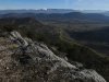
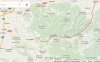
Specifically. does anyone know if it's possible to walk through the Sierra de la Demanda starting from Najera and ending up at Campolara (near Quintanilla de Lara). I couldn't find any wikiloc tracks, but notice from Google Maps that there are villages along the way and that some even have albergues...
An interesting idea. Najera-Aguiano-Vinegra de Abajo/Canales de la Sierra-Barbadello de Herrero-Campolara, then onto the Camino St Olav either directly to Burgos or via Covarrubis and the Ruta de Lana. A route could easily be planned that would go through Santo Domingo de Silos.
It's certainly off the beaten path. :)
[Edited to update and highlight more general content below]
 

Attachments

  • Najera detour.JPG
    Najera detour.JPG
    172.7 KB · Views: 39
Last edited:
The 9th edition the Lightfoot Guide will let you complete the journey your way.
I posted a variant of this in this thread www.caminodesantiago.me/community/threads/sierra-de-la-demanda last year. Not clear whether the OP, @jimabfalter , went for it or not.

@Viranani , you've planted a thought. I've been looking at Caminos Baztan or Vasco for next year. Could link up from Haro down to Najera and then look for a route through to Santo Domingo de Silos before heading up to Burgos on the Lana. Going to need some decent maps to stay off-road though. I can feel a trip to www.stanfords.co.uk/ coming on :0)
 
I couldn't find any wikiloc tracks, but notice from Google Maps that there are villages along the way and that some even have albergues...
Maps from OpenStreetMap will often show trails and small roads that Google's maps don't. There is also an app, OSMand, that works on Android (not sure about Apple) that will work offline with OSM to show where you are on a previously downloaded map. Maps can be viewed online at http://www.openstreetmap.org/

I'm not sure if this works or not because my very old browser doesn't show much but try taking a look at OSM's view of Viniegra: https://www.openstreetmap.org/?mlat=42.151667&mlon=-2.888889&zoom=15#layers=M
 
€2,-/day will present your project to thousands of visitors each day. All interested in the Camino de Santiago.
If you don't bother to go to Santo Domingo de Silos instead of to Campolara:

Nájera to Anguiano: http://es.wikiloc.com/wikiloc/view.do?id=11337397

Anguiano to Venta Goyo (an accommodation on the road something like 2 kms before Viniegra de Abajo): http://es.wikiloc.com/wikiloc/view.do?id=4173708

Venta Goyo to Canales de la Sierra (mostly on the road although at the damn you can border most of it on the left side before returning once again to the road).

Canales de la Sierra to Huerta de Arriba. You shouldn't have problems to design a route between both towns by yourself either over map or looking on Wikiloc for tracks in Canales de la Sierra.

Once in Huerta de Arriba, follow the GR 82 till Santo Domingo de Silos (you can easily find info about that GR online).

P.S.: Don't forget that out of Pamplona you have the Viejo Camino to Santiago de Compostela (aka de Pamplona branch of the Camino Olvidado). It joins in Aguilar de Campoo with the (Bilbao branch of the) Camino Olvidado and it joins the Francés in Columbrianos, next to Ponferrada. Of course, you can go to Ponferrada and take the Camino de Invierno... If you are walking the Vía de Bayona (aka the Burgos branch of the Camino Vasco del Interior), you can take the Viejo Camino in Miranda de Ebro.
 
Last edited by a moderator:
Exactly the kind of feedback I was hoping for! Wonderful, thank you everyone.
P.S.: Don't forget that out of Pamplona you have the Viejo Camino to Santiago de Compostela (aka de Pamplona branch of the Camino Olvidado). It joins in Aguilar de Campoo with the (Bilbao branch of the) Camino Olvidado and it joins the Francés in Columbrianos, next to Ponferrada. Of course, you can go to Ponferrada and take the Camino de Invierno... If you are walking the Vía de Bayona (aka the Burgos branch of the Camino Vasco del Interior), you can take the Viejo Camino in Miranda de Ebro.
And now there are more ideas thanks to Castilian...these old routes, Castilian, are new to me...so I had to look them up. Here are a few links so that if others are curious they'll give you a sense of them. Veeeerrrry interesting ideas! Speaking of the mountains and natural landscapes these caminos cross, one of the websites says, " A gift for these times of pollution and excess cement."
https://translate.google.com/translate?hl=en&sl=es&tl=en&u=https://es.wikipedia.org/wiki/Viejo_Camino_de_Santiago&anno=2
http://xacopedia.com/Viejo_Camino_de_Santiago
And I'm attaching a screenshot from that last site for those of us who do maps better than words.
Here are ways to avoid the rush almost completely! And the Invierno is definitely on my list.

Once in Huerta de Arriba, follow the GR 82 till Santo Domingo de Silos (you can easily find info about that GR online).
Ah my friend the GR 82! I walked on it out of SDdS this spring, by mistake. It made for a magical morning. And a very long day--because I was going in another direction altogether. But it was worth it (check out the view!). And then I noticed it again near Santa Maria de Lara, going straight over the hill. At that point I was glad to be on the St Olav...
 

Attachments

  • Viejo Camino.JPG
    Viejo Camino.JPG
    85.8 KB · Views: 21
  • Santo Domingo de Silos to Covarubbias on GR82 (3).JPG
    Santo Domingo de Silos to Covarubbias on GR82 (3).JPG
    348.8 KB · Views: 18
Last edited:
Down bag (90/10 duvet) of 700 fills with 180 g (6.34 ounces) of filling. Mummy-shaped structure, ideal when you are looking for lightness with great heating performance.

€149,-
Real maps? Do tell, Tinkatinker...
And I tried that link but got an error message. A site search is in order.:)
Hmm, try this one: http://www.stanfords.co.uk/ Been my favourite shop since the '60's. Away from the touristy stuff & the fluff they have presses full of real maps of real places. (I'm ex-Ordnance Survey). They carry good stock levels of the IGN.es series and will track down early Mapos Militares editions to fill gaps.

The IGN online version here: http://signa.ign.es/signa/ looks like it could be useful planning tool too. But I'm still struggling to plot a viable off-road route. As usual in much of rural Spain and especially in mountain country a track goes from the village to the highest meadows / grazing. It does not cross the heights. You need to improvise that bit and then pick up the track down to the next valley. Insular lot the Spanish :)
 
And now there are more ideas thanks to Castilian...these old routes, Castilian, are new to me...so I had to look them up.

This forum might be the best source for the Viejo Camino (aka the Pamplona branch of the Camino Olvidado) so you didn't have to look too far away. ;):)

@caminka walked it years ago and made a brief stage by stage report on post number 42 on this thread: www.caminodesantiago.me/community/threads/viejo-camino-de-santiago.7585 If you are interested in things like history, take a look at the rest of the thread because you'll find some useful/interesting info.

For more info about the Viejo Camino, take also a look at post 4 (made by @caminka ) and post 20 (made by myself) on this other thread: www.caminodesantiago.me/community/threads/developments-on-the-camino-olvidado-or-viejo-camino.19303

And if you want to get an idea of the scenery of part of the route (the GR-99 one), just look online for pictures of Orbaneja del Castillo, Pesquera de Ebro, Frías, the Hoces de Sobrón... Oh, and caminka herself put a link to her photos on post number 18 at www.caminodesantiago.me/community/threads/my-stages-on-the-camino-olvidado-viejo-camino-de-la-montaña.28456 BTW, on the last thread you can also find a stage by stage report of the Bilbao branch of the Camino Olvidado made by @peregrina2000 The Bilbao branch and the Pamplona branch (aka the Viejo Camino) meet in Aguilar de Campoo, as I said above so to get info about the Bilbao branch from Aguilar de Campoo onwards will be useful too... There's much more info about the Camino Olvidado out of Bilbao than about the Viejo Camino out of Pamplona so getting info about the Olvidado out of Bilbao is (way) easier.
 
Last edited by a moderator:
Hmm, try this one: http://www.stanfords.co.uk/ Been my favourite shop since the '60's. Away from the touristy stuff & the fluff they have presses full of real maps of real places. (I'm ex-Ordnance Survey). They carry good stock levels of the IGN.es series and will track down early Mapos Militares editions to fill gaps.
Oh, to be able to just walk in a store and have access to these things! Lucky you Tinkatinker.
I can use GPS but totally dislike it. A paper map is much more useful to me.

in much of rural Spain and especially in mountain country a track goes from the village to the highest meadows / grazing. It does not cross the heights. You need to improvise that bit and then pick up the track down to the next valley.
This actually sounds like fun. But I'm not 20 anymore, so also a bit more of a challenge!;)

This forum might be the best source for the Viejo Camino (aka the Pamplona branch of the Camino Olvidado) so you didn't have to look too far away.
Castilian, you never cease to amaze. There's a ton of good information there! Thanks.
Wow....Bookmark, bookmark, bookmark!
[Edit...and it just goes to show how we newbies keep trying to re-invent the wheel. Sorry and thanks for your patience, all you 'old hands'...it must be a tad annoying. ;)]
 
Last edited:
€2,-/day will present your project to thousands of visitors each day. All interested in the Camino de Santiago.
Great read- love anything off the beaten track:). Must admit- when i walked the camino Frances- I took the bus from burgos and went for two days to Santo domingo de silos and then went back to burgos to continue the camino- Santo domingo de silos was one of the highlights of my experieces on the camino for me. Next time will walk:)! Thanks for all the tips!
 
A selection of Camino Jewellery
Transport luggage-passengers.
From airports to SJPP
Luggage from SJPP to Roncevalles
I am the Invierno whisperer.
:D:D:D:D:D Hee heeeeeee....

(Thinking about May, Laurie. When I have less than a week free from Pamplona. There's no way I'm that fast.:D
Maybe, maybe, there will be time for the Invierno in August. :)
Others should definitely consider it!)
 
Last edited:
The Beloved and I will be on the Via Bayonna / Vasco del Interior starting May 7/8 down to S.Domingo de Calzada. Then at least to Leon on the Frances and then..... Salvador / Primitivo or Ponferrada / Invierno and now I'm reminded of La Robla down to Ponferrada and the Invierno.

And of course of that possible through the Sierra de la Demanda. I gave up researching when I couldn't get away from a 38km day from Valganon to Barbadillo de Herreros & no obvious accommodation. Most of the Albergues are 'group booking' only and even CR's are thin on the ground. These old bones just can't do those distances in mountain country anymore. But now, of course, I'm going to have to go back and have another look :).
 
Well, I just did a cursory check of CRs (and from my memory) to find that there are:
One each in: Banos de Rio Tobia, Mansilla de la Sierra, Barbadillo de Pez, Villaespasia, and Mansilla de la Sierra.
Two in: Anguiano--which looks like a particularly cool place: photos here. It has a bean festival and dances on stilts--oh, and a huge gothic monastery. Can you get much better than that?
 
The focus is on reducing the risk of failure through being well prepared. 2nd ed.
Well, I just did a cursory check of CRs (and from my memory) to find that there are:
One each in: Banos de Rio Tobia, Mansilla de la Sierra, Barbadillo de Pez, Villaespasia, and Mansilla de la Sierra.
Two in: Anguiano--which looks like a particularly cool place: photos here. It has a bean festival and dances on stilts--oh, and a huge gothic monastery. Can you get much better than that?


I am intrigued ...

Do any of these hikes in the Sierra de la Demanda offer ways to patch together a walk from Najera to the San Olav? I admit I'm having trouble keeping the route in my mind, but it looks wonderful.

https://www.traildino.com/trace/continents-Europe/countries-Spain/trails-GR82_Sierra_de_la_Demanda. Looks like this one goes through the Yecla gorge

https://en.m.wikipedia.org/wiki/Vía_Verde_de_la_Sierra_de_la_Demanda#Location.

http://www.minube.co.uk/tag/hiking-sierra-de-la-demanda-sz1161

http://www.summitpost.org/san-lorenzo/155145

Would you do this without a GPS, Viranani?
 
Do any of these hikes in the Sierra de la Demanda offer ways to patch together a walk from Najera to the San Olav? I admit I'm having trouble keeping the route in my mind, but it looks wonderful.
That (natch!) was my intention in posting the thread in the first place as I'd gotten hooked by the landscape around the Lara Valley. The map at the top of the thread shows what I was thinking--basically the very long way from Najera to Burgos through the Sierra de la Demanda and then intersecting the St Olav at Santa Maria de Lara. (Who needs an excuse to go back there, but the church was closed on Good Friday.:D)
Would you do this without a GPS, Viranani?
I do everything without a GPS. :D
Actually the way looks pretty straightforward, though (unfortunately) it would mostly be road walking--so a good map or GPS would allow one to find ways to get around that.
 
And checking your links, Laurie, the Via Verde would take a bunch of road walking out, as would my old nemesis the GR82 (though it's the long way around Robin Hood's barn).
 
The 9th edition the Lightfoot Guide will let you complete the journey your way.
Actually the way looks pretty straightforward, though (unfortunately) it would mostly be road walking--so a good map or GPS would allow one to find ways to get around that.
@Viranani, I saw this thread last year and became envious. I hope the following may be of use to you in planning your camino.

A suggestion in plotting your route is, instead of using maps.google.com, to use this online mapping site, mappingsupport.com (The entry point you really want is https://mappingsupport.com/p/gmap4.php )

Here's the reason: Google uses aerial photos to do mapping. mappingsupport has an interface that not only uses Google data but data from OpenStreetMap and topographical maps.

It looks like your camino from Najera south follows highway LR-113. Here are some maps using a point near the LR-113 as the center point, specifically 42.279929,-2.771842

Here is what Google has: https://www.google.com/maps/@42.282993,-2.771863
Note that you can swap between satellite and street view. When you use satellite view you can see roads and pistas not on the street view map.

Now, with mappingsupport.com there is a pulldown menu in the top right corner that you can use to swap the view between Google's Street, Satellite, Hybrid Street/Satellite, and Terrain views but also some topographical maps (from ERSI World, and OpenStreetMap Cycle) and the regular OpenStreetMap view (which loses elevation information but supplies some information that the OSM topo map doesn't.) Depending on the location your map shows you may have other view choices. Also, when you are using Google views you may be able to use the little streetview stick guy to get pictures of a place.

So, the following links will bring you to mappingsupport.com views of the same point (42.282993,-2.771863) that the Google map does. All the views are at the same zoom level but showing a different look to the map.
  1. Google Street Map. Shows water, roads and a restaurant.
  2. Google Satellite. Shows roads, hills woods, fields, orchards, buildings not seen on the above.
  3. Google Hybrid.
  4. Google Terrain. Some hill shading but essentially it is the same as Google street map.
  5. Topo ESRI World. Pretty much what you would expect from a topo map but notice that we have been centered on a convent, Convento de la Granja all along.
  6. Topo World OSM Cycle. Shows some of the roads and pistas that could be used as an alternate camino (but not all that show on a satellite view.)
  7. OSM. Some detail lost from the above but the highway is labelled and town boundries shown.
 
Wow. What a gold mine of information!
Thanks Rick!!! Tech support of the finest kind.
:confused:But. I was about to go to bed.
Discipline is required. Bookmarked for later.
 
Ok. So now I've looked again, and again, I'm still looking at taking the Greenway from Haro through S.Domingo de la Calzada to Ezcaray, where there appears to be an Albergue Juvenil and a hotel, and then across to Valganon with two hotels. From Valganon there is a wonderful looking track across the mountains to Barbadillo del Pez then on to Salas de los Infantes, Hacinas, Carazo & S.Domingo de Silos. Most of this is off-road or on un-mettled roads & tracks. But I'm still stuck for accommodation. Even the CR in BdP seems to now be a 'whole-house' holiday let rather than B&B.

So now I'm looking for a more northerly route that would still give a taste of the mountains from Valganon through maybe Fresneda, Pradoluengo and into Burgos following the R.Arlanzon. If I succeed in stringing anything together I'll post it.
 
€2,-/day will present your project to thousands of visitors each day. All interested in the Camino de Santiago.
Hi Rick. Yes. There are a couple of possible variations, the track up via Torrobia is a little longer but takes an 'Alpine zig-zag' approach to the climb rather than the brutal ascent via the Alto de Corcusa. If I could solve the accommodation issue I would probably go for it. If I could be confident of a dry bivouac and was walking solo I would probably go for it but with The Beloved to consider I'm hanging back.

As the Gmap4 shows there are plenty of opportunities to avoid road walking via Fresneda all the way to Burgos with a bit of careful navigation.

The GR82 looks like a lovely route to enjoy the Demandas, S.Domingo de Silos and the Montes de Oca but sadly doesn't provide an alternative 'camino' path to Burgos. I had started bothering with this one when I started speculating that earlier pilgrims might have headed straight to Silos rather than Burgos. At a time when most pilgs didn't carry a Brierley they were more likely to stray from "The Way" than we modern passengers. I thought a hunt for scallop shells and Jacobite chapels and shrines might evidence another 'camino viejo'. I'm beginning to think some large scale maps and a camper-van might be a more effective research tool than wish-full thinking and pure speculation.
 
I always enjoy threads about out of the way off-Camino routes, but I am too geographically challenged to follow these interesting ideas with all their permutations. I will happily follow in your footsteps, though, so I am glad you guys are willing to let me let me freeride.

I am also happy to try to help scout out out-of-the-way lodging. Did it last year for the San Olav and we came up with some really good choices, I think.

But you guys know you are really complicating my life. I have enough unwalked Caminos on my list to be thinking about walking non-Caminos that go near Caminos!

Buen camino, Laurie
 
The focus is on reducing the risk of failure through being well prepared. 2nd ed.
The GR82 looks like a lovely route to enjoy the Demandas, S.Domingo de Silos and the Montes de Oca but sadly doesn't provide an alternative 'camino' path to Burgos.
It is lovely, and you're right--it doesn't go even near Burgos. But. The San Olav and Ruta de Lana/Ebro do, and the GR82 intersects these routes at the church of Santa Maria de Lara, Covarrubias, and Santo Domingo de Silos. You could turn towards Burgos at any of these places. If you wanted to visit SDdS, you could walk to Covarrrubias on the GR82, then take the Ruta de Lana over to Silos, returning to Covarrubias the next day on the GR82--and from there take the San Olav up to Burgos. If SDdS isn't so big a deal for you, you could just continue on the San Olav from Santa Maria de Lara. All sorts of options. ;)
(Frankly, the morning between SDdS and Covarrubias on the GR82 ranks right up there as one of the most beautiful walking days ever, and I've walked in some seriously beautiful places. Doing it in the SDdS to Covarrubias direction would be best--walking towards the mountains rather than away from them.)
Have a look and see if this doesn't whet your appetite.View media item 4869
 
Last edited:

Most read last week in this forum

The Burguete bomberos had another busy day yesterday. Picking up two pilgrims with symptoms of hypothermia and exhaustion near the Lepoeder pass and another near the Croix de Thibault who was...
Between Villafranca Montes de Oca and San Juan de Ortega there was a great resting place with benches, totem poles andvarious wooden art. A place of good vibes. It is now completely demolished...
Just an FYI that all available beds are taken in SJPDP tonight - fully, truly COMPLETO! There’s an indication of how busy this year may be since it’s just a Wednesday in late April, not usually...
Left Saint Jean this morning at 7am. Got to Roncesvalles just before 1:30. Weather was clear and beautiful! I didn't pre book, and was able to get a bed. I did hear they were all full by 4pm...
Hi there - we are two 'older' women from Australia who will be walking the Camino in September and October 2025 - we are tempted by the companies that pre book accomodation and bag transfers but...
We have been travelling from Australia via Dubai and have been caught in the kaos in Dubai airport for over 3 days. Sleeping on the floor of the airport and finally Emerites put us up in...

❓How to ask a question

How to post a new question on the Camino Forum.

Similar threads

Forum Rules

Forum Rules

Camino Updates on YouTube

Camino Conversations

Most downloaded Resources

This site is run by Ivar at

in Santiago de Compostela.
This site participates in the Amazon Affiliate program, designed to provide a means for Ivar to earn fees by linking to Amazon
Official Camino Passport (Credential) | 2024 Camino Guides
Back
Top