• For 2024 Pilgrims: €50,- donation = 1 year with no ads on the forum + 90% off any 2024 Guide. More here.
    (Discount code sent to you by Private Message after your donation)
  • ⚠️ Emergency contact in Spain - Dial 112 and AlertCops app. More on this here.

Search 69,459 Camino Questions

Vadiniense route

alaskangirls

New Member
Time of past OR future Camino
June 2023 hopefully Vadiniense route
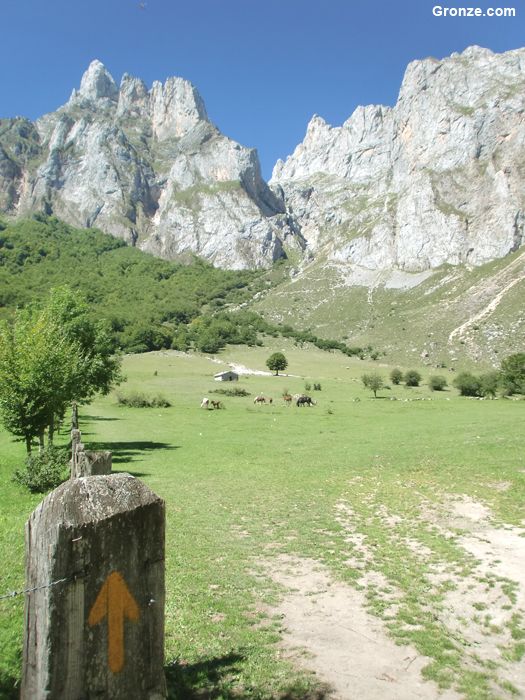
Hello! Looking hike some on the Camino...and Picos de Europa. It appears the the
Vadiniense route may be a good option for this but I am having difficulty finding any recent information about this. Any suggestions?
 
€2,-/day will present your project to thousands of visitors each day. All interested in the Camino de Santiago.
Hi, @alaskangirls, welcome to the forum. I have moved your post to the sub-forum on the Vadiniense and Lebañiego. The Lebañiego goes from San Vicente de la Barquera on the Norte to Potes and on to the monastery. The Vadiniense picks up from there and goes to Mansilla de las Mulas on the Francés.

Check out the posts you'll get to on this link. There is even a report from 2022!


I've walked both and would say that if you are interested in walking in the Picos, it's really only the part from Potes (near the end of the Lebañiego) to the pass at Pandetrave after Fuente Dé that has mountainous walking. The rest of the Vadiniense is pretty un-mountainous. Maybe a good idea would be to walk from San vicente to Fuente Dé and then spend a few days of day hiking in that area, because it is beautiful and there's a ton of hiking.
 
Also worth checking:
 
Ideal sleeping bag liner whether we want to add a thermal plus to our bag, or if we want to use it alone to sleep in shelters or hostels. Thanks to its mummy shape, it adapts perfectly to our body.

€46,-
If you want a taste of the Picos divert from the Lebañiego via La Hermida and the Sendera Tresviso; Sotres and the Ermita de Nuestra Señora de la salud o de la Santuca de Áliva to Fuente De where you can rejoin the Vadiniense.

The problem with that suggestion is you will miss Potes and Santo Toribio so maybe follow the Lebañiego through Potes (Orujo capital of Spain), visit Santo Toribio and continue onto Fuente De then reverse my suggestion above. That gives you the opportunity to loop back to San Vicente. 8 - 10 days hiking, reasonable scatter of accommodation.

How is your mountain navigation? Karst limestone country can play tricks.
 
Last edited:
Hi, @alaskangirls, welcome to the forum. I have moved your post to the sub-forum on the Vadiniense and Lebañiego. The Lebañiego goes from San Vicente de la Barquera on the Norte to Potes and on to the monastery. The Vadiniense picks up from there and goes to Mansilla de las Mulas on the Francés.

Check out the posts you'll get to on this link. There is even a report from 2022!


I've walked both and would say that if you are interested in walking in the Picos, it's really only the part from Potes (near the end of the Lebañiego) to the pass at Pandetrave after Fuente Dé that has mountainous walking. The rest of the Vadiniense is pretty un-mountainous. Maybe a good idea would be to walk from San vicente to Fuente Dé and then spend a few days of day hiking in that area, because it is beautiful and there's a ton of hiking.
Thank you for the information...is there a map you could recommend?
 
Thank you for the information...is there a map you could recommend?
If you mean GPS, there are interactive Wikiloc trails and online there is the ever excellent Gronze. Gronze is particularly useful as they update albergue information regularly. For personal reasons we couldn't actually walk most of the Vadiniense/Lebaniego but we were there last year and were aware that a lot of albergues have closed at least temporarily. There is also a Vadiniense Facebook group to join, but it is in Spanish. It is, by the way, a stunningly beautiful area.

So long as you are in Cantabria, the Vadiniense/Lebaniego is very well way-marked.
 
A selection of Camino Jewellery
Hi Alaskangirls
When I planned for the Lebaniego/Vadiniense a few years ago I also looked at whether I might combine some walking with the Picos, but in the end I ruled it out. I think it could be done, but if you did it unguided you'd want to be experienced and capable in the high mountains.
Have a look at Mapy.cz - enter Espinama Cantabria as a location and then select the outdoor map option from top left menu. You'll see that there are a few waymarked paths that can take you north into the central massif of the Picos and also bring you back south eventually to pick up the Vadiniense (although that bit is not so obvious).
A big circuit would be to head north west off the Vad at Cabanes, up to La Quintana (instead of going via Potes). Then head west, where you could even book to stay at the refugio Caseton de Andara before climbing into the high peaks.
A shorter circuit, including Potes and Santo Toribio, would be to come off the Vad at Fuente De - you could even take the cable car up into the mountains. From there you'd find several waymarked routes across to refuges such as Jermosa Collada and Cabana Veronica. Details of all the refuges and booking arrangements can be found here https://reservarefugios.com/en/shelters
I'd just stress again - this is something I've researched but not done myself, and having been up to the high point on the Vad in late June and observed a lot of snow still in place on the higher peaks around me, I'd not be doing it before late June. Having said that, if you are experienced, and the weather is clear, you could add a couple of unforgettable days in the high mountains to the Vadiniense camino
Cheers, tom
 
Hi Alaskangirls
When I planned for the Lebaniego/Vadiniense a few years ago I also looked at whether I might combine some walking with the Picos, but in the end I ruled it out. I think it could be done, but if you did it unguided you'd want to be experienced and capable in the high mountains.

My memory is that when I spent the night in Fuente Dé, I saw several posted signs with a lot of maps of day trails, in the vicinity of the paradaor. I was tempted because the walk from Potes is just gorgeous. Those trails would, I’m guessing, not require the same mountaineering skills as some of the circles you and Tinca describe. Does anyone know if I am right about that?

Thank you for the information...is there a map you could recommend?

I don’t use hard copy maps, but as @dick bird says there are lots of good GPS tracks available on wikiloc.com. Just use the search function, and you will find numberous tracks for every stage.
 
This year is an anniversary year, forgive me but I don’t have the exact info at hand, so I’m guessing that accommodation might actually be easier to find? Again assuming, but I’d think the powers that be might ensure the re-opening of the closed albergues….
 
Down bag (90/10 duvet) of 700 fills with 180 g (6.34 ounces) of filling. Mummy-shaped structure, ideal when you are looking for lightness with great heating performance.

€149,-
Thank you for the information...is there a map you could recommend?
If you want to go off-piste and into the mountains the CIGN 1:25000 series are hard to beat https://www.cnig.es/buscarArtsMenu?categoria=MTN25 Usually available locally, almost certainly in Potes or on order from CIGN. That said, as has been mentioned above, there are an extensive network of way-marked paths. Here's one blog: there are many more - https://www.packing-up-the-pieces.com/picos-de-europa-hiking-poncebos-asturias/#PoncebosHikes
 

❓How to ask a question

How to post a new question on the Camino Forum.

Forum Rules

Forum Rules

Camino Updates on YouTube

Camino Conversations

Most downloaded Resources

This site is run by Ivar at

in Santiago de Compostela.
This site participates in the Amazon Affiliate program, designed to provide a means for Ivar to earn fees by linking to Amazon
Official Camino Passport (Credential) | 2024 Camino Guides
Back
Top