- Time of past OR future Camino
- First: Camino Francés 2002; most recent: Norte/Primitivo 2019
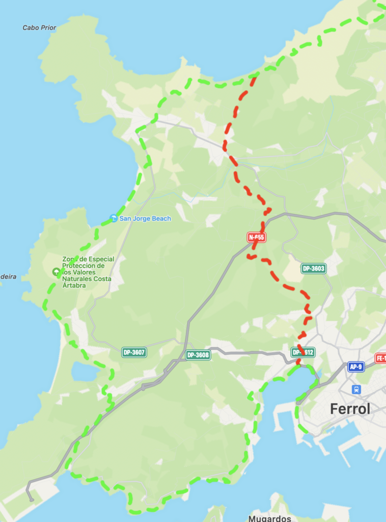
It's awesome to be back on the Camino do Mar, and to really see the route taking shape. When I came here the first time, it was like a treasure hunt, cobbling together an almost useless map with comments from a handful of forum members, and then searching assiduously at every trail intersection for a rumor of a waymark. Now, though, yellow arrows are plentiful! It's not perfect yet, of course, and there are some places that need attention. (Albergues are needed, too!) But through the first three stages, at least, I think you could easily make it through 80% of the Mar, maybe 85%, on the yellow arrows, in conjunction with the Cantabrico markers.
Some notes on each stage that I've cleared thus far. One overarching caveat: every time I point out a problem with waymarking, I'll fully acknowledge that the failure may be on my end!
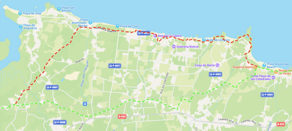
1) Ribadeo to Praia das Catedrais
Some notes on each stage that I've cleared thus far. One overarching caveat: every time I point out a problem with waymarking, I'll fully acknowledge that the failure may be on my end!
1) Ribadeo to Praia das Catedrais
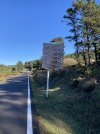
- Almost no yellow arrows exist prior to Rinlo. It's not a problem--just follow the Cantabrico along the coast.
- I didn't find a functional fountain until a couple km after Rinlo. Lots of broken ones!
- I made a reservation for Praia das Catedrais, but nobody checked. Maybe just because it wasn't low tide yet?
- I departed Ribadeo at 7:30. It was a Sunday. The first open bar I encountered was at Catedrais
- Not much else to note on this section, but it's an easy one--unless there's a vision for the Mar to not follow the coast all the way around, and instead cut across inland (which I would disagree with), the Mar and Cantabrico are synced up throughout
- The biggest development is that the Mar turns left off the Cantabrico farther west than it used to, and then it generally proceeds westward along very quiet paved roads. It no longer goes all the way south to the N634 for most of this section, and eventually passes an Eroski supermarket and the Igrexa de San Cosme de Barreiros (as it used to, just from a different angle). This walk is an improvement and the waymarks are good! I'd still recommend staying on the Cantabrico, plus the shortcut advised in the book, but I appreciate this
- The waymarks suddenly evaporated just as the route approached the N634 before the approach to the Rio Masama. I feel pretty good that this one's not on me, as a biker passed me in this moment, and I saw him pull over and consult his maps soon after, just as I was hunting in vain for an arrow
- That said, the arrows picked up quite reliably in the turnoff for Vilaronte, and the arrows are excellent from there onto San Martiño de Mondoñedo. The bar in Vilaronte was closed, but the one in Mondoñedo was open!
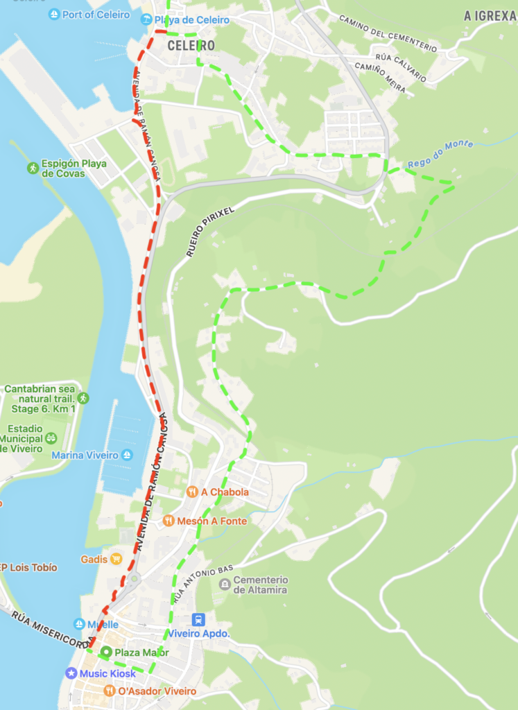
- The yellow arrows and San Rosendo are synced up leaving Mondoñedo. These follow a different approach than what I have mapped in the book. If you want to go into the center of Foz, I strongly recommend my approach. The yellow arrows seem to bypass Foz center, while the circuitous approach followed by the San Rosendo... I mean, it's just silly
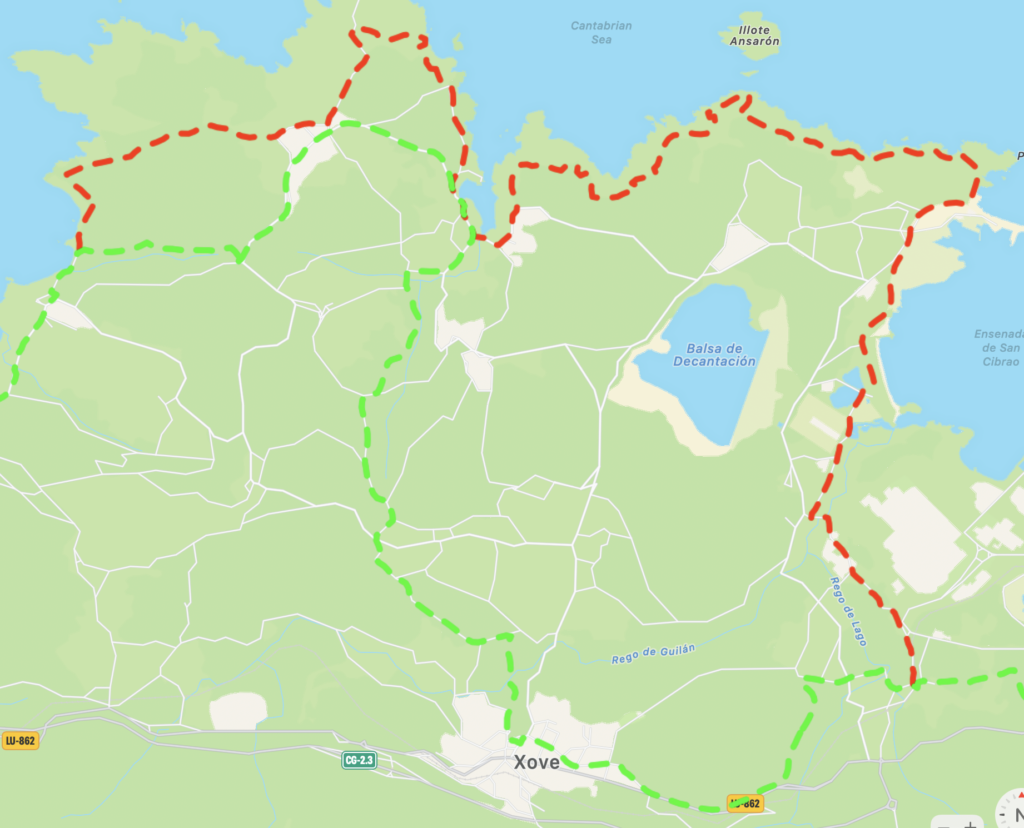
- I followed the Cantabrico from Foz to Burela. There's significant construction work going on with this path over the 2km before Fazouro, so be ready to divert to parallel roads. I just don't think it's worth climbing into the hills to get to the official Mar in this section
- Yellow arrows pick back up around Nois / Cangas de Foz. Cangas de Foz has a pretty reliable bar and small grocery just off the Cantabrico
- Last time I was here, highway construction before Burela caused me a lot of trouble, as it disrupted the route. All of that is done now, and the Mar/Cantabrico are synced up for that approach. Some of the waymarking hasn't made it back, but just stick with the trail. One tricky part: when the highway passes underneath the footpath, at the point where that construction project was most intensive, the footpath splits, with one going downhill to the left, and the other going uphill to the right. Go down and to the left! You won't see any waymarks until you reach the end of the footpath, where you'll see Mar and Cantabrico markings
- Thanks to that construction, you no longer have to go all the way down to the port and then backtrack up a steep hill. Instead, catch the yellow arrows calling for a turn uphill. They're pretty reliable leading you out of Burela
- The walk from Burela to San Cibrao is, in my view, the place where the Mar is loads better than the Cantabrico, and I'm thrilled to see pretty good waymarking here
- In particular, the arrows leading to the Sagradelos ruins is super reliable. It follows a slightly different trajectory than what I mapped out (going one track over to the south for a bit), but it's easy to navigate. (One small exception--there's a turn where the arrow is at the base of a power pole, and that pole is covered in bushes
- All of that said, the waymarks pretty much stop the moment you arrive in Sargadelos, and they remain super unreliable until the outskirts of Cervo
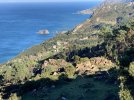
- The Sargadelos ruins are so great! There was also an open bar there, which makes everything better
- Arrows from the outskirts of Cervo to the outskirts of San Cibrao were great
- San Cibrao remains one of my favorite spots on any Camino. Even with some brief rain squalls


")