• Get your Camino Frances Guidebook here.
  • For 2024 Pilgrims: €50,- donation = 1 year with no ads on the forum + 90% off any 2024 Guide. More here.
    (Discount code sent to you by Private Message after your donation)
  • ⚠️ Emergency contact in Spain - Dial 112 and AlertCops app. More on this here.

Search 69,459 Camino Questions

Present State of Wayfinding - Valcarlos Route

Richard Ray

Not What He Once Was
Time of past OR future Camino
2019
My friend and I plan to walk the CF beginning September 8 or so leaving from St Jean. We want to "ease" into the walk a bit and have decided to take the Valcarlos route over two days. I've read several threads about this route, with some indicating that the path is poorly marked and the trails barely passable (and suggesting that we simply follow the highway the entire way) and others praising the easiness of wayfinding and the beauty of the walk. Naturally I'm a bit confused. Has anyone walked the Valcarlos route recently (2016) who can share their experience with the wayfinding of this route? Thanks for any advice you can offer!

Rich
 
St James' Way - Self-guided 4-7 day Walking Packages, Reading to Southampton, 110 kms
I walked the Valcarlos route in mid April this year and found the route to be well marked. There are a couple of places that might be confusing but the Pilgrim's office in St. Jean will provide you a map with photos showing you exactly what to look for. In spring the lower valley was beautiful! From higher elevations the views back through the valleys amazed me to think that I had just walked that far!

A personal note, the people on this forum are wonderful for providing helpful information, though sometimes perhaps too much information, which can induce an anxiety about the trip. Go with a sense of adventure and wonderment as you find your way!
 
The pilgrims office in SJPdP will give you the latest updates on the Valcarlos route. It is a well established route and but if there are any changes they are the first to know.
Buen Camino, SY
 
Join our full-service guided tour and let us convert you into a Pampered Pilgrim!
Leaving SJPP requires some care, but I found way finding on the rest of the Route Valcarlos variant relatively easy. It is well marked at all the critical junctions.

In early May the track surface was mostly fine. There were a small number of places where extra care might be required if it were very wet, but the major difficulty is the slope, not the track surface itself.
 
I agree that the major difficulty is the slope, it is rather steep coming at the time of day when you are tired if you go all the way to Roncesvalles in one day. The Cliff Bar that I has stashed in my pack for emergencies was great to give me that extra bit of a energy going up that mountain!
 
Many thanks for the terrific advice. Much appreciated!


I walked the Valcarlos route in mid April this year and found the route to be well marked. There are a couple of places that might be confusing but the Pilgrim's office in St. Jean will provide you a map with photos showing you exactly what to look for. In spring the lower valley was beautiful! From higher elevations the views back through the valleys amazed me to think that I had just walked that far!

A personal note, the people on this forum are wonderful for providing helpful information, though sometimes perhaps too much information, which can induce an anxiety about the trip. Go with a sense of adventure and wonderment as you find your way!
 
The 2024 Camino guides will be coming out little by little. Here is a collection of the ones that are out so far.
As I recall, in the still early stages of the Valcarlos route, when you are still on the road, the Camino path veers off on the right at a very slight angle into a meadow and from there, I think, into the woods. There's a way marker there, but if we weren't paying attention we could easily have missed it. Be prepared also, at the end, for the steep, short descent into the valley and steep, short ascent up to Valcarlo on the other side. We weren't prepared for that and were taken by surprise. :D Been Camino.
 
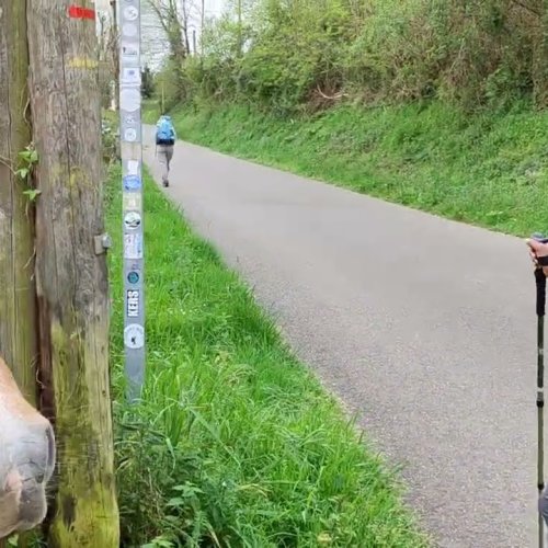
The not very visible marker indicating to turn right at an slight angle, mentioned by Icacos is this, I think.
See the markers in the lamp post. Just be watchful.
No, that's not the one. The one I'm thinking of goes directly onto a meadow, or a field. I recall being delighted to step off the asphalt and onto a path. At last a path! :):)
 
The 9th edition the Lightfoot Guide will let you complete the journey your way.
I walked it in late April of this year. It felt like I was walking alone because they had just opened the other route and most of the Pilgrims took that. Quite of few of them regretted it because of the very strong winds and heavy rain.

I stayed in Valcarlos and ate dinner in the Bar/Restaurant/Store in the center of town. (Luzaide) There was one man working, he cooked,served my dinner and ran the store. After a brief conversation he told me that he was the Mayor of Valcarlos. It was a fun night. Much different than Orrison.

In the morning it was raining, the first 5k out of Valcarlos is on the road but traffic was very light. Then you walk in the woods and it was very nice to be alone out of the wind. I thought that the trail was well marked. When you get to the top there is a decline into Roncesvalles but it nothing like the decent on the other trail. I kept walking to Espinal. For me, one overnight in Roncevalles was enough. I was looking for a different experience out of SJPdP this year and was pleased with the discovery.
 
Last edited:
Yes, there is a generally a very good signposting. But I wondered about this one. ¿Should I obey meekly the indication to the left, or follow the rebellious little pilgrim that insists on going to the right?
:):D

Little pilgrim 2.png
 
Last edited:
Yes, there is a generally a very good signposting. But I wondered about this one. ¿Should I obey meekly the indication to the left, or follow the rebellions little pilgrim that insist on going to the right?
:):D

View attachment 27394

Definitely follow that "rebellious little pilgrim to the right" along the left-side verges of the road in heavy rain, fog or snow. Down below in bad weather the Barrio Gainekoleta can get very messy!
 
Last edited:
The focus is on reducing the risk of failure through being well prepared. 2nd ed.
I walked the volcarlos route on april 01 and 02 2016. The route was well marked, we walked mostly on pathways with some roadside walking. As others have posted the office will gladly help you. We had to use the roadway part way due to flooding of the pathway. The office in SJPP was very helpful. There is plenty of hill to climb on this route too.

Angelhart
 
Yes, there is a generally a very good signposting. But I wondered about this one. ¿Should I obey meekly the indication to the left, or follow the rebellious little pilgrim that insists on going to the right?
:):D

View attachment 27394

Oh I remember that little turn off with affection. I was busting for a pee and despite there being little traffic everytime I reached for my fly I heard another vehicle approaching.

April 2012 had been fairly dry till I got to those trees at the bottom of the slope :rolleyes:
 
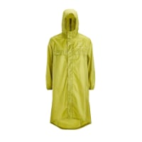
Very light, comfortable and compressible poncho. Specially designed for protection against water for any activity.

Our Atmospheric H30 poncho offers lightness and waterproofness. Easily compressible and made with our Waterproof fabric, its heat-sealed interior seams guarantee its waterproofness. Includes carrying bag.

€60,-
The first tricky part is getting across the river after leaving SJPDP. There is a large white building around 1.9kms out and you just turn at what looks like a driveway off to the right but in reality that's the road that leads you across the small bridge to the quiet country roads on the west side of the river.

The second is when exiting the small shopping mall area where it can be tempting to cross the bridge back on the road on the east side of the river. Resist this urge and stay on the west side of the river and you will find the nice trail resuming all the way to Arneguy.

From there everything is clearly marked as long as you are looking for those yellow arrows however you can make a decision in Arneguy too. If you cross the road and go through the town to the alternate route, it is quite beautiful however the end is very tough as you must drop right down into the river bottom and climb straight up to Valcarlos. If your legs are not well conditioned it's a tough climb. If that's the end of your day it may be fine to end that way but the other option is to stay on the road for a few kms between Arneguy and Valcarlos and avoid that big drop/climb.

After Valcarlos the trails are very well marked and in early April they were not mucky at all but as others have noted, the steepness will have you reaching for air!!
 
Transport luggage-passengers.
From airports to SJPP
Luggage from SJPP to Roncevalles
I walked the ValCarlos route in July 2013. I don't imagine much has changed on it since then and save for a couple of spots I found it easy enough to follow.
At the pilgrim's office in SJPdP they will give you a diagram/map showing both routes and what to look for to stay on course, and points out some tricky spots.
I took a photo of the diagram and attached it here, but can scan it if need be.
CAM00036.jpg
 
I walked the volcarlos route on april 01 and 02 2016. The route was well marked, we walked mostly on pathways with some roadside walking. As others have posted the office will gladly help you. We had to use the roadway part way due to flooding of the pathway. The office in SJPP was very helpful. There is plenty of hill to climb on this route too.

Angelhart
Is it a steep hill that you are going up for a long while?
 
The one from Galicia (the round) and the one from Castilla & Leon. Individually numbered and made by the same people that make the ones you see on your walk.
Is it a steep hill that you are going up for a long while?

The Valcarlos route does indeed go up almost continually for several hours; the incline is not too steep but it seems unending!

You climb from St Jean Pied de Port, elevation at departure 180m/594ft to Valcarlos/Luzaide, elevation 365 m/1198ft, to the highest point on the Valcarlos route at Puerto de Ibaneta, elevation 1057 m/3468 ft and then happily seem to almost float down into Roncesvalles, elevation 920m/3036ft.... Always after 11 climbs during the past years I arrived at the monastery crying in relief and most eager to just sit still!!
Would you say it is the most challenging from SJPD to Santiago or are there others equally as steep .... hills are not my favourite!
 
Would you say it is the most challenging from SJPD to Santiago or are there others equally as steep .... hills are not my favourite!
No for me. This was never the worst; just one of the bad ones. Alto de Perdon can be difficult and, of course, O Cebreiro. Any climb can be rough in heavy rain, snow or dense fog.
 
Last edited:
St James' Way - Self-guided 4-7 day Walking Packages, Reading to Southampton, 110 kms
Many thanks for the terrific advice. Much appreciated!
Richard.............I walked via Valcarlos last Sept 8th. similar to others follow the P.O. map out of town, once on the rural road you have to watch carefully for the turn off on the right to the start of the path. What I did was go to Google Maps and turn on their virtual map and you can follow the instructions out of town just as if you were there walking and you can see the turn off to the path. I recall there was a farm house which I memorized so when actually there it jumps out at you, if not you will walk past the turn off. The rest is easy from there on. The alburgue in Valcarlos is very nice, off the main road at the end of a dead end street, you have to watch carefully for it.
 
No for me. This was never the worst; just one of the bad ones. Alto de Perdon can be difficult and, of course, O Cebreiro. Any climb can be rough in heavy rain, snow or dense fog.
Thank you so much, I can see I need to train more on hills before starting my Camio.
 
I would advise to just train so you build a base. It seemed each time a significant hill or climb was ahead my fellow pilgrims and I would think well that is the last one thank goodness. Yet early on I found many towns are perched on tops of hills os your long walk was met by a final hill into town etc. There are many sizable hills on the Camino Frances. Don't let it bog you down you will make it to the top of each one. Just enjoy the wonderful surroundings you are in.
 
3rd Edition. More content, training & pack guides avoid common mistakes, bed bugs etc
I would advise to just train so you build a base. It seemed each time a significant hill or climb was ahead my fellow pilgrims and I would think well that is the last one thank goodness. Yet early on I found many towns are perched on tops of hills os your long walk was met by a final hill into town etc. There are many sizable hills on the Camino Frances. Don't let it bog you down you will make it to the top of each one. Just enjoy the wonderful surroundings you are in.
Thank you so much, I think I am just a little scared of what I have signed up for, but at the same time whatever it is that has propelled me towards the Camino is still pushing me ahead. I am now trying to walk a lot more hills and was advised by a friend about the 50 steps for climbing hills - take 50 steps then rest for 10/15 seconds for heart rate to come down and continue 50 steps at a time.....much appreciated.
 
Thank you so much, I think I am just a little scared of what I have signed up for, but at the same time whatever it is that has propelled me towards the Camino is still pushing me ahead. I am now trying to walk a lot more hills and was advised by a friend about the 50 steps for climbing hills - take 50 steps then rest for 10/15 seconds for heart rate to come down and continue 50 steps at a time.....much appreciated.

That's a really good tip from your friend. It's easy to just try to push on until you grind to a halt, so a regular brief stop is a great idea. I've also heard other advice about keeping your steps shorter when climbing a steep hill. As @Angel-hart says above, as well as the "big ones" there are lots of little hills you come upon on the approach to villages which are perched on a rise, sometimes at the end of a long day. Not all of them described very clearly in the guide books - in fact I amused myself by naming the Camino "The Way of the Unexpected Hill" after we had encountered a few of these! Great idea to take on as many hills as you can manage during your training.
 
That's a really good tip from your friend. It's easy to just try to push on until you grind to a halt, so a regular brief stop is a great idea. I've also heard other advice about keeping your steps shorter when climbing a steep hill. As @Angel-hart says above, as well as the "big ones" there are lots of little hills you come upon on the approach to villages which are perched on a rise, sometimes at the end of a long day. Not all of them described very clearly in the guide books - in fact I amused myself by naming the Camino "The Way of the Unexpected Hill" after we had encountered a few of these! Great idea to take on as many hills as you can manage during your training.
Thank you for advance notice ha ha.....onwards and upwards!
 
€2,-/day will present your project to thousands of visitors each day. All interested in the Camino de Santiago.

Most read last week in this forum

Just an FYI that all available beds are taken in SJPDP tonight - fully, truly COMPLETO! There’s an indication of how busy this year may be since it’s just a Wednesday in late April, not usually...
Between Villafranca Montes de Oca and San Juan de Ortega there was a great resting place with benches, totem poles andvarious wooden art. A place of good vibes. It is now completely demolished...
Hi there - we are two 'older' women from Australia who will be walking the Camino in September and October 2025 - we are tempted by the companies that pre book accomodation and bag transfers but...
We have been travelling from Australia via Dubai and have been caught in the kaos in Dubai airport for over 3 days. Sleeping on the floor of the airport and finally Emerites put us up in...
Hi all, Very new to this so please excuse any ignorance or silly questions :) I'm walking my very first Camino in 2 weeks (iieeeek) - the countdown is on and excitement through the roof. I've...
From a friend on the ground in Pamplona https://www.noticiasdenavarra.com/fotos/general/sociedad/2024/04/23/nieve-primaveral-presente-navarra-8152386.html

❓How to ask a question

How to post a new question on the Camino Forum.

Forum Rules

Forum Rules

Camino Updates on YouTube

Camino Conversations

Most downloaded Resources

This site is run by Ivar at

in Santiago de Compostela.
This site participates in the Amazon Affiliate program, designed to provide a means for Ivar to earn fees by linking to Amazon
Official Camino Passport (Credential) | 2024 Camino Guides
Back
Top