• For 2024 Pilgrims: €50,- donation = 1 year with no ads on the forum + 90% off any 2024 Guide. More here.
    (Discount code sent to you by Private Message after your donation)
  • ⚠️ Emergency contact in Spain - Dial 112 and AlertCops app. More on this here.
  • Camino Olvidado Guide created by one of our forum members

Search 69,459 Camino Questions

A navigation app or detailed map is essential on the Camino Olvidado

Time of past OR future Camino
2023 Podiensis, Olvidado, Invierno
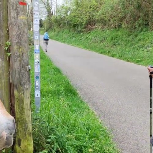
I’m on Day 42 from Le Puy and just finished Day 1 of the Olvidado in Güeñes. There are no yellow arrows, scallop shells, or signs from the Cathedral starting point and along the river in Bilbao. I first saw an arrow at about 6 km then they disappeared again until about 9 or 10 km. I did see some white and red blazes but I think they are for a different route because they turn away in places. Even after the arrows appear, they can be infrequent. For example, the Camino comes to a T intersection in Sodupe, but I didn’t see an indication of which way to turn. A friendly cyclist pointed me in the correct direction. I used the caminoolvidado.com navigation app and there are several others. I would have been lost without it. I used Buen Camino on the Podiensis and del Norte and GR10 on the, well, GR10. I had the same experience in San Sebastian and Guernica on the del Norte. The route markers or blazes seem to disappear in cities although I didn’t have that problem a year ago in Oviedo and Lugo on the Primitivo. I saw zero other pilgrims on my first day on the Olvidado. Fyi, the Hotel Erreka Güeñes is fine and Juan Carlo is great, but it’s about 700 m off the route. Not many options, though.
 
St James' Way - Self-guided 4-7 day Walking Packages, Reading to Southampton, 110 kms
I’m on Day 42 from Le Puy and just finished Day 1 of the Olvidado in Güeñes. There are no yellow arrows, scallop shells, or signs from the Cathedral starting point and along the river in Bilbao. I first saw an arrow at about 6 km then they disappeared again until about 9 or 10 km. I did see some white and red blazes but I think they are for a different route because they turn away in places. Even after the arrows appear, they can be infrequent. For example, the Camino comes to a T intersection in Sodupe, but I didn’t see an indication of which way to turn. A friendly cyclist pointed me in the correct direction. I used the caminoolvidado.com navigation app and there are several others. I would have been lost without it. I used Buen Camino on the Podiensis and del Norte and GR10 on the, well, GR10. I had the same experience in San Sebastian and Guernica on the del Norte. The route markers or blazes seem to disappear in cities although I didn’t have that problem a year ago in Oviedo and Lugo on the Primitivo. I saw zero other pilgrims on my first day on the Olvidado. Fyi, the Hotel Erreka Güeñes is fine and Juan Carlo is great, but it’s about 700 m off the route. Not many options, though.
Mapy.cz if free and brilliant for Picos and caminos.
For Olvidado, I used outdooractive and
What I would advise is .. do NOT follow the ORANGE Camino olvidado app.. it is safe, but you will walk alot of roads, and miss alot. Finally the train is close to you until Bonar. Use it if you need it... I went to Leon for new shoes and back on Olvidado the next day.
 
Buen camino on the Olvidado - there’s a lot of asphalt on the first day to Balmaseda, but after that the going gets much more pleasant.

I agree that some navigation assistance is essential. I know many forum members (myself included) have used Ender’s wikiloc tracks.


If you don’t know about him, Ender is one of the main forces behind the development of the Camino Olvidado and he is constantly working on some camino project or another.

I think the numbers are increasing, little by little, but you are unlikely to coincide with any/many others. I‘ve walked the Olvidado twice now and never saw another peregrino. Let us know how it goes for you! Buen camino, Laurie
 
The one from Galicia (the round) and the one from Castilla & Leon. Individually numbered and made by the same people that make the ones you see on your walk.
Definitely agree with Laurie (when do I not?😉).

Leaving Bilbao is actually quite easy when you know to follow the arrows for the Norte until the turnoff to the left for Balmaseda. You do follow GR tiles on the sidewalk until you reach the bridge where the Norte and Olvidado split.

Without Ender's tracks (Enderjace on Wikilocs) I would have had real problems. Even with his tracks it's a bit tricky in spots until you reach León province. From there on signage is good but I still appreciated the tracks to check if I was on course from time to time.

Take the B alternative routes into the mountains if you can. There are challenging at times but so worth the effort.

Let us know how you get on. There are a few of us that have walked the Olvidado this year.
 
Last edited:
I would support absolutely what the others have said about Ender’s tracks and mapy. Also, the way markers have been very good since La Robla.
 
Buen camino on the Olvidado - there’s a lot of asphalt on the first day to Balmaseda, but after that the going gets much more pleasant.

I agree that some navigation assistance is essential. I know many forum members (myself included) have used Ender’s wikiloc tracks.


If you don’t know about him, Ender is one of the main forces behind the development of the Camino Olvidado and he is constantly working on some camino project or another.

I think the numbers are increasing, little by little, but you are unlikely to coincide with any/many others. I‘ve walked the Olvidado twice now and never saw another peregrino. Let us know how it goes for you! Buen camino, Laurie
Laurie.. I meant to ask. I read somewhere on the WEB🤣, that Jose Cunarro is Ender, and that Ender is Enderface... I had been in touch with Jose before for a link to his Wiki route from Vegacervega to Pola De Gordon... So is Jose = Ender?
 
New Original Camino Gear Designed Especially with The Modern Peregrino In Mind!
Laurie.. I meant to ask. I read somewhere on the WEB🤣, that Jose Cunarro is Ender, and that Ender is Enderface... I had been in touch with Jose before for a link to his Wiki route from Vegacervega to Pola De Gordon... So is Jose = Ender?
Ender’s real name is José Antonio Cuñarro, but his Spanish friends all call him just Cuñarro. I’ve never heard anyone call him José or José Antonio. Ender and Enderjace are his screen names. Mystery solved!
 
Ender’s real name is José Antonio Cuñarro, but his Spanish friends all call him just Cuñarro. I’ve never heard anyone call him José or José Antonio. Ender and Enderjace are his screen names. Mystery solved!
And he explained on the Olvidado Facebook page that the 'jace' after Ender are his initials although I can't remember what the 'e' stands for🤦🏼‍♀️
 
Mapy.cz if free and brilliant for Picos and caminos.
On mapy.cz currently, there's a gap in the route between Quisicedo de Sotoscueva and Matamorisca.

It can do that sometimes on the less-traveled routes, even some that are important historically and were major pilgrimage routes.

Having said that, if you do need to DIY, the app is certainly very good for finding agricultural dirt roads and small road tarmac options variant from busier roads on a more historic route of some Camino.
 
€2,-/day will present your project to thousands of visitors each day. All interested in the Camino de Santiago.
Just completed Stage 3 from Mercadillo to Espinosa de las Monteros. There were no arrows or signs until 6 km, then so few they serve mainly to verify what I’m seeing on the navigation app. The trail is overgrown in places, not easily discernible at times, required minor bushwhacking a couple of times. There’s just not enough traffic on it to keep the trail consistently clear. Overall, good hiking but frequent checking of the app is a distraction. I would get lost without it, though. Plenty of solitude, occasional humans but no other pilgrims. More consistent arrows would be a big help.
 
Just completed Stage 3 from Mercadillo to Espinosa de las Monteros. There were no arrows or signs until 6 km, then so few they serve mainly to verify what I’m seeing on the navigation app. The trail is overgrown in places, not easily discernible at times, required minor bushwhacking a couple of times. There’s just not enough traffic on it to keep the trail consistently clear. Overall, good hiking but frequent checking of the app is a distraction. I would get lost without it, though. Plenty of solitude, occasional humans but no other pilgrims. More consistent arrows would be a big help.
This is always a problem with un-traveled caminos, especially when the route deviates from pre-existing local walking paths. This stage has been particularly vulnerable to vandalism, there is someone in the area who does not like pilgrims! Signage is expensive and requires a lot of coordination, but you can be sure the groups are working on it. I think it’s probably better when you get a bit further on. Are you using Ender’s tracks?

I also agree that frequent checking of the app is a distraction, which is one of the main reasons I use wikiloc. No need to check the app, it will beep at me if I go off-route. It is so great not to have to walk with the phone in your hand looking down frequently. It does make for a few more false starts, but the beeping function is very accurate and I much prefer backtracking a hundred meters to always having the phone in my hand. The function is so sensitive that I once got a beep that I was leaving the trail, when it turned out that the track went up to a big tree and back down, so I assume the person had taken a pit stop up behind the tree!
 
Walked from Santelices to Llano today. Despite the amount of road walking, I enjoyed today's walk. Waymarking was improved. Arija, where I originally planned to sleep, had kind of a sad feel. Meson La Piedra has closed in just the last week. It has a se vende sign in the window. I saw many those signs. There aren’t many housing options now so I will sleep at Hotel Araz in Llano, 4 km or so farther on. I was one of two customers having lunch (delicious and only €12) at Bar El Piñeo at 1:30 pm, the only place I saw open. The clerk at the alimentacion was surly. Even the lake is suffering. The water line has receded and there are vast expanses of dry lake bed. Waymarking has improved.
 
Last edited:
St James' Way - Self-guided 4-7 day Walking Packages, Reading to Southampton, 110 kms
Definitely agree with Laurie (when do I not?😉).

Leaving Bilbao is actually quite easy when you know to follow the arrows for the Norte until the turnoff to the left for Balmaseda. You do follow GR tiles on the sidewalk until you reach the bridge where the Norte and Olvidado split.

Without Ender's tracks (Enderjace on Wikilocs) I would have had real problems. Even with his tracks it's a bit tricky in spots until you reach León province. From there on signage is good but I still appreciated the tracks to check if I was on course from time to time.

Take the B alternative routes into the mountains if you can. There are challenging at times but so worth the effort.

Let us know how you get on. There are a few of us that have walked the Olvidado this year.
I’d appreciate insight from those who walked the Olvidado this year about food availability and lodging in the stages from Riello to Congosto. Casa Rural El Caruzal in Quintana de Fuseros has closed. That’s the second closure I’ve encountered. I know I need to pack food to Fasgar, but what about Igueña, Labaniego, and Congosto? If I had to pack in food for three consecutive stages, that’s a lot! I’m not sure I can get three days of food into my pack. Also, I’m hearing the Olvidado has been rerouted from Igueña to Noceda del Bierzo, not going through Labaniego anymore. Did you see that this year? Same issue there with food access. I have two navigation apps that don’t show the reroute. I’m very reliant on the nav app because the route markers and arrows have been frustratingly absent, inconsistent, and wrong a few times. At this point (I’m in Santabeñez de la Peña at the moment), I’m reluctant to walk a reroute without a nav app unless the old route is no longer open. Guidance from those with current experience would be much appreciated.
 
Casa Rural El Caruzal in Quintana de Fuseros has closed.
I’ve been in touch with the owners (who saved me back in 2010!) and they say the closure is temporary. I’ve asked them to let me know when it reopens, hopefully in a few months.

, but what about Igueña, Labaniego, and Congosto?
Both Igüeña and Congosto are big enough to have places to eat.

, I’m hearing the Olvidado has been rerouted from Igueña to Noceda del Bierzo, not going through Labaniego anymore. Did you see that this year? Same issue there with food access.

I THINK, but this is just based on what people like @mla1 says, that the route still goes through Labaniego. It just makes a detour up to Noceda where there is an albergue. I think others who have not wanted to sleep in Noceda have just continued on the “old route” straight to Labaniego.

My advice remains the same — I would use Enderjace’s wikiloc tracks. They are the most up to date, since he has been one of the moving forces behind marking the entire route.

At this point (I’m in Santabeñez de la Peña at the moment), I’m reluctant to walk a reroute without a nav app unless the old route is no longer open. Guidance from those with current experience would be much appreciated.
I hope you have GPS tracks for the new mountain options. From Guardo you have two choices, one straight shot on flat land straight to Puente Almuhey, and a mountain alternative that adds a lot of kms but that takes you through some absolutely beautiful terrain and also takes you to Puente Almuhey. Same from Boñar, the alternative through Vegacervera is incredible, while the choice through La Robla is pretty ho-hum. Good luck!
 
I’d appreciate insight from those who walked the Olvidado this year about food availability and lodging in the stages from Riello to Congosto.
I walked from Igüeña to Congosto so can't help you there.

Congosto has several café/restaurantes but they are closed one day of the week. If that is the case, Gloria the hospitalera will let you know and WhatsApp you a menu to choose from. She will then buy food for you and leave it in your room (there is a fridge and microwave). In the evening she will come by to stamp your credential and receive payment.
Casa Rural El Caruzal in Quintana de Fuseros has closed. That’s the second closure I’ve encountered. I know I need to pack food to Fasgar, but what about Igueña, Labaniego, and Congosto?
In Igüeña there is a great albergue run by the Café/Restaurant across the street. I'm sure they could make you something to take along. The owner was very kind to open up early so I could have breakfast at 6.30.

I didn't stop in Lebaniego but going through there were no stores or cafe's.

If I had to pack in food for three consecutive stages, that’s a lot! I’m not sure I can get three days of food into my pack. Also, I’m hearing the Olvidado has been rerouted from Igueña to Noceda del Bierzo, not going through Labaniego anymore.
This is not correct although true that someone from the town wants you to go through Nocedo. If you follow Ender's Wikiloc tracks you pass the albergue on the right but go to Lebaniego.
Did you see that this year? Same issue there with food access. I have two navigation apps that don’t show the reroute. I’m very reliant on the nav app because the route markers and arrows have been frustratingly absent, inconsistent, and wrong a few times. At this point (I’m in Santabeñez de la Peña at the moment), I’m reluctant to walk a reroute without a nav app unless the old route is no longer open. Guidance from those with current experience would be much appreciated.
 
Down bag (90/10 duvet) of 700 fills with 180 g (6.34 ounces) of filling. Mummy-shaped structure, ideal when you are looking for lightness with great heating performance.

€149,-
I do have
I’ve been in touch with the owners (who saved me back in 2010!) and they say the closure is temporary. I’ve asked them to let me know when it reopens, hopefully in a few months.


Both Igüeña and Congosto are big enough to have places to eat.


I THINK, but this is just based on what people like @mla1 says, that the route still goes through Labaniego. It just makes a detour up to Noceda where there is an albergue. I think others who have not wanted to sleep in Noceda have just continued on the “old route” straight to Labaniego.

My advice remains the same — I would use Enderjace’s wikiloc tracks. They are the most up to date, since he has been one of the moving forces behind marking the entire route.


I hope you have GPS tracks for the new mountain options. From Guardo you have two choices, one straight shot on flat land straight to Puente Almuhey, and a mountain alternative that adds a lot of kms but that takes you through some absolutely beautiful terrain and also takes you to Puente Almuhey. Same from Boñar, the alternative through Vegacervera is incredible, while the choice through La Robla is pretty ho-hum. Good luck!
I do have those tracks but to be honest, after 50 days from Le Puy, including the GR10 through the Pyrenees from SJPdP to Hendaye, I’ve seen enough mountain vistas to scratch that itch for a while. I’m going through La Robla and looking forward to Ponferrada and the Invierno. If I was walking only the Olvidado +/- the Invierno, I would take those Alta options. I appreciate all that has been done to make the Olvidado possible, but it is a work in progress, to say the least. Aside from trail conditions in places, the one thing that would make the experience much, much more fulfilling is consistent route markings. Whatever nav app someone wants to use, there are several and Ender gets many endorsements and that’s fine, the constant wondering and checking is frustrating. I’m sincere about being accepting and grateful for what the Camino gives, but I confess this limitation has diminished my experience, speaking only for myself. Hoping the second half is better, although I have a case of tender shin splints I’m nursing. I have two more days to Cistierna where I’m taking a zero. I’ll reassess there. Laurie, thanks for your frequent contributions. By the way, it’s the Wise Pilgrim app that talks about lack of food options from Riello to Congosto, including Igueña and Labaniego and even Congosto. I’ve also seen personally that many villages that show food availability (bars, restaurants , tiendras) in the app are closed when I go through.
 
I walked from Igüeña to Congosto so can't help you there.

Congosto has several café/restaurantes but they are closed one day of the week. If that is the case, Gloria the hospitalera will let you know and WhatsApp you a menu to choose from. She will then buy food for you and leave it in your room (there is a fridge and microwave). In the evening she will come by to stamp your credential and receive payment.

In Igüeña there is a great albergue run by the Café/Restaurant across the street. I'm sure they could make you something to take along. The owner was very kind to open up early so I could have breakfast at 6.30.

I didn't stop in Lebaniego but going through there were no stores or cafe's.


This is not correct although true that someone from the town wants you to go through Nocedo. If you follow Ender's Wikiloc tracks you pass the albergue on the right but go to Lebaniego.
Is the albergue in Igueña the Albergue del Catoute? And what’s the name of the café? Do you have contact info? Thanks.
 
Very light, comfortable and compressible poncho. Specially designed for protection against water for any activity.

Our Atmospheric H30 poncho offers lightness and waterproofness. Easily compressible and made with our Waterproof fabric, its heat-sealed interior seams guarantee its waterproofness. Includes carrying bag.

€60,-
By the way, it’s the Wise Pilgrim app that talks about lack of food options from Riello to Congosto, including Igueña and Labaniego and even Congosto.
I think the one thing that you can’t predict are spontaneous closings for family emergencies or routine days off or holidays. I remember on my first Olvidado in 2014, I had not prepared for the lack of ATM machines. I was down to 5 or 6 euros in Congosto, and was happily astonished to find a cheap plato combinado for that very amount! I now stick 100 € out of sight and forget about it.

but I confess this limitation has diminished my experience,
I know that everyone has different expectations and different tolerance levels, so it’s good to have someone balance out my enthusiastic assessment that this is the best camino of all (especially in combination with the Invierno)! I know the various component parts of the Olvidado association are working hard, but there is only so much that people can do. I have found the wikiloc tracks to be a perfect antidote to the places where marking was unclear, but I understand that some don’t like to do that.

I think it’s the very rare camino that combines excellent waymarking, good facilities, and no crowds. So, I think you have to pick and choose your caminos according to which aspects are more important. I’m not being critical, just saying that I think that an untraveled camino hits a sweet spot where it has a perfect combination of those three things, but then the snowball effect starts and the crowds come (see the Primitivo). The Invierno isn’t there yet. I think you may hit the Invierno at its sweet spot because the marking is excessive (IMHO), the facilities are fine, and the crowds are still very low.

Whatever nav app someone wants to use, there are several and Ender gets many endorsements and that’s fine, the constant wondering and checking is frustrating.
I don’t mean to say this a million times, so if I’ve already said this to you, I apologize, but wikiloc completely removes the need to check. It will beep at you if you go off-route. I do not ever walk with my phone in my hand, I just wait to be told that I’ve made a mistake.

Anyway, I hope you enjoy the rest of the Olvidado. Buen camino, Laurie
 
I think the one thing that you can’t predict are spontaneous closings for family emergencies or routine days off or holidays. I remember on my first Olvidado in 2014, I had not prepared for the lack of ATM machines. I was down to 5 or 6 euros in Congosto, and was happily astonished to find a cheap plato combinado for that very amount! I now stick 100 € out of sight and forget about it.


I know that everyone has different expectations and different tolerance levels, so it’s good to have someone balance out my enthusiastic assessment that this is the best camino of all (especially in combination with the Invierno)! I know the various component parts of the Olvidado association are working hard, but there is only so much that people can do. I have found the wikiloc tracks to be a perfect antidote to the places where marking was unclear, but I understand that some don’t like to do that.

I think it’s the very rare camino that combines excellent waymarking, good facilities, and no crowds. So, I think you have to pick and choose your caminos according to which aspects are more important. I’m not being critical, just saying that I think that an untraveled camino hits a sweet spot where it has a perfect combination of those three things, but then the snowball effect starts and the crowds come (see the Primitivo). The Invierno isn’t there yet. I think you may hit the Invierno at its sweet spot because the marking is excessive (IMHO), the facilities are fine, and the crowds are still very low.


I don’t mean to say this a million times, so if I’ve already said this to you, I apologize, but wikiloc completely removes the need to check. It will beep at you if you go off-route. I do not ever walk with my phone in my hand, I just wait to be told that I’ve made a mistake.

Anyway, I hope you enjoy the rest of the Olvidado. Buen camino, Laurie
Here’s an anecdote about my “work in progress” comment. On my stage from Llano to Olea, I was on the dirt road that goes up into the forest after Retortilla. The route took me through snarled, brambly underbrush, definitely some bushwhacking. I thought, this can’t be it or it has been rerouted (maybe it has been but that’s where two nav apps showed it) I arrived at a barbed wire fence, no gate, but sure enough and right in front of me, a yellow arrow was on the fence post. I looked around for a gate but eventually took off my pack, lied down and scooted under the bottom wire strand. Then I was walking through a mountaintop grazing area with no obvious trail other than cattle tracks but infrequent, seemingly random rocks on the ground with arrows. Nav app aside, the trail marking should be more obvious. I descended to the railroad and Cervatos but by the time I got over the climb to Olea, I had gone through three fences without gates, one of which was electrified. I’m not looking for a Frances experience, but that level of trail condition is not reasonable, once again emphasizing my singular viewpoint with no generalization to others.
 
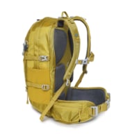
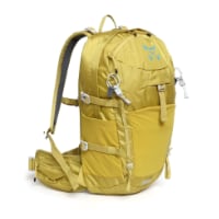
Technical backpack for day trips with backpack cover and internal compartment for the hydration bladder. Ideal daypack for excursions where we need a medium capacity backpack. The back with Air Flow System creates large air channels that will keep our back as cool as possible.

€83,-
I walked from Igüeña to Congosto so can't help you there.

Congosto has several café/restaurantes but they are closed one day of the week. If that is the case, Gloria the hospitalera will let you know and WhatsApp you a menu to choose from. She will then buy food for you and leave it in your room (there is a fridge and microwave). In the evening she will come by to stamp your credential and receive payment.

In Igüeña there is a great albergue run by the Café/Restaurant across the street. I'm sure they could make you something to take along. The owner was very kind to open up early so I could have breakfast at 6.30.

I didn't stop in Lebaniego but going through there were no stores or cafe's.


This is not correct although true that someone from the town wants you to go through Nocedo. If you follow Ender's Wikiloc tracks you pass the albergue on the right but go to Lebaniego.
I just walked the west section of the Olvidao from La Robla.

In Iguena the bar across the road from the albergue was open but the only food they had were some very tired Empanadillas.

Re the Lebaniego/Noceda issue - i posted:
As always I used Enders Wikiloc tracks, the way markers and mapy. Normally this mostly coincide and any differences are less than a km different. However, this was not the case today. Just after Quintana de Fuseros the way markers and Wikiloc took a right turn and then drifts across a few places and heads to Noceda. No idea why as the mapy option look much better and head s more directly to Labaniego. It certainly appears better if like me you intend to carry on to Congosto. As I followed Enders track and then took an alternate route to join the Camino at Atlanta. More details here - https://www.caminodesantiago.me/community/threads/from-la-robla-24-sep-2023.83275/
 
Is the albergue in Igueña the Albergue del Catoute? And what’s the name of the café? Do you have contact info? Thanks.
look at my guide : THE PRACTICAL GUIDE TO THE CAMINO OLVIDADO FROM BILBAO - SUMMER 2022.
Cheers Mick.
 
look at my guide : THE PRACTICAL GUIDE TO THE CAMINO OLVIDADO FROM BILBAO - SUMMER 2022.
Cheers Mick.
I have the guide and got the information I need, thanks. It is a helpful resource although things change quickly.
 
Technical backpack for day trips with backpack cover and internal compartment for the hydration bladder. Ideal daypack for excursions where we need a medium capacity backpack. The back with Air Flow System creates large air channels that will keep our back as cool as possible.

€83,-
Just adding my input on the Igueña to Labaniego route, which I walked today. Shortly after Quintana there is a very clearly marked yellow arrow pointing to the right, which goes to Noceda. There is an old wooden sign that says to continue straight to go to Labaniego. Those who want to go directly to Labaniego could be easily misled here. Markers continue on the Labaniego route for another km or two, then disappear completely, including at several intersecting junctions. The arrows pick up again a few km before Labaniego. Wise Pilgrim, Buen Camino, and caminoolvidado do not show the Noceda turn. By the way, the donativo in Labaniego is fantastic. Antonio and his wife are effusive in their welcome and bring over hot, home cooked meals from their place across the street. I got here at lunchtime and they had chicken wings, meatballs, fresh bread, and apple cake. Dinner is coming over at 7:00 pm. Breakfast is self-serve. There’s a fully stocked kitchen and a four burner cooktop. Great people, great place.
 
Sorry, I’m confused! Is the lebaniego camino part of the Camino del Norte?
 
Ideal sleeping bag liner whether we want to add a thermal plus to our bag, or if we want to use it alone to sleep in shelters or hostels. Thanks to its mummy shape, it adapts perfectly to our body.

€46,-

❓How to ask a question

How to post a new question on the Camino Forum.

Forum Rules

Forum Rules

Camino Updates on YouTube

Camino Conversations

Most downloaded Resources

This site is run by Ivar at

in Santiago de Compostela.
This site participates in the Amazon Affiliate program, designed to provide a means for Ivar to earn fees by linking to Amazon
Official Camino Passport (Credential) | 2024 Camino Guides
Back
Top