• For 2024 Pilgrims: €50,- donation = 1 year with no ads on the forum + 90% off any 2024 Guide. More here.
    (Discount code sent to you by Private Message after your donation)
  • ⚠️ Emergency contact in Spain - Dial 112 and AlertCops app. More on this here.

Search 69,459 Camino Questions

caminka's voie de la nive in 2022

caminka

Veteran Member
Time of past OR future Camino
see signature
six weeks wasn't enough camino yet, so I decided to go a bit closer to home and do two parts in france that I hadn't done before. they also neatly connected my various previous caminos so now I can say that I have walked from mediterranean to the atlantic. ;-)

voie de la nive was a bit of a challenge. not very lot of info on the net, not many people walking it, not much services. I like challenges of this kind.

I stayed in refuge st jacques in bayonne where they have printed descriptions and sketch maps. not too much up-to-date info, though, only what an occasional pilgrim who walked it and stayed there brought along. I was told that a week prior a peregrina was getting lost quite a lot on the route. she started in sjpp and walked to bayonne, so I was hoping that the waymarking was better in the 'right' direction.

I armed myself with hand-made info sheets composed from recent accounts on this forum, printed maps with the route marked on them and mostly info from aucoeurduchemin site. here I learned that the route is actually called chemin de poste. there were gps tracks which were of great help because the route marked on their info sheets is sometimes no longer accurate (bayonne - helette and helette - sjpp). gronze was also useful for the first day which is the same as voie de baztan - though where they split I didn't see.

the first challenge overcome, there was already the second one. distances for the daily stages are not favourable. the first proposed day is usually only 14km to ustaritz, then the next day is from there to helette (30km), and the last day to sjpp is also fairly long and reportedly the most challenging (27km). so I did a lot of googling and came up with this plan:

day 1 - 24km: bayonne - cambo-les-bains 23km, back to ustaritz by train +1km
day 2 - 22km: train to cambo-les-bains 1km then cambo-les-bains - helette 20km
day 3 - 27km: helette - sjpp

trains back to ustaritz left cambo-les-bains at 11.56, 13.03 and 17.23, morning trains back were at 6.55, 7.58 and 9.05.

it worked beautifully.

the third challenge was accommodation. there were only pre-covid lists on the net, like this one from 2017 or this one for voie de baztan. some hosts were probably no longer hosting pilgrims. I was right.

in ustaritz gronze lists maison familiale a ustaritz which is actually madame natalie sabio. she only has 4-5 places and I wasn't sure about its location because gronze says it's in ustaritz but accommodation list's address is 2km before ustaritz. anyway, it was full for the day I would be there.
natalie sabio in/close to ustaritz. 0623 49 33 85, reservation obligatory. 4-5 places. €20 bed & breakfast, dinner €14.

there were one or two hotels which were above my budget.

then I tried the curé, the local priest. after about 10 phone calls to the parish listening to the recorded message I finally got his mobile number down. (some french number are just ridiculous.) I was overjoyed when he said yes, we have basic accommodation for pilgrims set up, you just show up at presbytere next to the church which you pass and ring the bell. according to the parish's site, someone is there tuesday - saturday 10h - 12h and tuesday - friday 15h - 17h. not sure what happens on other days.

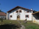
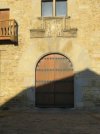
presbytere in ustaritz is the building next to the second church in the park and the rooms are at the back. they are also used for meeting or workshops for locals, so there is other stuff in the rooms and there might be other people there in the afternoon.
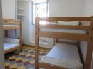
there are three rooms which can all be used as sleeping accommodation, as I have experienced when a french couple showed up and the curé installed them in a smaller room so that we all had our space. very nice. the door in the biggest room I stayed in I couldn't close all the way, but it's a small town.
there are three fold-out beds and six mattresses, two toilets, one shower, disposable linen, a microwave, some cups and cutlery, and a small supply of tea bags and coffee. all donativo.
presbytere in ustaritz. 0559 93 18 00, curé 0684 26 16 02. tuesday - saturday 10h-12h and tuesday - friday 15h-17h. 9 places. donativo.
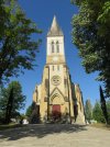
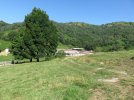
IMG_8608.JPG IMG_8635.JPG IMG_8634.JPG

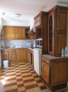
gite d'etape in helette. 0559 37 61 65, reservation obligatory. six beds, one shower, one toilet, linen, full kitchen. €17.
key in mairie: monday, tuesday, thursday 8h-12h+14h-18h, friday 8h-12h, at the post office on saturday 9h-12h (0559 37 52 92), and at madame annie chapelet on sunday (0559 37 66 69, 0644 17 30 39)
IMG_8682.JPG IMG_8684.JPG IMG_8687.JPG


the next challenge was water and other services. fill up with water when you can as there are very few places with it, especially on days 2 and 3.

day 1
- along the flat tarmac bikelane along the river are three water points, also marked on info boards along the route, one just outside bayonne at a playground, another where a road called chemin jantot about half-way and another before ustaritz shortly before the waymarking splits away from the river.
- about two-thirds to ustaritz is a footbridge with a bar across
- ustaritz has a supermarket up on the main road
- water at the cemetery at eglise st sebastian at the end of the first climb after ustaritz, followed by a steep stony descent
- water in the toilets in the main park off route in cambo-les-bains (or on route if you miss the sticker before the last steep short climb into the old part of town with a restaurant and two small hotels)
- water in the toilets at cambo-les-bains' train station
- all other services in cambo-les-bains are in the main town across the river

day 2
- two restaurants in macaye
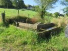
- the only water point is after macaye in zahiola, just up from the crossorad with the board helette, on the route, a lovely lavoir-abrevoir with superb water
- three water points in helette, at the cemetery, in the main square and in the toilets on the right of the building straight ahead as you come to the main square
- helette has a small shop which opens in the afternoon (probably not sunday)

day 3
- the only water point is in irisarri's cemetery which is left off route past a bakery

I walked in july.


it is possible to break the stage ustaritz - helette in two parts. after the long ascent through the woods you come to a more or less flat stretch of the road which ends in a crossroad at paxkoenea. somewhere right of this crossroad, off route, is maison dornarianea. 7km from cambo-les-bains, so 14.5kms from ustaritz. + whatever kms off route.
maison dornarianea in paxkoenea. 0607 33 81 42, resevation obligatory. the host is messieur saint estevan, there are 1-2 places. €18, dinner €10.

it is also possible to break the stage helette - sjpp. somewhere around irissari is gite escots claude, probably best to call ahead, maybe you can get a pick-up?
gite escots claude around irissari. 0559 37 52 37, 0684 16 33 79, reservation obligatory. €15, breakfast €4, dinner €15, half-pension €32.
 
Last edited:
€2,-/day will present your project to thousands of visitors each day. All interested in the Camino de Santiago.
Thank you for your detailed notes! I’m always pleased when I walk a route you’ve already done as I know your notes will be impeccable.
 
@caminka, thank you for this - your notes are always so detailed and precise! 😊 🙏

People regularly ask about this route, so I hope someone will make it a sticky.
I have never considered following the VdN, since you can go directly from Bayonne to Pamplona on the Baztan, saving a day or two. But for those who want to walk from Bayonne, but do not want to miss SJPP and Roncesvalles, this is really valuable information.
 
A selection of Camino Jewellery
Thank you for your detailed notes! I’m always pleased when I walk a route you’ve already done as I know your notes will be impeccable.
thank you, what a compliment! 😊 I like to have the practical aspect done in advance so that I don't need to bother with it (too much) when I walk.
 
Last edited:
@caminka, thank you for this - your notes are always so detailed and precise! 😊 🙏

People regularly ask about this route, so I hope someone will make it a sticky.
I have never considered following the VdN, since you can go directly from Bayonne to Pamplona on the Baztan, saving a day or two. But for those who want to walk from Bayonne, but do not want to miss SJPP and Roncesvalles, this is really valuable information.
I try! :)

it is unfortunate that the challenging parts (day 3 especially) are sparcely waymarked and the stickers are minuscule! I can't imagine how it is walking it in the other direction. french pilgrims who start in lourdes or change from vois d'arles to voie de piemont in oloron-sainte-marie also use it to go to bayonne and continue on sentier littoral and camino del norte, so I was surprised at the spartan waymarking and little updated info.

for that reason I would not recommend it for first-time pilgrims who wish a warm-up before the pyrenees.

more observations to follow!
 
Last edited:
easy to read accommodation recap:

0km bayonne
- refuge st jacques, 14 places, 0559 25 71 33, rue gosse, €10 bed & breakfast, full kitchen, washing machine, info sheets, open from 14h.
- veronique, 8 places, 0687 30 45 15, €25 bed & breakfast, call in advance.
- other accommodation on gronze

14km ustaritz
- natalie sabio in/close to town, 4-5 places, 0623 49 33 85, reservation obligatory, €20 bed & breakfast, dinner €14.
- presbytere next to second church, 9 places, 0559 93 18 00, curé 0684 26 16 02, tuesday - saturday 10h-12h and tuesday - friday 15h-17h, disposable linen, microwave, some cutlery, donativo.

14.5km +? paxkoenea
- maison dornarianea, 1-2 places, 0607 33 81 42, resevation obligatory, €18, dinner €10.

13km helette
- gite d'etape, 6 places, 0559 37 61 65, reservation obligatory, one shower, one toilet, linen, full kitchen, €17. key in mairie: monday, tuesday, thursday 8h-12h+14h-18h, friday 8h-12h, at the post office on saturday 9h-12h (0559 37 52 92), and at madame annie chapelet on sunday (0559 37 66 69, 0644 17 30 39)

9km +? irisarri
- gite escots claude, 0559 37 52 37, 0684 16 33 79, reservation obligatory, €15, breakfast €4, dinner €15, half-pension €32.

18km sjpp
 
Technical backpack for day trips with backpack cover and internal compartment for the hydration bladder. Ideal daypack for excursions where we need a medium capacity backpack. The back with Air Flow System creates large air channels that will keep our back as cool as possible.

€83,-
some observations for day 1 (bayonne - cambo-les-bains) part 1

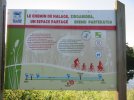
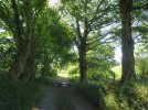
when leaving refuge st jacques in bayonne, go right, left down, down the stairs and exit the old town opposite la tour de sault. head to the river (don't cross it) and go along it. the asphalt bike/hike lane - called chemin de halage, zirga bidea, the towpath - is obvious and usually populated with dog-walkers, joggers and cyclists, and when there are houses also occasional car. this makes it very tricky to find a suitable bush if needed.

the split with sentier littoral is well marked but not very obvious (fourth photo). in any case, you don't need to worry about it.

no food services apart from the bar across the footbridge about two thirds on the way to ustaritz.

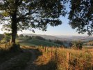
IMG_8595.JPG IMG_8596.JPG IMG_8598.JPG IMG_8600.JPG IMG_8604.JPG

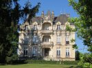
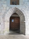
when you are within sight of ustaritz, you come to a T crossroad at a parking lot. stickers point right then left before the hill. I followed chemin de halage further along the river and reached ustaritz close to a bus stop and just shy of a bakery (on the right). turn left, pass the first church, a restaurant, the main road going across the bridge to the train station, and reach the second church in a park, next to a baroque mansion. heading right up the bigger street after the park leads to the main road on top of the town and a supermarket left on it.

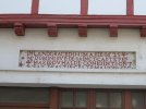
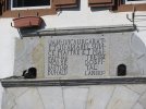
the route continues straight on past lovely basque houses with some long inscription stones and a viewpoint with benches to a crossroad with a cross. stickers want you to go straight down the main road which is very busy and narrow and has no sidewalk. instead, head right, pass a pedestrian crossing, and after no. 581 (left) turn left to a lane that descends to the start of a bridge and the main road with stickers.

IMG_8609.JPG IMG_8611.JPG IMG_8613.JPG

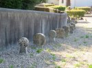
a steady asphalt ascend leads to a cemetery with the church of st sebastian. cemetery has water and basque gravestones called hilarri.

IMG_8622.JPG IMG_8623.JPG
 
some observations for day 1 (bayonne - cambo-les-bains) part 2

to the right of the church a steep stony lane (the only respite from asphalt on day 1!) descends to houses and becomes a quiet minor road through halsou, past its lavoirs and the church with cemetery (I didn't see any water taps), through a forest with a small picnic spot by the river, to a Y crossroad at the start of the ascent to cambo.

IMG_8627.JPG IMG_8628.JPG IMG_8630.JPG IMG_8631.JPG IMG_8632.JPG

in the Y crossroad fork right twice with red-white waymarks (GR waymarks) to bypass this old part of cambo and reach the main road at the railway.

or you can miss this turn, head up the hill to the first crossroad (on top), feel confused, check the map and turn right. the road leads past a bar, restaurant and hotel to a public park with toilets (water) and swings, turn right after the park and reach the main road and stickers at the railway.

cross the railway and follow it left to the train station with another set of toilets (water).
 
Last edited:
Thanks for your wonderful description. For those who have mapy.cz on their phones, the Voie de la Nive is clearly shown, with no need to download anything further. Here is the track:
 
Down bag (90/10 duvet) of 700 fills with 180 g (6.34 ounces) of filling. Mummy-shaped structure, ideal when you are looking for lightness with great heating performance.

€149,-
some observations for day 2 (cambo-les-bains - helette)

in front of the train station of cambo-les-bains is a crossroad/roundabout. stickers go right here to the bridge across the river then left before the bridge and round some fields back to the railway.
I took a small road straight ahead parallel to the railway which turned into a track past gardens and ended on the road with stickers.

this road ended on a busy main road where you turn left then right into the first minor road, route des paturages. this undulates past houses then through woods above the river to a fork. fork left up here. the climb starts and it is very steep in several short sections, but woody. there is a zigzag, more climbing, and a fork.

fork right and more steadily ascend past pastures and farm with viewss, and around a small valley to ascend to a fork under a big cow shed/warehouse above. the right fork down then straight ahead should lead to maison dornarianea, if maps are correct.

IMG_8646.JPG IMG_8650.JPG IMG_8652.JPG

follows another steep climb then a more steady climb to a ridge with tracks on both sides then a descent to an unmarked T crossroad. turn right down then in the following T crossroad shorty turn left. ascend to the main road and the main road left to macaye. you may see some serious animals in the pastures.

IMG_8657.JPG IMG_8662.JPG

the first restaurant in macaye is at the start (it was still closed when I passed) opposite mairie with an interesting relief of a man holding a pouch and a cup(?). the second restaurant is in the following crossroad where the stickers turn right. this is perhaps more a bar and has/had a very small shop which looked closed (there were lots of dead flies laying around). I asked for water here but was told that it's too expensive and that there is a tap further up. I didn't see any taps.

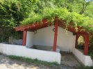
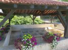
a steep climb to a fork, turn left, climb some more then descend to a crossroad with a board for helette pointing right down, in zahiola. ignore it and keep straight ahead up to a lavoir-abrevoir with excellent fresh water.

IMG_8666.JPG

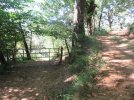
after the fountain turn right up and after the steep climb the asphalt finally ends. the farm road ascens to a ridge then steeply descends to a T crossroad before a stream. I didn't see any stickers here. turn sharp left to the left track (the right track ends in a field), cross a muddy area with big trees (photo) and steeply climb to a minor road. turn left then right and undulate past farms to a crossroad with a big house called ospitalea on the right.

IMG_8669.JPG IMG_8677.JPG IMG_8678.JPG

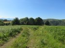
straight on descend across a stream then ascend to the first crossroad, with another crossroad to the right. go right to this other crossroad, turn right and in 50m turn left into a wide grassy, and possibly a overgrown, lane bordered by bushes. it leads to the busy main road where you turn right.

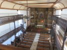
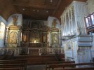
cross a stream and ascend past a road left down to an electricity pole before a bigger tree. stickers follow the road up to the crossroad then turn left past a picnic spot. but to the left of the electricity pole is an old lane, probably a bit overgrown but passable, that also ascends to the picnic spot. turn left on the road, after the stream turn right and ascend past the church (you can climb the typical basque galleries and see how the nave looks from above) with cemetery (water, some interesting tombstones) to the main square in helette.

IMG_8704.JPG

mairie and post office are on the right, shop is on the left.

for gite d'etape cross the square to a stone cross, pass to the left of it, pass garages in the building on the right, descend to a fork and keep along the house on the left to its small courtyard. the door into the gite is on the left. there is also a friendly crafts shop in the courtyard.
 
Last edited:
the first restaurant in macaye is at the start (it was still closed when I passed)
Sadly, you missed THE best meal I have had in five Caminos and perhaps life! We had lunch there and everything was fresh and local. The cheese course was phenomenal and when we asked where the cheese was from, the owner pointed out the window at the cows on the surrounding hills 😂. Turns out the cheese factory IS just down the street and we picked up some for future picnic lunches.

This route in its entirety was phenomenal. While it’s poorly waymarked (“unlike the Spanish, we French do not paint yellow arrows on our beautiful lands”🙄😂), a gps mapping program ensures you’ll make it. As we climbed out of her field, lost and wandering in the hills near SJPdP, a kindly shepherdess greeted us with a smile and pointed us in the correct direction. Getting lost was part of the adventure.
 
This route in its entirety was phenomenal. While it’s poorly waymarked (“unlike the Spanish, we French do not paint yellow arrows on our beautiful lands”🙄😂),
very true, but this route was poorly waymarked even for french standards. (granted, it is not a gr or a pr.)
 
The focus is on reducing the risk of failure through being well prepared. 2nd ed.
observations for day 3 (helette - sjpp) part 1

this was the most challenging orientation-wise because it was the least well waymarked and the route has been changed on at least two sections. for the better, avoiding more asphalt and more main road but very sparcely waymarked.

the first tricky spot was leaving helette. as far as I could see, the route is not waymarked through the village. from gite d'etape look left across a parking lot and you will see a small road going up on the other side of the main road. that's the one.

but don't forget to leave the key at the post box at the mairie!

ascend due south to a fork with an iron cross in front of a tree. this cross is difficult to spot in early morning or in the mist or rain and I almost walked straight past it. you need to veer right here past a house.

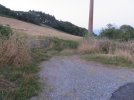
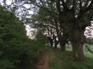
descend to the farm at the end of asphalt and veer to a track to the left of an electricity pylon (photo). in 100m you come to a fork with no visible waymarking (photo). don't fork left to a better looking level path. if you make that mistake (as I did) you will pass a beautiful old tree (photo) and come to a small valley. the path continues on past more old trees (photo) but you must not follow it and have to turn right down an overgrown lane to get back to the route.

IMG_8749.JPG IMG_8752.JPG IMG_8750.JPG IMG_8751.JPG

instead, in the fork go right down an overgrown path/lane which soon becomes less overgrown and quite steep down through woods. on bottom you end on a road with a building left, this is an old lavoir.

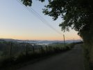
head right and soon cross the main road diagonally left for another minor road. follow this road with nice views all the way to a crossroad with a cross and a bus stop. it's lots of ups and downs through lovely countryside.

IMG_8755.JPG IMG_8754.JPG IMG_8758.JPG

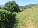
turn left, pass an estate on the right (the route used to turn right in front of it) to ascend to a fork/crossroad between two estates. turn left to a road behind the houses on the left and ascend to the end of asphalt. right a beautiful track with more beautiful views descends to a farm. my favourite kind of route.

IMG_8759.JPG IMG_8760.JPG IMG_8761.JPG
 
observations for day 3 (helette - sjpp) part 2

keep straight on down past the farm and in between its warehouses then up to a crossroad, and further on to the next crossroad, it's a T crossroad. stickers turn right here to head into irisarri and bypass both the bakery and the cemetery with water but I chose to go left to pass by both.

I turned left then twice right and ended on the main road in the newer part of irisarri. I turned right and reached the cemetery. the water tap was on the outside wall on the corner in front of it. I zigzagged through the cemetery, peaked into the church and visited the bakery.

IMG_8771.JPG IMG_8772.JPG

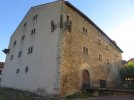
then I crossed the street and made a thorough outside inspection of the ospitalea, an imposing stone building which is now an exhibition space and a former hospitalers commanderie. unfortunately, it was closed due to covid.

IMG_8790.JPG IMG_8776.JPG IMG_8778.JPG IMG_8780.JPG IMG_8789 – kopija.JPG

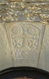
at one corner was also an interesting sculpted cross. here I joind the stickers by turning left.

IMG_8782.JPG IMG_8783.JPG
 
observations for day 3 (helette - sjpp) part 3

top up water!

stickers lead past the more rough side of the commanderie, descend and fork right to a minor road (by a playground). this road is followed for a good while. take care not to fork right towards chambres d'hotes but in the next fork do fork right or you will end on the main road and miss the most spectacular part.

in the third fork go left past two fine trees and start really ascending. ascend all the way across a pass with big old chestnuts to the end of asphalt by a meadow with an old shepherds' hut called margueta.

IMG_8799.JPG IMG_8800.JPG

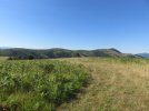
from here on the stickers were very scarce. ascend above the hut, cross the cow gates and descend a wide grassy lane (possibly with cows) to a fork (unmarked). fork left to ascend a rought dirt path which is later bordered by a stone wall/fence on the right.

IMG_8802.JPG IMG_8803.JPG

it also bends right to the high point with two lone trees visible on the other side of the wall. bend left (unmarked) and descend a grassy track, bending left, to a grove and a track.

IMG_8804.JPG IMG_8806.JPG

at the grove turn left (unmarked) on a good track and follow it to a minor road with signposts for 'sentier des contrabandiers'. turn left (unmarked) and follow this road up to a pass then right down, then up to a gravel road going left down. the route used to go down this road.

but the route was changed to avoid more of the main road walking. keep up to another pass (unmarked), bend left and descend, very steeply at the end, to the first house of the farm garaitkoexea. the house is a former shed and has wooden doors for carts carting hay into the shed.

turn sharp right here (unmarked), to a track past a gate and above a fenced meadow. it can be very muddy. after a bit more then 100m, in the midst of the deepest mud, fork left down a steep track with a gate. there was a sticker on the gate!

IMG_8812.JPG

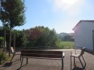
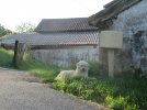
steeply descend to a meadow and skirt it along the bottom edge to the other side where begins a track leading through woods to a clearing with a ruin left. keep straight on/right (unmarked) on a path/lane/track skirting trees (on the right, unmarked, below left is a house), cross a fence and descend to a minor road in the valley with a huge farm ahead, called susperregia. a bench was here under a tree a bit before the road! with a friendly border collie.

IMG_8813.JPG IMG_8815.JPG IMG_8817.JPG

descend the road all the way down to the main road, turn right and follow it just past a camping. veer left to a minor road and stay on it, crossing the main main road and in la magdeleine joining red-white waymarkings of voie du puy which will lead you to sjpp.

la madeleine's church has a walled-in door which was made specifically for cagots, a frowned-upon and pretty much unwanted people who were thought to be the source of misfortunes and diseases, and had many restrictions placed upon them.
 
Last edited:
New Original Camino Gear Designed Especially with The Modern Peregrino In Mind!
If anyone wants to walk the Voie de Nive, they have a ready-made guide to print! It sounds like the waymarking could be better, and that a track might be the way to go - but it looks well worth it.
Merci for all your posts, @caminka!
 
six weeks wasn't enough camino yet, so I decided to go a bit closer to home and do two parts in france that I hadn't done before. they also neatly connected my various previous caminos so now I can say that I have walked from mediterranean to the atlantic. ;-)

voie de la nive was a bit of a challenge. not very lot of info on the net, not many people walking it, not much services. I like challenges of this kind.

I stayed in refuge st jacques in bayonne where they have printed descriptions and sketch maps. not too much up-to-date info, though, only what an occasional pilgrim who walked it and stayed there brought along. I was told that a week prior a peregrina was getting lost quite a lot on the route. she started in sjpp and walked to bayonne, so I was hoping that the waymarking was better in the 'right' direction.

I armed myself with hand-made info sheets composed from recent accounts on this forum, printed maps with the route marked on them and mostly info from aucoeurduchemin site. here I learned that the route is actually called chemin de poste. there were gps tracks which were of great help because the route marked on their info sheets is sometimes no longer accurate (bayonne - helette and helette - sjpp). gronze was also useful for the first day which is the same as voie de baztan - though where they split I didn't see.

the first challenge overcome, there was already the second one. distances for the daily stages are not favourable. the first proposed day is usually only 14km to ustaritz, then the next day is from there to helette (30km), and the last day to sjpp is also fairly long and reportedly the most challenging (27km). so I did a lot of googling and came up with this plan:

day 1 - 24km: bayonne - cambo-les-bains 23km, back to ustaritz by train +1km
day 2 - 22km: train to cambo-les-bains 1km then cambo-les-bains - helette 20km
day 3 - 27km: helette - sjpp

trains back to ustaritz left cambo-les-bains at 11.56, 13.03 and 17.23, morning trains back were at 6.55, 7.58 and 9.05.

it worked beautifully.

the third challenge was accommodation. there were only pre-covid lists on the net, like this one from 2017 or this one for voie de baztan. some hosts were probably no longer hosting pilgrims. I was right.

in ustaritz gronze lists maison familiale a ustaritz which is actually madame natalie sabio. she only has 4-5 places and I wasn't sure about its location because gronze says it's in ustaritz but accommodation list's address is 2km before ustaritz. anyway, it was full for the day I would be there.
natalie sabio in/close to ustaritz. 0623 49 33 85, reservation obligatory. 4-5 places. €20 bed & breakfast, dinner €14.

there were one or two hotels which were above my budget.

then I tried the curé, the local priest. after about 10 phone calls to the parish listening to the recorded message I finally got his mobile number down. (some french number are just ridiculous.) I was overjoyed when he said yes, we have basic accommodation for pilgrims set up, you just show up at presbytere next to the church which you pass and ring the bell. according to the parish's site, someone is there tuesday - saturday 10h - 12h and tuesday - friday 15h - 17h. not sure what happens on other days.

presbytere in ustaritz is the building next to the second church in the park and the rooms are at the back. they are also used for meeting or workshops for locals, so there is other stuff in the rooms and there might be other people there in the afternoon.
there are three rooms which can all be used as sleeping accommodation, as I have experienced when a french couple showed up and the curé installed them in a smaller room so that we all had our space. very nice. the door in the biggest room I stayed in I couldn't close all the way, but it's a small town.
there are three fold-out beds and six mattresses, two toilets, one shower, disposable linen, a microwave, some cups and cutlery, and a small supply of tea bags and coffee. all donativo.
presbytere in ustaritz. 0559 93 18 00, curé 0684 26 16 02. tuesday - saturday 10h-12h and tuesday - friday 15h-17h. 9 places. donativo.
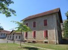
View attachment 132846 View attachment 132847 View attachment 132848

gite d'etape in helette. 0559 37 61 65, reservation obligatory. six beds, one shower, one toilet, linen, full kitchen. €17.
key in mairie: monday, tuesday, thursday 8h-12h+14h-18h, friday 8h-12h, at the post office on saturday 9h-12h (0559 37 52 92), and at madame annie chapelet on sunday (0559 37 66 69, 0644 17 30 39)
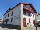
View attachment 132849 View attachment 132850 View attachment 132851


the next challenge was water and other services. fill up with water when you can as there are very few places with it, especially on days 2 and 3.

day 1
- along the flat tarmac bikelane along the river are three water points, also marked on info boards along the route, one just outside bayonne at a playground, another where a road called chemin jantot about half-way and another before ustaritz shortly before the waymarking splits away from the river.
- about two-thirds to ustaritz is a footbridge with a bar across
- ustaritz has a supermarket up on the main road
- water at the cemetery at eglise st sebastian at the end of the first climb after ustaritz, followed by a steep stony descent
- water in the toilets in the main park off route in cambo-les-bains (or on route if you miss the sticker before the last steep short climb into the old part of town with a restaurant and two small hotels)
- water in the toilets at cambo-les-bains' train station
- all other services in cambo-les-bains are in the main town across the river

day 2
- two restaurants in macaye
- the only water point is after macaye in zahiola, just up from the crossorad with the board helette, on the route, a lovely lavoir-abrevoir with superb water
- three water points in helette, at the cemetery, in the main square and in the toilets on the right of the building straight ahead as you come to the main square
- helette has a small shop which opens in the afternoon (probably not sunday)

day 3
- the only water point is in irisarri's cemetery which is left off route past a bakery

I walked in july.


it is possible to break the stage ustaritz - helette in two parts. after the long ascent through the woods you come to a more or less flat stretch of the road which ends in a crossroad at paxkoenea. somewhere right of this crossroad, off route, is maison dornarianea. 7km from cambo-les-bains, so 14.5kms from ustaritz. + whatever kms off route.
maison dornarianea in paxkoenea. 0607 33 81 42, resevation obligatory. the host is messieur saint estevan, there are 1-2 places. €18, dinner €10.

it is also possible to break the stage helette - sjpp. somewhere around irissari is gite escots claude, probably best to call ahead, maybe you can get a pick-up?
gite escots claude around irissari. 0559 37 52 37, 0684 16 33 79, reservation obligatory. €15, breakfast €4, dinner €15, half-pension €32.
Thank you so so much. I thought I would do chemin de la Nive to get my walking legs and kinks out before starting the Frances but now as a solo walker and new to the whole peregrina experience I’m reconsidering if I should even do this. Not so much due to infrastructure but worried about getting lost 😞
 
these notes are FAR superior to the ones I had when walking "the wrong way" in 2014. I got lost every day! But still, I suggest it every time people ask how to get from Bayonne to SJPDP because it is such a beautiful walk! Now they have your notes, they have no excuse.
 
St James' Way - Self-guided 4-7 day Walking Packages, Reading to Southampton, 110 kms
Thank you so so much. I thought I would do chemin de la Nive to get my walking legs and kinks out before starting the Frances but now as a solo walker and new to the whole peregrina experience I’m reconsidering if I should even do this. Not so much due to infrastructure but worried about getting lost 😞
not to discourage you but you at least need to be used to french type of waymarkinkg for non-gr and non-pr routes - these are official walking routes which are typically well waymarked.
the stickers for non-gr pilgrim routes are quite small dark blue squares with a thin-lined yellow scallop and often have the tendency to disappear into the surroundings. they are sometimes supplemented with wooden signposts and (yellow) arrows. usually they are fairly well placed but you need eagle eyes to spot them. on voie de la nive they were nonconsistent or lacking especially on the most challenging off-road parts.

if you are versed in walking with a gps, have reasonable orientation skills and can funcion with a paper map, I think you could do it. it really helps if you can read french descriptions on aucoeurduchemin's site's pdf with maps (which are outdated in parts, use the gps from their site). speaking french helps if you need to ask for directions.
the only really orientation-challenging sections are three crossings of hills between helette and the main road before sjpp.

but if this is your first camino and you wish a pre-sjpp walk, it's perhaps better to start in orthez (train station) and walk a combination of voie de vezelay and voie du puy (orthez - sauveterre - ostabat - sjpp) which is well waymarked and has enough services.
or maybe voie du piemont from oloron-sainte-marie (train station) but this one is not a walk in the park terrain-wise and there are just enough services (oloron - hopital-st-blaise - mauleon - saint-just - sjpp).
 
Last edited:
If anyone wants to walk the Voie de Nive, they have a ready-made guide to print! It sounds like the waymarking could be better, and that a track might be the way to go - but it looks well worth it.
Merci for all your posts, @caminka!
oh! that's wonderful news. it could be a great introduction and training for those starting in sjpp. hopefully with detailed-enough maps that a gps is not needed (but useful).

you're welcome! ☺️
 
Last edited:
Ideal sleeping bag liner whether we want to add a thermal plus to our bag, or if we want to use it alone to sleep in shelters or hostels. Thanks to its mummy shape, it adapts perfectly to our body.

€46,-
these notes are FAR superior to the ones I had when walking "the wrong way" in 2014. I got lost every day! But still, I suggest it every time people ask how to get from Bayonne to SJPDP because it is such a beautiful walk! Now they have your notes, they have no excuse.
awww, thank you! ☺️

the route is not waymarked in the direction from sjpp to bayonne and I am not surprised at all that you got lost. even in the 'right' way I veered off route a few times, with the gps and the printed map and after walking so many caminos that I feel quite confident in my orientation skills. luckily, my sixth sense has also developped so much that it starts niggling at me if the route doesn't feel right.
 
@caminka, was there a clear waymarking where the Baztan and VdN part company, or did you have to wing it?
I have not seen it.

I remember two signposts for voie de baztan on the first day along the river. that's all.

according to gronze and waymarked trails the split is in ustaritz shortly after the park with the church with the presbytere pilgrim accommodation and voie de baztan then passes by the supermarket. I have actually walked something like that when I was strolling around ustaritz but I don't remember any signsposts or waymarks (wasn't really paying attention, to be honest).

I was basically following my printed maps and the gps out of ustaritz.
 
Last edited:
Ideal sleeping bag liner whether we want to add a thermal plus to our bag, or if we want to use it alone to sleep in shelters or hostels. Thanks to its mummy shape, it adapts perfectly to our body.

€46,-
awww, thank you! ☺️

the route is not waymarked in the direction from sjpp to bayonne and I am not surprised at all that you got lost.
Actually, in 2014 it WAS waymarked, albeit minimally. There were occasional little metal signs. In fact my boys found one in long grass when chasing a lizard! Because there was no lamppost or fence post to attach it to in the immediate vicinity (and we weren’t carrying screws in our backpacks!), I allowed them to take it home as a souvenir. Perhaps all the signs have met a similar fate.
 
If anyone wants to walk the Voie de Nive, they have a ready-made guide to print! It sounds like the waymarking could be better, and that a track might be the way to go - but it looks well worth it.
Merci for all your posts, @caminka!
where can I find the map??
I’m now on the chemin de poste, but people in Bayonne told me there’s no map, so I’m following google map which took me to the highway and had a terrible first day (Bayonne-cambo).
I’ll follow caminka’s great guide but also wanna have a map in case.. thank you!
 
The 2024 Camino guides will be coming out little by little. Here is a collection of the ones that are out so far.
Actually, in 2014 it WAS waymarked, albeit minimally. There were occasional little metal signs. In fact my boys found one in long grass when chasing a lizard! Because there was no lamppost or fence post to attach it to in the immediate vicinity (and we weren’t carrying screws in our backpacks!), I allowed them to take it home as a souvenir. Perhaps all the signs have met a similar fate.
that's too bad. I didn't see any such signs. they were probably replaced by stickers, although I didn't see them in the 'opposite' direction. I did check occasionally, especially if I wasn't entirely sure where to turn to because waymarks in the opposite direction may help figuring out my direction.
 
where can I find the map??
I’m now on the chemin de poste, but people in Bayonne told me there’s no map, so I’m following google map which took me to the highway and had a terrible first day (Bayonne-cambo).
I’ll follow caminka’s great guide but also wanna have a map in case.. thank you!
printable maps with the route marked on them are from aucoeurduchemin site.
 
Join our full-service guided tour and let us convert you into a Pampered Pilgrim!
@caminka

That’s an incredible thread … thank you! 😊

Such detailed way-marking and guidance … even with a gps, I‘d want to follow your Way.

Buen Camino … I’m in awe of the distances/caminos you’ve walked 😳

PS Lovely photographs … they really capture the beauty of the walk and are also helpful as regards sticking to the way!
 
I arrived at Sjpdp this noon! Your pictures and report helped me a lot. Without it, I couldn’t make this little Camino for 3days. Thank you so much!!!
you are most welcome! it always makes me happy when people find my notes useful. ☺️
 
@caminka

That’s an incredible thread … thank you! 😊

Such detailed way-marking and guidance … even with a gps, I‘d want to follow your Way.

Buen Camino … I’m in awe of the distances/caminos you’ve walked 😳

PS Lovely photographs … they really capture the beauty of the walk and are also helpful as regards sticking to the way!
you are welcome! ☺️

I sincerely hope that the notes are enough and you wouldn't get lost.

Buen Camino … I’m in awe of the distances/caminos you’ve walked 😳
errrr .... thank you! ☺️ I really like walking and everything else that comes with it! 😀

PS Lovely photographs … they really capture the beauty of the walk and are also helpful as regards sticking to the way!
that was sort of their intention. I usually forget to take 'practical' photos (like crossroads and such) but in this case I tried to remember to do so.
 
The 2024 Camino guides will be coming out little by little. Here is a collection of the ones that are out so far.

❓How to ask a question

How to post a new question on the Camino Forum.

Forum Rules

Forum Rules

Camino Updates on YouTube

Camino Conversations

Most downloaded Resources

This site is run by Ivar at

in Santiago de Compostela.
This site participates in the Amazon Affiliate program, designed to provide a means for Ivar to earn fees by linking to Amazon
Official Camino Passport (Credential) | 2024 Camino Guides
Back
Top