- Time of past OR future Camino
- Most years since 2012
Since I am still not expecting to be on the Camino soon, I'm trying to do useful things with my time here on the forum.
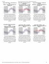
I would like to create the ultimate weather thread - to be linked to a FAQ (Frequently Asked Questions) series. When people ask "what will the weather be like in month X", everyone recounts their own experience, which is great fun. But where should we refer those people for the best information?
Feel free to give links to good weather information sites, or even describe what you would tell someone who asks about the weather. Remember that usually they are trying to figure out what clothes or equipment they need to pack.
(Of course, I could research this myself, but that would be work, and I know the forum community would like to help!)")
I would like to create the ultimate weather thread - to be linked to a FAQ (Frequently Asked Questions) series. When people ask "what will the weather be like in month X", everyone recounts their own experience, which is great fun. But where should we refer those people for the best information?
Feel free to give links to good weather information sites, or even describe what you would tell someone who asks about the weather. Remember that usually they are trying to figure out what clothes or equipment they need to pack.
(Of course, I could research this myself, but that would be work, and I know the forum community would like to help!)

 (Camino del Norte,...)