• For 2024 Pilgrims: €50,- donation = 1 year with no ads on the forum + 90% off any 2024 Guide. More here.
    (Discount code sent to you by Private Message after your donation)
  • ⚠️ Emergency contact in Spain - Dial 112 and AlertCops app. More on this here.

Search 69,459 Camino Questions

Notes on the Norte, July 2023

Dave

Active Member
Time of past OR future Camino
First: Camino Francés 2002; most recent: Norte/Primitivo 2019
This is my first time back on the first half of the Norte since COVID. It's good to be back! The walk remains as stunning as ever. Some assorted observations on developments, changes, and other stuff on the stages I've walked thus far (Irún-Güemes).
  • It sure looks like they've re-routed the "official" route in Stage 1 through Leko, instead of staying at the high level until the final descent to Pasaia. I don't get it. They've also wiped out the old yellow arrows, at least near the turn-off. My recommendation is to ignore the yellow arrows calling for that detour through Lekos. If you can handle an extra kilometer and a bit more up-and-down, stay with the GR into Pasaia. If you can't, follow the old Camino by following the GR until it forks left uphill soon after the Leko split. Instead, follow the trail into the trees. Eventually, it'll dump you out on a paved road. Turn left onto that road and stick with it for a bit. When it makes a hairpin turn to the left, go straight onto a minor paved road. You'll be seeing old yellow arrows at this point
  • There are two new pilgrim rest areas en route to Orio. The first comes just as the pavement (finally) ends after Barrio Igeldo--it's a small, wooden kiosk on the edge of the woods with coffee and tea. The other comes after the pavement resumes, just after you've crested a small hill--it's a personal home on the right, with lots of comfortable seating. Really nice spot
  • If you follow the GR into Deba--and you should!--it has kind of an annoying ending, doubling back inland after the Ermita de Santa Catalina and rejoining the Camino for the final descent. Well, it wasn't always that way--some erosion concerns forced the closure of a more direct approach. I was walking this on a Saturday, and I saw tons of locals coming up that route, so I checked it out--looks like it's totally viable once again! To do this, pause as you approach the Ermita de Santa Catalina. Before you step across the fence posts into the shrine's grounds, turn around, and look for the footpath descending to your left. That's the way. It will drop you right by the beach in Deba and save some distance in the process
  • It's a common complaint (or sad observation, maybe) that bars often open later on the Norte than the CF. Well, there's a bar in Deba directly across from the albergue that opens at 06:00 every day, even Sunday!
  • I'll need to calculate this out when I get home and have access to a proper computer and all of my notes, but it sure felt like a *lot* more of the walk through the woods to Markina has been paved. (Also, I'll once again plug the old approach into Markina. When you arrive at a gravel road atop the hills overlooking Markina, and the waymark calls for a sharp right turn, note that there's another trail splitting off to the left at that point. It's steep in places, for sure, so maybe not best for those with balky knees, but it trims off a kilometer.)
  • Due to albergue closures in Gernika and Eskerika, the albergue in Olabe has become a pinch point. Totally caught me by surprise. From Markina, people are looking at 18km to Olabe or 30ish km to Pozueta/Gerekiz, so they're leaning heavily towards the former. A lot of people were turned away because all of the beds were already reserved
  • One of the new things I was most excited to try this time was the coastal approach from Gernika to Portugalete. This follows the GR123 and it's well waymarked most of the time with the red/white blazes. There's a surf hostel in Bakio, 25km from Gernika, that is definitely much pricier than a pilgrim albergue, but still cheaper than a hotel--and the attached restaurant is buzzing with activity. The major highlight of this variant is getting to see Gaztelugatxeko (note that a reservation is required to access the church!). The train from Bilbao connects with Plentzia, further on this walk, so you could potentially stay in Bakio, then stay in Bilbao for one or two nights while commuting by train. On the whole, I was glad to do it. The walking was lovely--harder surfaces at the beginning and ending, but tons of fantastic coastal scenery in between. After so many tourist-focused towns early on the Norte in the Basque Country, it was kind of nice to see some quieter Basque beach towns
  • I had also mapped out plans to follow the GR from the Portugalete side of the Puente Colgante to Playa de la Arena. Alas, I just didn't have the juice to walk those this time--they go atop those two big hills and I think the views would be awesome. But it was cloudy, and I was tired. I followed the bike track and wished as always for something more exciting
  • A detour is currently in effect between Pobeña and Covarón. That bummed me out--hope it's fixed up soon. (Judging by the fence "blocking" the official route, I don't think many locals are following the rules.)
  • They've done a better job of waymarking the route split in Ontón. Much appreciated
  • On the flip side, they've now changed the waymarks so that you're steered back inland from the beach in Mioño, instead of following the wonderful coastal walk. This is ridiculous. I think it's intended to drive more traffic past the newer albergue in Santullan, and I appreciate that, but covering up the old waymarks to steer everyone that way? That's annoying. Follow the coast if you don't want to stay in Santullan--stay on the road as it winds around the water, then fork left uphill on the road past the restaurant. Some waymarks survive after that and it's otherwise intuitive
  • I finally had the chance to walk around the Santoña peninsula! It adds around 8km to the walk. A lot of this walk is in thick tree cover, so there are fewer views than I expected, but when things opened up it was great. The route drops you in just above the Playa de Berria, slipping in between the prison and the cemetery, cheerily enough
  • The inland variant to Isla is now waymarked from Noja. I prefer the coastal approach, of course. Still, I hope Isla is getting enough traffic to keep that albergue alive
  • Some current prices: 1.10 for Pasaia ferry, 0.50 for Puente Colgante, 2.50 for Laredo ferry
One last thing: I've got to say, I'm deeply discouraged by the state of pilgrim albergues in the Basque Country. Looking back over the years since I've been paying attention to this... Albergue Goikoerrota after Irun closed. The municipals in San Sebastian and Zarautz are long gone. The albergue that used to be at Gran Camping Zarautz--gone, too. Orio has closed. Zumaia's two in the center--one private, one parochial--are both gone. Markina has lost two privates over the years. The private that used to be next to Zenarruza closed, reopened, closed, reopened, and has now been shuttered for a while. Munitibar's has closed. Mendata's is closed... at least for now. Same for Gernika--both the short-lived refuge and the youth hostel. Eskerika is closed and for sale.

I'm impressed by the work that has been done with the municipal albergues in Irún and Deba. Cramped as Deba's space is, they make it work. But where are the other municipals? And is there any support for private albergues that want to focus on pilgrims, not tourists and surfers? More options need to be made available to pilgrims, especially in the summer.

Anyway, time to get back outside--it's a beautiful afternoon in Güemes.
 
Ideal sleeping bag liner whether we want to add a thermal plus to our bag, or if we want to use it alone to sleep in shelters or hostels. Thanks to its mummy shape, it adapts perfectly to our body.

€46,-
The other comes after the pavement resumes, just after you've crested a small hill--it's a personal home on the right, with lots of comfortable seating. Really nice spot
Were they serving cake and coffee for donations? I learned that it's organized by the Twelve Tribes, and the money goes to that group, which I would rather not contribute to.
 
Thank you Dave for writing this down. And sad to read about the disappearing albergues.I have very fond memories of the parochial in Zumaia, to name just one.

Do you have any idea why this is the case ? A result of covid ? Municipal albergues not being able to cope with growing numbers of pilgrims ? Or deliberate decisions by the powers that be (who ever they are) to stimulate pilgrims to stay in hotels and pensions ?
 
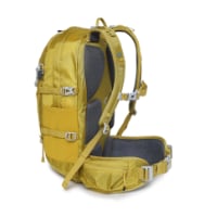
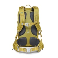
Technical backpack for day trips with backpack cover and internal compartment for the hydration bladder. Ideal daypack for excursions where we need a medium capacity backpack. The back with Air Flow System creates large air channels that will keep our back as cool as possible.

€83,-
Were they serving cake and coffee for donations? I learned that it's organized by the Twelve Tribes, and the money goes to that group, which I would rather not contribute to.
Hmm... I know about the Twelve Tribes location before San Seb. Is this one before Orio also attached to that?
 
Do you have any idea why this is the case ? A result of covid ? Municipal albergues not being able to cope with growing numbers of pilgrims ? Or deliberate decisions by the powers that be (who ever they are) to stimulate pilgrims to stay in hotels and pensions ?
Lots of different factors--older buildings breaking down, deaths in family, challenges with meeting regulations (which is probably influenced by the tight margins of the albergue life).

There's a fair amount of scuttlebutt in different places on the Norte of private businesses resenting the donation-based model of some pilgrim albergues. I'd like to think that's not a major factor, but you have more and more private hostels that are charging 30+ euros for beds in the summer (the prices in SanSeb and Zarautz are wild), and they want to maximize their market. On the flipside, there was always a lot of talk when the municipals were open about phony pilgrims (like, genuinely not walking, not trying to break the new rule!) getting credentials to get 5-euro beds in SanSeb and Zarautz to avoid the pricier places.

I think the short answer is that it's just not a priority. People will grit their teeth and pay whatever they have to pay.
 
Very light, comfortable and compressible poncho. Specially designed for protection against water for any activity.

Our Atmospheric H30 poncho offers lightness and waterproofness. Easily compressible and made with our Waterproof fabric, its heat-sealed interior seams guarantee its waterproofness. Includes carrying bag.

€60,-
It sure looks like they've re-routed the "official" route in Stage 1 through Leko, instead of staying at the high level until the final descent to Pasaia. I don't get it. They've also wiped out the old yellow arrows, at least near the turn-off. My recommendation is to ignore the yellow arrows calling for that detour through Lekos. If you can handle an extra kilometer and a bit more up-and-down, stay with the GR into Pasaia. If you can't, follow the old Camino by following the GR until it forks left uphill soon after the Leko split. Instead, follow the trail into the trees. Eventually, it'll dump you out on a paved road. Turn left onto that road and stick with it for a bit. When it makes a hairpin turn to the left, go straight onto a minor paved road. You'll be seeing old yellow arrows at this point
Thanks for this @Dave It's a relief to read this in a way. Last year we were based in Hondarribia for about 5 days and decided to go for a walk via the Alpiniste route to Pasajes. It had been a few years since we'd walked the Norte. When we came to the 'turn off' you described I was a bit confused I said to my husband ' this doesn't feel right'. But it had been a while so …

… instead of following my instincts, we took the turn and ended up in Lezo and walking back to Pasajes on the concrete footpath. It was not at all pleasant, especially with the memories of the other approach. Next time, we will definitely ignore those arrows and stay on the GR. Thank you.
 
Last edited by a moderator:
Can you give a little more detail about your warning in Mioño? Going to be walking there tomorrow and can't follow what you refer to when I look at the map in the Wise app. Thanks!
 
The one from Galicia (the round) and the one from Castilla & Leon. Individually numbered and made by the same people that make the ones you see on your walk.
Can you give a little more detail about your warning in Mioño? Going to be walking there tomorrow and can't follow what you refer to when I look at the map in the Wise app. Thanks!
Dave is guy with the answers, but I did a little searching on wikiloc and found tracks that avoid Mioño and hug the coast. I’m assuming that’s what Dave is talking about, but since you’re heading out tomorrow, I thought I’d butt in. ;)

 
Dave is guy with the answers, but I did a little searching on wikiloc and found tracks that avoid Mioño and hug the coast. I’m assuming that’s what Dave is talking about, but since you’re heading out tomorrow, I thought I’d butt in. ;)

Yes I believe this is the one. I didn't see the turn off for this route at all, though I wasn't looking for anything until reaching Miono.

I found this stage to be rather frustratingly marked with multiple "official" routes that led to some confusion, esp the signage within Miono.

It was a long day from Portugalete to Islandes!
 
This is my first time back on the first half of the Norte since COVID. It's good to be back! The walk remains as stunning as ever. Some assorted observations on developments, changes, and other stuff on the stages I've walked thus far (Irún-Güemes).
  • It sure looks like they've re-routed the "official" route in Stage 1 through Leko, instead of staying at the high level until the final descent to Pasaia. I don't get it. They've also wiped out the old yellow arrows, at least near the turn-off. My recommendation is to ignore the yellow arrows calling for that detour through Lekos. If you can handle an extra kilometer and a bit more up-and-down, stay with the GR into Pasaia. If you can't, follow the old Camino by following the GR until it forks left uphill soon after the Leko split. Instead, follow the trail into the trees. Eventually, it'll dump you out on a paved road. Turn left onto that road and stick with it for a bit. When it makes a hairpin turn to the left, go straight onto a minor paved road. You'll be seeing old yellow arrows at this point
  • There are two new pilgrim rest areas en route to Orio. The first comes just as the pavement (finally) ends after Barrio Igeldo--it's a small, wooden kiosk on the edge of the woods with coffee and tea. The other comes after the pavement resumes, just after you've crested a small hill--it's a personal home on the right, with lots of comfortable seating. Really nice spot
  • If you follow the GR into Deba--and you should!--it has kind of an annoying ending, doubling back inland after the Ermita de Santa Catalina and rejoining the Camino for the final descent. Well, it wasn't always that way--some erosion concerns forced the closure of a more direct approach. I was walking this on a Saturday, and I saw tons of locals coming up that route, so I checked it out--looks like it's totally viable once again! To do this, pause as you approach the Ermita de Santa Catalina. Before you step across the fence posts into the shrine's grounds, turn around, and look for the footpath descending to your left. That's the way. It will drop you right by the beach in Deba and save some distance in the process
  • It's a common complaint (or sad observation, maybe) that bars often open later on the Norte than the CF. Well, there's a bar in Deba directly across from the albergue that opens at 06:00 every day, even Sunday!
  • I'll need to calculate this out when I get home and have access to a proper computer and all of my notes, but it sure felt like a *lot* more of the walk through the woods to Markina has been paved. (Also, I'll once again plug the old approach into Markina. When you arrive at a gravel road atop the hills overlooking Markina, and the waymark calls for a sharp right turn, note that there's another trail splitting off to the left at that point. It's steep in places, for sure, so maybe not best for those with balky knees, but it trims off a kilometer.)
  • Due to albergue closures in Gernika and Eskerika, the albergue in Olabe has become a pinch point. Totally caught me by surprise. From Markina, people are looking at 18km to Olabe or 30ish km to Pozueta/Gerekiz, so they're leaning heavily towards the former. A lot of people were turned away because all of the beds were already reserved
  • One of the new things I was most excited to try this time was the coastal approach from Gernika to Portugalete. This follows the GR123 and it's well waymarked most of the time with the red/white blazes. There's a surf hostel in Bakio, 25km from Gernika, that is definitely much pricier than a pilgrim albergue, but still cheaper than a hotel--and the attached restaurant is buzzing with activity. The major highlight of this variant is getting to see Gaztelugatxeko (note that a reservation is required to access the church!). The train from Bilbao connects with Plentzia, further on this walk, so you could potentially stay in Bakio, then stay in Bilbao for one or two nights while commuting by train. On the whole, I was glad to do it. The walking was lovely--harder surfaces at the beginning and ending, but tons of fantastic coastal scenery in between. After so many tourist-focused towns early on the Norte in the Basque Country, it was kind of nice to see some quieter Basque beach towns
  • I had also mapped out plans to follow the GR from the Portugalete side of the Puente Colgante to Playa de la Arena. Alas, I just didn't have the juice to walk those this time--they go atop those two big hills and I think the views would be awesome. But it was cloudy, and I was tired. I followed the bike track and wished as always for something more exciting
  • A detour is currently in effect between Pobeña and Covarón. That bummed me out--hope it's fixed up soon. (Judging by the fence "blocking" the official route, I don't think many locals are following the rules.)
  • They've done a better job of waymarking the route split in Ontón. Much appreciated
  • On the flip side, they've now changed the waymarks so that you're steered back inland from the beach in Mioño, instead of following the wonderful coastal walk. This is ridiculous. I think it's intended to drive more traffic past the newer albergue in Santullan, and I appreciate that, but covering up the old waymarks to steer everyone that way? That's annoying. Follow the coast if you don't want to stay in Santullan--stay on the road as it winds around the water, then fork left uphill on the road past the restaurant. Some waymarks survive after that and it's otherwise intuitive
  • I finally had the chance to walk around the Santoña peninsula! It adds around 8km to the walk. A lot of this walk is in thick tree cover, so there are fewer views than I expected, but when things opened up it was great. The route drops you in just above the Playa de Berria, slipping in between the prison and the cemetery, cheerily enough
  • The inland variant to Isla is now waymarked from Noja. I prefer the coastal approach, of course. Still, I hope Isla is getting enough traffic to keep that albergue alive
  • Some current prices: 1.10 for Pasaia ferry, 0.50 for Puente Colgante, 2.50 for Laredo ferry
One last thing: I've got to say, I'm deeply discouraged by the state of pilgrim albergues in the Basque Country. Looking back over the years since I've been paying attention to this... Albergue Goikoerrota after Irun closed. The municipals in San Sebastian and Zarautz are long gone. The albergue that used to be at Gran Camping Zarautz--gone, too. Orio has closed. Zumaia's two in the center--one private, one parochial--are both gone. Markina has lost two privates over the years. The private that used to be next to Zenarruza closed, reopened, closed, reopened, and has now been shuttered for a while. Munitibar's has closed. Mendata's is closed... at least for now. Same for Gernika--both the short-lived refuge and the youth hostel. Eskerika is closed and for sale.

I'm impressed by the work that has been done with the municipal albergues in Irún and Deba. Cramped as Deba's space is, they make it work. But where are the other municipals? And is there any support for private albergues that want to focus on pilgrims, not tourists and surfers? More options need to be made available to pilgrims, especially in the summer.

Anyway, time to get back outside--it's a beautiful afternoon in Güemes.
Thank you kindly for sharing. Looking forward to the rest of your camino notes. Buen Camino!
 
The focus is on reducing the risk of failure through being well prepared. 2nd ed.
Some additional notes, as I'm now in San Vicente de la Barquera:
  • I forgot to mention this last time: for some odd reason, the waymarked approach through the town of Castro-Urdiales mostly follows the main road, especially after the church. That's miserable. Just stay to the coast. As you approach the end of the last beach, loop inland. Aim for the plaza de toros--the Camino moves inland just behind that (same target for the albergue)
  • There is so much asphalt in Cantabria--don't miss the opportunities to get off it! After Galizano, you'll see multiple options for continuing onto Somo, but my goodness, it's not worth saving a few km to follow the highway, or even the inland road route. Head to the cliffs, and when they run out, just keep walking on the beach all the way to Somo!
  • The Somo-Santander ferry now costs E3.30
  • Throughout Cantabria, the most prominent waymarks these days are blue signs. They're your best option for finding your way in Santander, but they're limited. If in trouble, find your way to the cathedral--the Camino passes just below it
  • I had to detour to a Decathlon/Forum Sports to buy new shoes after Santander. The mall isn't terribly far off route, kind of in the Penacastillo area. Imagine my surprise when there was a Camino waymark in front of the mall, and then more after that, leading me back to the route!
  • Related to pavement in Cantabria... I cannot strongly encourage you enough to make the time to follow the unmarked coastal route between Santander and Boo. It's a great walk, but it also helps offset all of the pavement that follows (and that includes the official route to Boo).
  • Speaking of Boo, the Camino officially bypasses Boo center these days, though the route to Albergue Piedad is clearly signposted and not too far off
  • What's clear is that they're moving people away from the long-time approach that involves the train from Boo to Mogro (or, before that, walking across the train bridge, which was so fun, alas). Instead, the official, strongly encouraged approach heads down to Arce, across the pretty old bridge, and then back up to Mar. And... woof. More pavement, more kms, more exposure. More bars, I suppose, so there's that. Still, I'd recommend doing the Boo-Mogro skip (when I feel bad about getting on the train, I ask myself why I don't feel similarly bad about taking the ferries, given that they're both just water crossings) and then follow the old route direct to Mar.
  • The tiny albergue in Polanco is open again. I couldn't believe it when I arrived there around 5pm and discovered only a single pilgrim. We each got a private room, with our own bunkbed. They've even built a giant new Lupa supermarket just down the road
  • Waymark wars, part 1: After crossing the bridge in Barreda, by the Solvay factory, very insistent waymarks encourage you to turn left for Santillana del Mar, whereas the traditional route goes right. I've been skeptical of that left turn, but I figured I should try it this time. It's ok at first, but before long you're on the CA-131 highway, following it all the way to Santillana. And a funny thing: the waymarks are consistent until Albergue Osa de Andara, and then they evaporate immediately after. The route is certainly shorter than the official approach, and the official approach is paved the whole way too, but the latter is much quieter
  • Waymark wars, part 2: The waymarks leading to Playa de Oyambre after Comillas have been obliterated, in favor of the old, interior route. If you keep following road signs towards Oyambre, though, you'll eventually see some waymarks reappear
  • When you get to Playa de Gerra, abandon the road! Join the beach and follow it around to Meron. Finally a small break from the pavement
  • The San Vicente albergue had a brief reemergence, but almost immediately it seems to have been sold and rebranded as a hostel--open to pilgrims, of course, but geared towards a much wider audience. Better than nothing, though... albergues are very limited in this stretch, given that Serdio remains closed
Finally, I recognize that I might be the last pilgrim walking without a connected smartphone (hence my response rate--sorry Mananath, and thanks Laurie), but I've stayed in a couple hotels now and been surprised to discover that they weren't actually staffed with an in-person presence. Instead, in both cases a code and instructions were emailed to me at check-in time. Things worked out--I just had to find wifi access and get the info--but it caught me off-guard.

Dave

PS - I was so happy to get to catch Giulia at Albergue Izarra for a bit this morning, and I hope more pilgrims keep heading to Caborredondo. As she mentioned, right now Izarra is one of just three donation-based albergues in all of Cantabria, along with Guemes and Onton.
 
PS - I was so happy to get to catch Giulia at Albergue Izarra for a bit this morning, and I hope more pilgrims keep heading to Caborredondo. As she mentioned, right now Izarra is one of just three donation-based albergues in all of Cantabria, along with Guemes and Onton.

There are definitely more! Edit: didn't read well, you were just talking about Cantabria... I hope you'll pass by Anna's wonderful albergue in Pendueles (Aves de Paso).
 

Attachments

  • Donativos.jpg
    Donativos.jpg
    136.7 KB · Views: 14
Regarding the low number of (pilgrims) albergues on the Norte, I am afraid this is not going to change. Like you said, tourists are just much more interesting for villages and towns on the northern coast. They spend a lot more money than pilgrims would. Tourism is growing every year, mostly because of climate change (the south of Spain is getting unbearable in summer).
 
€2,-/day will present your project to thousands of visitors each day. All interested in the Camino de Santiago.
Regarding the low number of (pilgrims) albergues on the Norte, I am afraid this is not going to change. Like you said, tourists are just much more interesting for villages and towns on the northern coast. They spend a lot more money than pilgrims would. Tourism is growing every year, mostly because of climate change (the south of Spain is getting unbearable in summer).
I've been absolutely blown away by the number of camper vans along the coast this year. They always existed, of course, but it seems like every parking lot is stuffed full of them.

And yeah, mercifully there are more donativos outside of Cantabria! In fact, I'm in a newish one tonight, in Duesos, just a km inland from Playa de la Espasa.
 
I've been absolutely blown away by the number of camper vans along the coast this year. They always existed, of course, but it seems like every parking lot is stuffed full of them.
Yes, that changed drastically in the Covid years and they are here to stay...
 
OK, I'm now in Amandi/Villaviciosa, just before the Primitivo split. Very sad to not be heading into the mountains this time, but I'm coast-bound all the way. Some notes on the latest chunk:
  • There's a new alt route "forestal" before La Acebosa and just after the expressway bridge. Turn right--you'll see two small yellow arrows leading you onto a dirt track. It's great--highly recommended, offroad the whole way, and shorter to boot. Inconsistent waymarks, but generally keep going straight and you'll be fine. Follow signs to the bar in Serdio
  • The Serdio albergue remains closed, unfortunately, but the former proprietor is offering some beds in the neighboring village
  • Waymark wars, Part 3 - Maddeningly, someone has obliterated the waymarks calling for a turn onto the coastal variant (and off the highway) before Pendueles. Curiously, the waymarks on that coastal variant suddenly reappear after Buelna. Huh. Anyway, watch the pavement closely on the right side of the road and you'll be able to spot the turn off, not too long after you've joined the highway. It's far superior
  • What's old is new again: the route used to bypass Munoroderro (sorry, can't get the tilde to work), then some years ago it was re-routed to pass through the village, and now it bypasses it once again. This means that the Lebaniego split comes a little earlier, on the road from Serdio
  • There are construction signs on the route after Pesues to Unquera, suggesting one should detour to the highway... but it's fine. Stick with the official route. It's far superior
  • There are basically no waymarks now for encouraging the climb to and walk along Llanes's walls... that's a shame. A lovely walk to Poo
  • Also, the GR E9 from Andrin is really nice... and also hillier than I remembered! Impressive views, though, and I think worth the trade-off in extra distance to stay off the highway
  • Waymarks are all over the place in Ribadesella. They can't seem to decide on how they want pilgrims to move through the city center once you're there. Ultimately, get to the bridge across the river, and then I suggest following the beach all the way around--a waymark will catch you at the end
  • There's a newish donativo albergue in Duesos,1km off-route from Playa de la Espasa. You'll see small yellow arrows with an A to guide you there. A very comfortable stay with pilgrim hosts in a nice village
  • La Isla remains officially off route, with a clearly marked detour
  • There's now a giant Mercadona supermarket when exiting Villaviciosa. Complete with poke bowls, burgers to go, and a seating area with microwaves. Fancy
Very happy to be back at Albergue La Ferreria tonight!
 
€2,-/day will present your project to thousands of visitors each day. All interested in the Camino de Santiago.
There's a new alt route "forestal" before La Acebosa and just after the expressway bridge. Turn right--you'll see two small yellow arrows leading you onto a dirt track. It's great--highly recommended, offroad the whole way, and shorter to boot. Inconsistent waymarks, but generally keep going straight and you'll be fine. Follow signs to the bar in Serdio
Thanks for this tip. I did this section today and really enjoyed it, esp the lack of pavement!
 
OK, I'm in Ribadeo now, at the end of my time on the Norte, as I'll be veering off onto the Mar this morning. I had done this last stretch more recently, so that afforded me some freedom to experiment a bit more...
  • The variant leading into Gijon from Camping Deva is completely unmarked at the split. Annoying, as I think the variant is much better--off road a good bit, and more pleasant scenery. Turn left at the camping, follow the road as it curves right, and then at a T you'll find waymarks that will lead you in
  • I've been trying to find better options for the Gijon-Aviles stage, as it's... underwhelming. I'm really excited to note that I developed an alternative from Tamon to Aviles that passes the southern edge of the Embalse de Trasona and then joins the Oviedo route in Villalegre for the final approach. Not a great walk, by any means, but it gets you off the highway. I'll make a map and gpx tracks when I get home
  • My plan had been to follow the coast from Salinas, after Aviles. (The Norte doesn't officially pass through Salinas anymore, but it's easy enough to follow the old way.) Then I got to Salinas and discovered the coastal access was blocked by tunnel construction! Well, this turned out to be a blessing in disguise, as there's a waymarked walking path called the Senda Costa Norte. It's a really good walk, mostly off road, that is much better than the official Camino in this stretch. Goes through Arnao, Santa Maria del Mar, and a few other small beaches. Later, I cut down to join the Playa de Requesinos, and then just walked along the beach all the way to San Juan de la Arena. It's a short walk from there to El Castillo
  • Of course, my plan had been to take the summer ferry across from San Juan de la Arena to San Esteban de Pravia. Alas, they cancelled it five days before I got there. Would be a cool option if it were running!
  • I made the small detour to Cudillero once again, this time to spend the night at the new albergue, Albergue La Concha. Very easy, and a lovely little fishing town
  • This was my second time taking the high-level route from Soto de Luina to (after) Cadavedo. Love it. It definitely doesn't get used much--I didn't see a soul. You may read that it's overgrown. Here's the thing: you don't have to follow those overgrown footpaths! The first two times that waymarks deviate off the gravel road onto footpaths, just stay on the gravel road! It rejoins soon after. The third time is a little trickier--the Camino forks right at the base of the hill, while the road/path also continues straight up ahead of you. It's possible to just keep going straight, and you'll have a clearer (and shorter) path. It's just a wicked hill. Same thing later, when you'll see a maddeningly steep ascent ahead of you on the road (vehicles can do that?!). If you can swing it, you can just go straight, ignoring the left turn onto a footpath. The views are much better if you do. (The footpath is climbing to the same point, so the uphill is non-negotiable--it's just more gradual over there.) The one place you must go onto a footpath is when it forks right, through a gate, just before the radio tower. Last time I walked, I mentioned that the last 2km were miserable--soggy and overgrown. The first 25m were absolutely the same, but after that it was much improved! Note that water refills remain a problem, and you will have to backtrack to Cadavedo if you want to stay there.
  • From Hotel Canero, I followed the white/yellow blazes to Playa de la Cueva, and then from there I followed what became labeled as the Ruta de la Cangrexa. Awesome walk! So much better than the official Camino, and maybe not even a full km longer. Definitely some additional ups and downs, as you're going down to beaches, up to cliffs, etc. But it leads you directly into Luarca and makes for a great last part of this stage
  • The route through Tapia felt longer than it should have been. Once I get home, I'll compare tracks and see what's changed. For one thing, though, they really don't need to force this route through Figueras. It makes no sense. Maybe they really want to promote having pilgrims take the boat across to Ribadeo? Dunno.
  • Similarly, waymarking through and out of Tapia remains super inconsistent. Just be aware that, leaving Tapia, you'll also be following the red/white blazes for a while (though not the whole time, necessarily!). They're much more consistent
One last thing: I was amazed to learn from Sergio at Albergue La Ferreria that 75% of pilgrims who stay at his albergue continue on the Norte, while only 25% go onto the Primitivo. I guess people just decide, "I'm doing the Norte this year," and stick with it? I'd still advise people to do the Norte/Primitivo split. I think it's the best of both worlds--the best coastal walking on the first half of the Norte, some great mountain stretches on the Primitivo (which you're now quite prepared for!), and (I think) a tighter pilgrim community on the Primitivo as well. That said, the variants I did in these last sections made me enjoy this part of the coast, from Gijon to Luarca especially, much more than I have before. Unfortunately, the Norte just misses too much of the coast in this section, and there are some parts where you have to add a lot of kms to make a detour work (like the option before Navia). These variants improved the walk, got me off pavement, got me to some really nice beaches/scenery, and didn't add much in terms of distance.

Onto the Mar!
 
St James' Way - Self-guided 4-7 day Walking Packages, Reading to Southampton, 110 kms
OK, I'm in Ribadeo now, at the end of my time on the Norte, as I'll be veering off onto the Mar this morning. I had done this last stretch more recently, so that afforded me some freedom to experiment a bit more...
  • The variant leading into Gijon from Camping Deva is completely unmarked at the split. Annoying, as I think the variant is much better--off road a good bit, and more pleasant scenery. Turn left at the camping, follow the road as it curves right, and then at a T you'll find waymarks that will lead you in
  • I've been trying to find better options for the Gijon-Aviles stage, as it's... underwhelming. I'm really excited to note that I developed an alternative from Tamon to Aviles that passes the southern edge of the Embalse de Trasona and then joins the Oviedo route in Villalegre for the final approach. Not a great walk, by any means, but it gets you off the highway. I'll make a map and gpx tracks when I get home
  • My plan had been to follow the coast from Salinas, after Aviles. (The Norte doesn't officially pass through Salinas anymore, but it's easy enough to follow the old way.) Then I got to Salinas and discovered the coastal access was blocked by tunnel construction! Well, this turned out to be a blessing in disguise, as there's a waymarked walking path called the Senda Costa Norte. It's a really good walk, mostly off road, that is much better than the official Camino in this stretch. Goes through Arnao, Santa Maria del Mar, and a few other small beaches. Later, I cut down to join the Playa de Requesinos, and then just walked along the beach all the way to San Juan de la Arena. It's a short walk from there to El Castillo
  • Of course, my plan had been to take the summer ferry across from San Juan de la Arena to San Esteban de Pravia. Alas, they cancelled it five days before I got there. Would be a cool option if it were running!
  • I made the small detour to Cudillero once again, this time to spend the night at the new albergue, Albergue La Concha. Very easy, and a lovely little fishing town
  • This was my second time taking the high-level route from Soto de Luina to (after) Cadavedo. Love it. It definitely doesn't get used much--I didn't see a soul. You may read that it's overgrown. Here's the thing: you don't have to follow those overgrown footpaths! The first two times that waymarks deviate off the gravel road onto footpaths, just stay on the gravel road! It rejoins soon after. The third time is a little trickier--the Camino forks right at the base of the hill, while the road/path also continues straight up ahead of you. It's possible to just keep going straight, and you'll have a clearer (and shorter) path. It's just a wicked hill. Same thing later, when you'll see a maddeningly steep ascent ahead of you on the road (vehicles can do that?!). If you can swing it, you can just go straight, ignoring the left turn onto a footpath. The views are much better if you do. (The footpath is climbing to the same point, so the uphill is non-negotiable--it's just more gradual over there.) The one place you must go onto a footpath is when it forks right, through a gate, just before the radio tower. Last time I walked, I mentioned that the last 2km were miserable--soggy and overgrown. The first 25m were absolutely the same, but after that it was much improved! Note that water refills remain a problem, and you will have to backtrack to Cadavedo if you want to stay there.
  • From Hotel Canero, I followed the white/yellow blazes to Playa de la Cueva, and then from there I followed what became labeled as the Ruta de la Cangrexa. Awesome walk! So much better than the official Camino, and maybe not even a full km longer. Definitely some additional ups and downs, as you're going down to beaches, up to cliffs, etc. But it leads you directly into Luarca and makes for a great last part of this stage
  • The route through Tapia felt longer than it should have been. Once I get home, I'll compare tracks and see what's changed. For one thing, though, they really don't need to force this route through Figueras. It makes no sense. Maybe they really want to promote having pilgrims take the boat across to Ribadeo? Dunno.
  • Similarly, waymarking through and out of Tapia remains super inconsistent. Just be aware that, leaving Tapia, you'll also be following the red/white blazes for a while (though not the whole time, necessarily!). They're much more consistent
One last thing: I was amazed to learn from Sergio at Albergue La Ferreria that 75% of pilgrims who stay at his albergue continue on the Norte, while only 25% go onto the Primitivo. I guess people just decide, "I'm doing the Norte this year," and stick with it? I'd still advise people to do the Norte/Primitivo split. I think it's the best of both worlds--the best coastal walking on the first half of the Norte, some great mountain stretches on the Primitivo (which you're now quite prepared for!), and (I think) a tighter pilgrim community on the Primitivo as well. That said, the variants I did in these last sections made me enjoy this part of the coast, from Gijon to Luarca especially, much more than I have before. Unfortunately, the Norte just misses too much of the coast in this section, and there are some parts where you have to add a lot of kms to make a detour work (like the option before Navia). These variants improved the walk, got me off pavement, got me to some really nice beaches/scenery, and didn't add much in terms of distance.

Onto the Mar!
Hey Dave- do you know if the coastal path out of Salinas is significantly longer than the official route? I am planning on walking from Salinas to Soto de Luina tomorrow which will be a long day as is. Don't want to add on a bunch of kms, if possible.

Thanks!
 
My track recording is going to need a lot of clean-up once I get home, so I don't feel good about estimating distances from that, especially given how tight your margins are with that stage. Here's a gpx track someone else posted as a reference point: https://es.wikiloc.com/rutas-mounta...costera-asturiana-en-btt-senda-norte-41343990

It starts further back in Salinas than you will, and does a loop at the end that is probably equivalent to going straight into Soto del Barco. I'd also suggest staying on the beach the first time this veers inland, only turning inward when you arrive on the outskirts of San Juan. Shorter and easier, and certainly pleasant enough.

You be the judge! I'm much more confident asserting that the variants I did around Luarca are much closer in length to the official route.
Thanks for the info Dave! I ended up taking the regular route. After looking through that wikiloc track I felt it would add too much to today's walk, which was pretty long as is.
 
Technical backpack for day trips with backpack cover and internal compartment for the hydration bladder. Ideal daypack for excursions where we need a medium capacity backpack. The back with Air Flow System creates large air channels that will keep our back as cool as possible.

€83,-

Most read last week in this forum

I use Alltrails a lot here in the US, in Iceland, on the Via Podiensis and a bit on the CF. Will it be useful on the Norte? For example, people here say the "warm up" from Biarritz to Irun (or...
Last May I walked the first part of the Norte in the opposite direction, from Santander to Irun. Since I only had two weeks and couldn't reach Santiago anyway, I wanted to swim against the tide...
Tomorrow I fly to Bilbao to start my 5th stint on the Camino. I did the Frances in three parts (2016, 2017 and 2022). Last year I did the Portuguese from Porto. I did the first 200 km of the...
I thought I had this all figured out, but I have ended up with 2 train tickets from San Sebastian (I don't even know if it's the airport or the town) to Irun, instead of ONE that goes all the way...
Hi! I’m a Camino newbie planning on walking Camino del Norte this May-June. I have previous hiking experience and do well on longer distances and so on, but not any super recent multi day long...
I’m on day 2 of the CDN and I’m just blown away by the views. Day 1 Irun to San Sebastián, day 2 San Sebastián to Askizu Buen Camino

❓How to ask a question

How to post a new question on the Camino Forum.

Forum Rules

Forum Rules

Camino Updates on YouTube

Camino Conversations

Most downloaded Resources

This site is run by Ivar at

in Santiago de Compostela.
This site participates in the Amazon Affiliate program, designed to provide a means for Ivar to earn fees by linking to Amazon
Official Camino Passport (Credential) | 2024 Camino Guides
Back
Top