• For 2024 Pilgrims: €50,- donation = 1 year with no ads on the forum + 90% off any 2024 Guide. More here.
    (Discount code sent to you by Private Message after your donation)

Search 69,459 Camino Questions

Roman Roads in Spain and Portugal

Pelegrin

Veteran Member
Time of past OR future Camino
2019
This interesting map shows the Roman roads In Hispania:
As you can see the Camino Portugués follows Via XIX in Galicia that is indicated on the C. P. near some Miliarium (Roman milestones) that still remain.
Via de la Plata follows Via XXIV.
To remark is the Roman name for Santiago: Assegonia and the name for Porto: Cale
PortuCale was the origin of the name Portugal.
https://sashat.me/2018/11/21/roman-roads-of-iberia/
 
The one from Galicia (the round) and the one from Castilla & Leon. Individually numbered and made by the same people that make the ones you see on your walk.
This interesting map shows the Roman roads In Hispania:
As you can see the Camino Portugués follows Via XIX in Galicia that is indicated on the C. P. near some Miliarium (Roman milestones) that still remain.
Via de la Plata follows Via XXIV.
To remark is the Roman name for Santiago: Assegonia and the name for Porto: Cale
PortuCale was the origin of the name Portugal.
https://sashat.me/2018/11/21/roman-roads-of-iberia/
Awesome!! Very interesting info
 
A selection of Camino Jewellery
The one from Galicia (the round) and the one from Castilla & Leon. Individually numbered and made by the same people that make the ones you see on your walk.
Thank you - very interesting thread.
Here is a link to an ongoing multilayered Swedish Digital Atlas of the Roman Empire and routes throughout Europe which you might find of interest.
http://dare.ht.lu.se/
Margaret, you never cease to amaze. Such a fascinating link: it's possible to zoom in and get all sorts of inforamtion from the side panel. I'm fascinated by the density of iron-age castros in what is now Galicia - and with how it's possible to more or less trace the modern caminos. We walk very old roads, to be sure.
 
This interesting map shows the Roman roads In Hispania:
As you can see the Camino Portugués follows Via XIX in Galicia that is indicated on the C. P. near some Miliarium (Roman milestones) that still remain.
Via de la Plata follows Via XXIV.
To remark is the Roman name for Santiago: Assegonia and the name for Porto: Cale
PortuCale was the origin of the name Portugal.
https://sashat.me/2018/11/21/roman-roads-of-iberia/
Thanks so much for this map! This marker is near Mos, Galicia on the Portugués.
 

Attachments

  • IMG_8093.JPG
    IMG_8093.JPG
    3.1 MB · Views: 63
Thanks so much for this map! This marker is near Mos, Galicia on the Portugués.
Real Roman Milestone on the Camino Portuguese. I am I out on Roman Numbering System:-} This was an original milestone that was badly eroded so none of the original details could be made out.
 

Attachments

  • Rom-milestone Via XVIII.jpg
    Rom-milestone Via XVIII.jpg
    560.9 KB · Views: 38
The one from Galicia (the round) and the one from Castilla & Leon. Individually numbered and made by the same people that make the ones you see on your walk.
To remark is the Roman name for Santiago: Assegonia and the name for Porto: Cale
PortuCale was the origin of the name Portugal.
/
I recently found out that Cale could come from the Celtic language spoken there meaning Harbour, like Scottish Gaelic ´cala' and Irish 'caladh'.
Then, the meaning of PortusCale = Portugal, would be Harbourharbour.
https://en.wikipedia.org/wiki/Portus_Cale
 
Technical backpack for day trips with backpack cover and internal compartment for the hydration bladder. Ideal daypack for excursions where we need a medium capacity backpack. The back with Air Flow System creates large air channels that will keep our back as cool as possible.

€83,-
I'm bumping this thread, because one of the links that was most useful had ceased to work.
But (Hallelujah!) it is up again now at this address, not yet as fully functional as it was, but at least the map is there, and a very fascinating map it is:

Here is a screenshot of the Roman road which is now the first part of the Camino Viejo, out of what is now Pamplona (Pompelo), headed to what is now Vitoria-Gasteiz (near Victoriacum), also showing the area that is now crossed by the Camino Frances route a bit to the South:
 

Attachments

  • Capture.PNG
    Capture.PNG
    2.2 MB · Views: 28
Margaret, you are (as ever) a source of treasure. Gracias peregrina!
My first visceral response was "Oh, wow, this is beautiful!" 😊
But is this the same database? It seems much less detailed than the Swedish version.
 
Get a spanish phone number with Airalo. eSim, so no physical SIM card. Easy to use app to add more funds if needed.
Margaret, you are (as ever) a source of treasure. Gracias peregrina!
My first visceral response was "Oh, wow, this is beautiful!" 😊
But is this the same database? It seems much less detailed than the Swedish version.
VN. You are correct. The Harvard map is not the same as the earlier DARE map which you cite above. Mea-culpa

However on the Harvard site if you tap the 3 bars on the top right, then tap The Map, and then Roman World you do see a wealth of info
compiled from multiple sources.
 
Last edited:
On every one of my three Caminos--- I walked on ancient Roman roads.

The French route- the Portuguese and the Primitivo all have sections that were built 2,000 years ago by the Roman Empire. The roads were everything --they consolidated the trade and brought wealth and commerce to the Empire.

For example --Roman Road XIX on the Portuguese Route. The Romans built the ancient highway to take them into Lusitania which is now modern Portugal and so it was known as the Via Lusitanorum. The road heads due west to Iria Flavia (Padron). Then it turns south to Caldas de Reis, Pontevadra, Tui, Ponte da Lima and Porto, eventually running through Lisbon.


Map-Roman-Roads-in-Spain-Wikipedia (1).png
Roman engineers used a series of long rods which were aligned perfectly in order to lay out the course of a road. It is the reason that Roman roads are so very straight. The engineer would sight down the tips of the rods until they were all visually stacked one on top of the other. Any rod which fell to one side or the other on the sighting was summarily moved to the centerline and the road was thus marked. Using both rods and gromas (for right angles) the road’s direction was set as “rigor” and the straighter and more rigorous the path, the less material was needed to build the road.

Once the road was staked out, it was excavated down to the bedrock or at least the firm surface, using spades wielded by legionnaires and slaves. The ditch of the roadbed was then filled in with rubble, gravel and stones that allowed for water to drain, making the road winter-proof. It also helped to make the road flood-proof in the spring, since the bed was raised above the level of seasonal flooding. The pavementum was the next layer made of tamped-down gravel and then stones or lava blocks were set down to finish off the top of the road.

Often Roman roads were built through bog land--- where there was no stone to be quarried and the rock and stone had to be carted in from many miles away. Most Roman roads were cambered on the top so that rain water spilled to either side where drainage ditches were dug to bring the water away from the road. Certain roads also included walking paths laid out next to the road.

The major roads acting as long highways between cities were military affairs. They were built under the direction of a Roman military consul and paid for by the Empire. However, there were also secondary roads that were locally built and paid for by municipalities. More than 5,000 miles of roads covered Espania during the time of the Roman Empire.
 
Last edited:
Technical backpack for day trips with backpack cover and internal compartment for the hydration bladder. Ideal daypack for excursions where we need a medium capacity backpack. The back with Air Flow System creates large air channels that will keep our back as cool as possible.

€83,-
There's a good display on information panels on the stage of the Via de la Plata between the Embalse and Cañaveral, seemingly in memorium for the Roman Road that wasn't very visible! (See the first photo in 2017.)

A place where I got a stronger sense of the ancient roads was on the Vasco del Interior, right out of and after San Adrian's tunnel. This second photo doesn't illustrate the famous straightness, but the road was making its way down the hill from a tunnel in the mountain.
 

Attachments

  • 20170402_154909.jpg
    20170402_154909.jpg
    144.3 KB · Views: 30
  • 20191010_124112.jpg
    20191010_124112.jpg
    263.6 KB · Views: 32
Thank you so much, @VNwalking and @mspath for lifting this thread: The links in the original posts were (obviously) not working anymore. I am so enjoying these links you provide!
 
Last edited:
Get a spanish phone number with Airalo. eSim, so no physical SIM card. Easy to use app to add more funds if needed.
There was a stretch of a few km of Roman Road on the Vadiniense, although I have forgotten precisely where. I was told one of the reasons why the Romans insisted on straight roads, no matter how troublesome, was that their carts could only turn with great difficulty.
 
Get a spanish phone number with Airalo. eSim, so no physical SIM card. Easy to use app to add more funds if needed.
I have always assumed the elongated pavers in the middle were for the horses with carts to keep from wandering off course. Correct?
When you build a stone wall without mortar, you use large stones to stabilized the wall - I think it was more about preventing any shifting and enhancing the stability which could change with rain and frost heaving. Also long stones would have more surface area to keep them in place. There are only two things that hold a stone wall together - friction and gravity. Builders need to maximize these dynamic principles when building without mortar.
 
St James' Way - Self-guided 4-7 day Walking Packages, Reading to Southampton, 110 kms
I have always assumed the elongated pavers in the middle were for the horses with carts to keep from wandering off course. Correct?
Builders need to maximize these dynamic principles when building without mortar.
Someone with real expertise please correct me if I'm wrong but I was under the impression from a fair amount of reading that most Roman roads don't have the elongated pavers.

And they most certainly were built with mortar, at least in some of the many layers of construction:
 
you know you are on a Roman Road when they are straight as arrows.
I used to think for a long time that every straight road was Roman in origin but it is not true. Many of them were built under Napoleon. I know next to nothing about Spain in this context but it is true for a number of other European countries.
 
Last edited:
3rd Edition. More content, training & pack guides avoid common mistakes, bed bugs etc
And they most certainly were built with mortar, at least in some of the many layers of construction:
The post (not mine) about the elongated pavers referred to the Summum Dorsum or top layer of a Roman road.

Romans did not use mortar in this top layer.

The top layer is just like a stone wall built without mortar- friction and gravity are the forces that hold it together.

Hence my analogy to building "dry" stone walls without mortar-- to hold them together

When I ran Great Eastern Mussel Farms in Tenants Harbor-- we were right on the ocean on an abandoned granite quarry. I would gather up random granite blocks there and built a number of dry stone walls on my property. I would face the flat sides out - and always alternated the seams - and use big anchoring stones every few feet. No mortar --just maximizing the weight of the stone (gravity) and laying stones flat if I could-- for friction so the wall would stay in place.

An elongated paver would be technically used because of the longer surface area creating more friction --and thus more force to hold the thing together -

Mortar was used in the Rudus section (middle of five layers) of Roman roads - but mixed with sand and gravel. So you are absolutely right about the use of mortar in Roman roads - some of the layers. but you can not see it on the Camino - it is two feet down.

Also I did not see any elongate pavers in the Roman roads I walked on- most of the stones were hexagonal/square shaped or round and relatively uniform in size on the top layer with sand in the chinks.

I can only say what I saw walking on a very small percent of Roman roads.
Clearly there was no mortar in the top layer - I can not say what was down two feet.

It is fairly easy to recognize dry stone construction verses mortared brick/stone. Particularly if you actually have built a dry stone wall.

There were elongated pavers on the more modern cobblestone streets in the cities in Portugal --but not a Roman built road. Old roads however--- perhaps as one poster suggest built during the times of Napoleon.?

It was very hard on my feet walking on these old Roman roads (Portuguese Route )- I often tried to walk the edge as the paving stones felt "bumpy" on my feet!
Hated walking on cobblestone!
 
Last edited:
I used to think for a long time that every straight road was Roman in origin but it is not true. Many of them were built under Napoleon. I know next to nothing about Spain in this context but it is true for a number of other European countries.


Indeed @Kathar1na , especially the case in South Holland.

 
The post about the elongate pavers referred to the Summum Dorsum or top laye
Actually, the summum dorsum, was either made of gravel, called gloren stratata, or polygonal stone tiles, silicea stratata - not elongate stones.

Immediately under that is the nucleus, made of cement with a mix of fine stone chips, slag, clay and sand which formed a layer of impermeable, sealed fine-grained concrete.

The silica stratata were set in place when the concrete was wet.
 
Down bag (90/10 duvet) of 700 fills with 180 g (6.34 ounces) of filling. Mummy-shaped structure, ideal when you are looking for lightness with great heating performance.

€149,-
I used to think for a long time that every straight road was Roman in origin but it is not true. Many of them were built under Napoleon. I know next to nothing about Spain in this context but it is true for a number of other European countries.
There's evidence that some of the Roman roads in France and Spain were first made by Gauls/Celts.
 
Any archeologists out there who have an idea of how much less worn down, eroded, or covered over these roads would have been for the 12th-15th C pilgrims? Would they have looked more recognizable as useable roads by roughly double their viability to now? OR have things changed little in the last 1000-ish years as compared to their first thousand-ish?
Some sections now are so clear and in such good condition, but large chunks are missing and known not by their own imprint on the land but by other structures, necessary navigation clues in topography, and various written records.
1000 years ago? How much more was simply available for the average villager to make use of on a quotidian basis?
Hmmmm.
 
Get a spanish phone number with Airalo. eSim, so no physical SIM card. Easy to use app to add more funds if needed.
The dirt roads and so on are still quite similar to the same or similar ones in the 12th to 15th Centuries or Roman times, but apart from those, everything is massively different, from the industrialisation and tarmacking etc between the 19th and 21st Centuries (though some changes started as early as the 16th Century, with the invention of public transport by coach and barge). AND from the fact that there are now roads through previously impassable terrain.

Having said that, some infrastructure elements existed in the Roman road system that were only replaced from 16th Century onwards (hostelry and re-supply points etc), so that apart from the Pilgrim Hospitals and so on, mediaeval pilgrims had fewer resources to rely on than both travellers in the Roman period and Pilgrims of the modern era.

Not to mention the wolves and brigands (in Roman times, even lions) and the difficulty sometimes to find drinking water. Rivers too were major obstacles, and could often only be crossed on rare bridges or ferry crossing points, for a tax -- else long detours upriver to find a ford, which was basically unfeasible for the major rivers unless you had a well-trained horse.

The average villager of course was not a Pilgrim or a traveller though, and outside of periods of drought and famine, all he needed would be found on his doorstep or at the nearest market or from an itinerant pedlar.
Thanks. I appreciate all that information, and thank you for engaging the question, but it wasn’t really what I was seeking.

I wasn’t thinking of infrastructure or the imprints of culture etc, but of the “stones and bones” features of the actual road itself. Tarmac is one obvious change, but I wonder if 1000 years ago more sections of the engineered stone roads were visible, obviously less eroded, or pretty much as they are now?

All the rest is where my interests normally turn (especially to the creation of hospitals and their internal structures for organizing nuns into nursing orders and monks into apothecaries, confessors into physicians... the creation of clinical medicine as we know it...).

Bit it is the literal stones and concrete beneath our feet that I am pondering. I know that many many roads are buried under two millennia of dirt, and that stones were removed from some structures (more so in central Italy where Etruscan ossuraries were convenient squares for repurposing) to make the roads, which might then have been disassembled to help build a new edifice. But when we encounter the stone roads that still sit at the surface, and we can see the cart ruts in the stones... well how much more shallow were they (if at all) 100 years ago? Were the stone sections significantly longer than they are now, or pretty much the same?

I think of the Roman foundations below the approach to Notre Dame Church in Paris, for example. Or the lost towers of the library of Charles II, and I wonder if maybe 1000 years ago many sections of road were just unknown? Buried deep and without many people who could read what was left behind. Does the Codex tell people about roads they can generally *see* and walk upon or does it read to the 12th C pilgrim as “new”?

Had I another lifetime to study such things I would. Hoping the hive mind might know.
 
I wonder if 1000 years ago more sections of the engineered stone roads were visible, obviously less eroded, or pretty much as they are now
I’m not sure that there is a detailed answer to your question. I don’t recall that medieval pilgrims described the state of the road surface in their reports. It is difficult enough to figure out where exactly they walked. There were no roads singled out as “caminos” or “pilgrims” roads in the Middle Ages, at least not long-distance roads. Pilgrims used long-distance trade routes.

The general view is that the network of Roman roads fell into disrepair after the end of the Roman Empire although Roman roads continued to be used throughout the Middle Ages. Not all Roman designed and Roman built roads were paved, and even long-distance Roman roads were not necessarily paved throughout.

Some parts of paved Roman roads fell into disuse, some parts disappeared under tarmac or soil, some parts continued to be used and maintained to this day, some parts that had disappeared from view have been identified in recent decades and even been dug up so that we can admire them ... I don’t think that there is a general answer at what point in time a track was no longer fit for purpose or what its condition was like eight hundred years ago.
 
Last edited:
The focus is on reducing the risk of failure through being well prepared. 2nd ed.
The major long-distance Roman road from Astorga via Pamplona to Bordeaux (link to Wikipedia article in Spanish; the English one is not good) is often mentioned. It's the road that pilgrims take when they cross the Pyrenees on the mountain passes/valleys near Roncesvalles. The crossing is mentioned in the Codex Calixtinus.

There have been archeological digs and studies in recent decades. I spent some time trying to understand the exact track and the history of this road. All I can say is: I abandoned the idea that I was walking on the same trail that Romans walked or travelled or where they transported goods.

Here's a view of "the road" in 2017 (left), 1881 (right), and sometime some 2000 years ago (middle). What was it like between 1140 and 1880? How long was the track in the middle even used by anyone? What did the surface look like during these 700 years? How long was it usable? I don't think that there are answers to such questions.

Evolution of the road a few dozen metres north of the chapel of Ibañeta
Calzada Ibaneta.jpg
 
Last edited:
There have been archeological digs and studies in recent decades.
It's actually quite interesting what's going on in this respect in the region between Roncesvalles and Pamplona. It's not mentioned in the Camino guidebooks and largely unknown to many because much of it is fairly recent: the archeological site of the Roman settlement of Iturissa (mentioned in the Antonine Itinerary) near Burguete (link) and a rediscovered and a re-established trail of a calzada Romana between Burguete / Espinal and Artzibar that can be walked for 26 km. As I understand it, this major Roman road was neither straight nor paved in this area (link).
 
Last edited:
@Kathar1na —- these are exactly the kinds of ideas and knowledge (and awareness of what we don’t yet know, maybe can’t ever) I was hoping someone would have.

When Dear Spouse walked, he was lucky to be in the company of a pilgrim with a newly minted PhD in geology and land formation patterns. I wish I’d been on that walk because I just love the logic and reasoning (as well as pure rock science of formation history) that goes into being able to read the earth that way.

So thanks to @Kathar1na, I’m now off to read what I can of the articles in Spanish (I’m getting there), and thanks to @JabbaPapa other readers may have new information to ponder...

Taking my coffee off to read now!
 
St James' Way - Self-guided 4-7 day Walking Packages, Reading to Southampton, 110 kms
I wasn’t thinking of infrastructure or the imprints of culture etc, but of the “stones and bones” features of the actual road itself. Tarmac is one obvious change, but I wonder if 1000 years ago more sections of the engineered stone roads were visible, obviously less eroded, or pretty much as they are now?
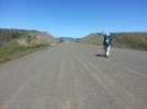
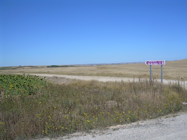
Not sure I was clear enough -- but Roman roads were dirt roads along most of their length, so that when I say that the current dirt roads are similar but the tarmacked sections are not, it was an answer.

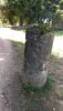
As to the paved section, virtually nothing remains of them, though some cobbled sections where the cobbles were maintained well into the Middle Ages (very locally, that's an exception to the general situation) do remain, though it's doubtful if it's in the original Roman configuration.

Some old roman roads, since tarmacked, that approach old towns do have the hump typical of those roads, but again these are just rare structural and infrastructural remnants.

And roads themselves are by their very nature infrastructures.
But when we encounter the stone roads that still sit at the surface, and we can see the cart ruts in the stones... well how much more shallow were they (if at all) 100 years ago? Were the stone sections significantly longer than they are now, or pretty much the same?
Well, one does have to remember that some of those paved/flagged roads that persist are Mediaeval or Renaissance, rather than Roman.

Many "Roman" roads or paths or ways in Europe are actually nothing of the sort -- there are four or five of them just locally ; but only one of them is the remnant, along mostly a different track than the original, of the Via Aurelia.

The others are pathways down from the mountains to the market town, and could be pre-roman, roman, mediaeval, or even early modern -- although the village uphill was the frontier between Cisalpine and Transalpine Gaul, and was an important hub for the road system, and has the remains of a major Roman Trophy monument.
I think of the Roman foundations below the approach to Notre Dame Church in Paris, for example.
The Roman city was mostly south of the river, in the accidentally well-named Latin Quarter -- named because the mediaeval scholars, Doctors, and theologians spoke Latin, not for the Roman origins of the quartier around the Sorbonne.

They established themselves there as Julius Caesar had demonstrated massive flaws in the defences of the two Parisian islands, that would only be corrected in the Middle Ages and by the mediaeval defensive ramparts architecture and the canalisation work on the river itself.
 
This new video mentioned by @Raggy in another post is excellent for answering a lot of questions about Roman roads. The prevention is in clear Spanish which you can slow down if desired by clicking on settings. You can also add subtitles. Even if you don't understand a word of Spanish, the visuals are understandable and fascinating.
Roads:
www.rtve.es

Roman engineering - Roads - RTVE.es

In this documentary, the Public Works engineer Isaac Moreno will take us to fly over the plains of Spain and France, in which we will observe the paths and vestiges of the Roman roads.
www.rtve.es
 
Join the Camino Cleanup in May from Ponferrada to Sarria. Registration closes Mar 22.
Thank you @islandwalker , this looks fantastic. It will not play for me, though, either because of my slow connection or because of something else. Is anyone else out there having trouble?
Hmm...that is a shame, because watching the entire series is like taking a course in Roman engineering. The narrator is enthusiastic and the topics are presented as mysteries to be solved. The visuals alone, especially the animated reenactments, are stunning.

As to why it won't play for you, I'm guessing it might be your internet speed. RTVE has restrictions by country on many of its documentaries, but this one doesn't seem to have country restrictions (although, how would I know since I am only accessing it from the US?). I hope people from other countries will try it out and be able to give you a better answer!
 
because watching the entire series is like taking a course in Roman engineering. The narrator is enthusiastic and the topics are presented as mysteries to be solved. The visuals alone, especially the animated reenactments, are stunning.
Yes, a pity because it looks like there are some fantastic videos, right up my alley. I have bookmarked the post, though, so that I can try another time (and/or place).
 
New Original Camino Gear Designed Especially with The Modern Peregrino In Mind!
On my 2019 pilgrimage, I walked two sections of paths which I had been informed were Roman roads: a section of the route up to Fuenfria Pass on the Madrid and an interesting walk from near Diamondi down to the river crossing at Belesar, on the Invierno. My time at Diamondi and the walk down the Roman road to the river made that morning a high point on all my pilgrim walking. And besides, it was not raining. The two stretches of "Roman" road were quite different. The path up towards the Fuenfria pass was very rough, requiring some leaping from stone to stone (I had got off the pilgrim path, which was very busy with local hikers on that fine day. Where I ended up walking was quite an adventure). I would not have missed my visit to Diamondi and walk down the cobbled path there a month or so later for anything. The combination of the amazing old church and the steep cobbled path made me feel like a genuine ancient pilgrim on the Way to Santiago. And the building adjacent to the church is being made into an albergue, for anyone who would like to experience this.
 
Watching now on my hotspot and it’s *amazing* — a hotel! That gives evidence to the amount of traffic on that particular road! *Swoon*
Thank you @islandwalker
Oh, @Faye Walker, I am so glad you like it. All three of us in our family are loving this series. We can hardly believe our eyes at some of the steps taken to produce these constructions. I thought I knew a lot about Roman roads and aqueducts, but wait til you see the real story behind those aqueducts. Just amazing to think of the precision they accomplished in terms of slope. And all the wells/airshafts/access shafts for the tunneled sections - wow!
Here's the first one in the aqueduct series to add to Raggy's list above:
https://www.rtve.es/alacarta/videos/ingenieria-romana/acueductos/5781769/
My time at Diamondi and the walk down the Roman road to the river made that morning a high point on all my pilgrim walking.
@Albertagirl , what a great experience!
 

❓How to ask a question

How to post a new question on the Camino Forum.

Similar threads

Forum Rules

Forum Rules

Camino Updates on YouTube

Camino Conversations

Most downloaded Resources

This site is run by Ivar at

in Santiago de Compostela.
This site participates in the Amazon Affiliate program, designed to provide a means for Ivar to earn fees by linking to Amazon
Official Camino Passport (Credential) | 2024 Camino Guides
Back
Top