• For 2024 Pilgrims: €50,- donation = 1 year with no ads on the forum + 90% off any 2024 Guide. More here.
    (Discount code sent to you by Private Message after your donation)

Search 69,459 Camino Questions

Topography - does it really matter??

PilgrimPillar

Rota Vicentina, fisherman’s trail, is sweet...
Time of past OR future Camino
Please come with
suggestions….
Thx….!!
From time to time there is questions regarding alternative routes and how physically challenging they are.

As picture is illustrating our background coulors our answers and viewpoint. My upbringing in Norway as a land of «fjords, valleys and mountains» reflects inclination to focus less on topography.

Why? Going uphill we just walk at a slower pace. Nothing more, nothing less.

Is this a way to over simplify the matter at hand? Do I dilute the message?? What is your opinion???

Happy new year caminandes!
🌲🫎🇳🇴☃️🎅🏻🎁
IMG_1919.jpeg
 
3rd Edition. More content, training & pack guides avoid common mistakes, bed bugs etc
From time to time there is questions regarding alternative routes and how physically challenging they are.

As picture is illustrating our background coulors our answers and viewpoint. My upbringing in Norway as a land of «fjords, valleys and mountains» reflects inclination to focus less on topography.

Why? Going uphill we just walk at a slower pace. Nothing more, nothing less.

Is this a way to over simplify the matter at hand? Do I dilute the message?? What is your opinion???

Happy new year caminandes!
🌲🫎🇳🇴☃️🎅🏻🎁
View attachment 161504
For me it makes a difference. I weigh 48 kilo and therefore am carrying a bit over 10% of my body weight esp when taking water and food needs for the day into account. I need to train for hills in advance of starting or I suffer in the first 5 days or so.
 
Is this a way to over simplify the matter at hand?
Yes. highlanders are used to walking uphill; lowlanders are not. Even if lowlanders do walk slower they are going to hurt, maybe even for a few days. Thinking of the Route Napoleon and the descent to Zubiri I see several opportunities for the pain to turn into real injuries from falling or twisting ankles or knees.
 
A selection of Camino Jewellery
It's simple: Things we are used to are easy. Things we are not used to are difficult. With training we can get used to new things and make them easier. So with regards to the Camino and elevation some have to train, some don't. Guess that is simple enough ;-)
 
Last edited:
It can be as simple as a mental challenge for those unused to steep inclines. Then there is the very real issue of knee problems when going downhill on steep grades or lack of cardio fitness going up.

It’s not necessarily as straightforward as just going slower for everyone…..although I know what you mean. On most holidays we hike. Not everyone is the same and the things we find enjoyable, others have found a bit horrific……not because we are doing anything unusual but rather, we just do it. As we have gotten older, the challenges increase but, in our view, that is how we will keep on getting older. The alternative of lack of mobility would truly be horrific.
 
Is this a way to over simplify the matter at hand? Do I dilute the message?? What is your opinion???

Happy new year caminandes!
🌲🫎🇳🇴☃️🎅🏻🎁
Yes, probably over simplified. I'll have to check with my aching bones and get back to you.
Happy & Safe Trails in 2024!
P.S. That is a beautiful topo map.
 
Down bag (90/10 duvet) of 700 fills with 180 g (6.34 ounces) of filling. Mummy-shaped structure, ideal when you are looking for lightness with great heating performance.

€149,-
Great topo map ..which also highlights those nations who are used to hills and those who are not. The are nots don't get much practice. People who live in bungalows ( one story houses) often struggle with stairs

In short, the route napoleon will be easy for some and very hard for others. Fore warned is fore armed
 
I think the issues come from anticipation of the unknown. The big secret of the repeat Peregrinos is that if you lower your expectations you’re in for a great experience. The internet, and social media especially, has made it easier to try to micro-manage and IMHO the Camino’s not like that.

I have, on several occasions wondered ‘where exactly is this fearsome climb?’, only to find it was several miles previously.
 
A selection of Camino Jewellery
From time to time there is questions regarding alternative routes and how physically challenging they are.

As picture is illustrating our background coulors our answers and viewpoint. My upbringing in Norway as a land of «fjords, valleys and mountains» reflects inclination to focus less on topography.

Why? Going uphill we just walk at a slower pace. Nothing more, nothing less.

Is this a way to over simplify the matter at hand? Do I dilute the message?? What is your opinion???

Happy new year caminandes!
🌲🫎🇳🇴☃️🎅🏻🎁
View attachment 161504
I agree. One important key to hiking fitness is simple….become a regular walker. Walk almost daily. Cycling probably also qualifies. This is not a training issue. This is a lifestyle issue. Walking up is tougher aerobically. Walking down is tougher physically. Pace and breath control are very important skills to acquire when walking distances. For me this means finding my pace. On aerobic uphills this means a pace where I control my breathing. If your breathing gets out of control you need to ask yourself why this is happening. Maybe it is because you are walking too fast. Maybe you are tying to keep someone else’s pace. In long distance trekking we generally walk at least an hour before taking a break. You walk at a pace that you can maintain…almost like forever. You can…most of the time…also talk or maintain a conversation with proper pace and breath control. Most hikers also work to control their breathing. For me this a solid exhale that depending on terrain can be every step or every 2, 3, or 4 steps. A solid exhale helps me to know that I also have a strong inhale which brings oxygen to all the cells in my body. Feeding your cells is what it takes to walk long distances. This is the way to put one foot in front of the other virtually continuously regardless of the terrain.
 
€2,-/day will present your project to thousands of visitors each day. All interested in the Camino de Santiago.
The issue with simply walking slower is how much longer it takes and how different the trail conditions are when one is walking at night in the dark with a dead cell phone battery on a very steep downhill because one missed the turn for the less steep trail (I speak from experience :)).
 
For those not used to hills or mountains, yes, topography does make a difference, in my opinion (and experience).

For those who carry heavier loads (body weight or backpack) it also does.

For those with medical problems as well (knees, heart...).

It can be very important for planning stages (when will you arrive? In time before dark in difficult terrain? Before the storm hits? Before you run out of water? Ect.)

Not that important on most Caminos, but on more remote paths with less infrastructure, where not reaching the next water spot or refuge in time because you got too slow can be catastrophic, topography definitely matters.

But I'd guess for the experienced hill- and mountain hikers, on the other hand, walking easy paths on endless flat "boring" plains like the meseta might be challenging just as well, but more mentally...?
 
I spent 2 weeks in Norway back in 1970 during my "European Experience" backpacking trip and still remember those magnificent fjords (and ferry trips in between). At 79 with health/wealth deficiencies and tyranny of distance (from Australia) my Camino experience is limited to making Web-Apps as "virtual tours" and that is MOST satisfying for me and easy on the knees.
 
The focus is on reducing the risk of failure through being well prepared. 2nd ed.
It makes a difference in the time you allow to complete your days journey, how much food and water you will need and possibly how exposed the route may be. The first day of the Camino Frances out of SJPDP is a classic example.
 
Maybe not if you're young and/or healthy, but if you have bad knees or whatever, then yes topography makes a huge difference.

If there is an easier alternative to an "official" route, I nearly always follow it, even if it's tarmac instead of trail. I have occasionally taken detours of some dozens of kilometres to avoid a certain topographical feature.
 
Going uphill we just walk at a slower pace.
Precisely. That is how we calculate when we are likely to arrive at our destination or whether we actually have enough time at all. We always make a point of looking at the profile for each day´s stage of the camino so that we at least know what to expect, and we are experienced hikers. Many people who walk the camino have no experience of walking at all, so topography can make a world of difference.
 
The 2024 Camino guides will be coming out little by little. Here is a collection of the ones that are out so far.
I think the issues come from anticipation of the unknown. The big secret of the repeat Peregrinos is that if you lower your expectations you’re in for a great experience. The internet, and social media especially, has made it easier to try to micro-manage and IMHO the Camino’s not like that.

I have, on several occasions wondered ‘where exactly is this fearsome climb?’, only to find it was several miles previously.
The unknown and lesser expectations….I like that 👍
 
It all boils down what one is used to. I am not highly trained and not especially young, but I do some walking in the Swedish mountains now and then. There was no climb on the Camino Frances that I considered exhausting. It felt like a gentle up and down. There were maybe two climbs on the Camino Primitivo that felt a bit exhausting, but nothing I would consider a challenge. My daily mileage was a self-chosen challenge, sometimes the heat was, but not the climbs. But then I do know that there are others who are not used to it or are not so lucky. Walking uphill can be a motion for your legs, feet and the joints that you are not used to. It may lead to injury, the same when walking downhill. No matter how slowly you walk, some people get knee problems when they do. So I know for many people topography plays an enormous role, even if they walk slowly and short distance only.
 
Join our full-service guided tour and let us convert you into a Pampered Pilgrim!
From time to time there is questions regarding alternative routes and how physically challenging they are.

As picture is illustrating our background coulors our answers and viewpoint. My upbringing in Norway as a land of «fjords, valleys and mountains» reflects inclination to focus less on topography.

Why? Going uphill we just walk at a slower pace. Nothing more, nothing less.

Is this a way to over simplify the matter at hand? Do I dilute the message?? What is your opinion???

Happy new year caminandes!
🌲🫎🇳🇴☃️🎅🏻🎁
View attachment 161504
Sounds good to me, we have a couple of those fjords, valleys and mountains as well
🥝
 
I didn't read every post here, but, I agree with the concept that "what we are used to is easy" however, having just done Le Puy-en-Velay to Lectoure, topography was viewed before hand (but not fully appreciated) BUT we were not expecting the actual terrain... the roots, the rocks and the narrow (barely a shoe wide) ruts we would be placing our feet in while walking. That too is an element in measuring "challenge" ... 1703944819870.png
 
St James' Way - Self-guided 4-7 day Walking Packages, Reading to Southampton, 110 kms
BUT we were not expecting the actual terrain... the roots, the rocks and the narrow (barely a shoe wide) ruts we would be placing our feet in while walking. That too is an element in measuring "challenge" ...
Oh yes, on the Via Podiensis a few days after LePuy, here is my friend climbing up a steep path. Did you say roots and rocks? 😅
Screenshot_20231230-084046~2.pngScreenshot_20231230-084110~2.png
 
Join our full-service guided tour of the Basque Country and let us pamper you!
From time to time there is questions regarding alternative routes and how physically challenging they are.

As picture is illustrating our background coulors our answers and viewpoint. My upbringing in Norway as a land of «fjords, valleys and mountains» reflects inclination to focus less on topography.

Why? Going uphill we just walk at a slower pace. Nothing more, nothing less.

Is this a way to over simplify the matter at hand? Do I dilute the message?? What is your opinion???

Happy new year caminandes!
🌲🫎🇳🇴☃️🎅🏻🎁
View attachment 161504
I hate uphills.

I am a Norwegian like you (Tromsø).

Everywhere I look outside my windows, it is uphill. My country is pestered with it.

I love the Meseta: No uphills, except from Castrojeriz (But I stop there, sleep, and take the hill in the morning; 45 mins of climbing).

F**k uphills.

I don't llike downhills either; they are always followed by an uphill, it seems...
 
Last edited:
I suspect that in the more general sense than merely the hilly-ness of the terrain, topography is a major influence on the routes that we walk or ride today. Saying that, I also think we have many generations of our forebears to thank for plotting out pathways through the countryside that both take advantage of the natural shapes of the landscape, and avoid those parts which present more difficult going.

While the advent of trains and motor vehicles and the associated demand for rail and road networks suitable for heavy, long distance, haulage might have seen the pilgrim paths moved to less advantageous alignments, we don't seem to have been banished completely. I can think of a few places where the priority is abundantly clear. The roads and rail lines are built in the lower parts of the valleys, farmland then takes up the lower, arable slopes, and the pilgrim paths are then on the upper slopes in rougher terrain at the edge of the arable land.

There have been some interesting comments in this thread. This one sent me looking for the topographic map:
P.S. That is a beautiful topo map.
What I did find was a relief map, quite a different thing. But it was followed by this from the same member:
In the US Army, the most dangerous thing in battle is a second lieutenant with a road map,
I suppose someone who criticises the navigation skills of junior commissioned officers who wasn't able to tell the difference between a topographic map and a relief map might have caused a moment of mirth in the officers club afterwards. It certainly made me smile!

This one, however, does deserve a more serious response.
The issue with simply walking slower is how much longer it takes and how different the trail conditions are when one is walking at night in the dark with a dead cell phone battery on a very steep downhill because one missed the turn for the less steep trail (I speak from experience :)).
The first attempt I know of at formulating a calculation for this was in 1892, when a rule of thumb was developed by a Scot, Naismith. Many variations of this rule have followed, and Brierley's guides use a variation of this that looks similar to the corrections due to Tranter. You can find an explanation here, in Wikipedia.

@JulieandPeter, I don't think that there is any answer to the second part of your question better than 'as long as it takes'.

If the calculations shown in the Wikipedia article all look a little complicated, I agree. I use a variation that is much easier to calculate if you know the ascent and descent for a stage, such as is provided by Brierley in his guidebooks.

Equivalent distance= Distance + (ascent + 1/2 descent) * 0.008. where ascent and descent are in metres, and distance is in kilometres.​
If even that is going to challenge your arithmetical skills, add 15% of the ascent (in metres) to the distance (in km). I think that will give a small overestimate, but these are rules of thumb!

p.s., it is quite a nice relief map.
 
Last edited:
The 2024 Camino guides will be coming out little by little. Here is a collection of the ones that are out so far.
I didn't read every post here, but, I agree with the concept that "what we are used to is easy" however, having just done Le Puy-en-Velay to Lectoure, topography was viewed before hand (but not fully appreciated) BUT we were not expecting the actual terrain... the roots, the rocks and the narrow (barely a shoe wide) ruts we would be placing our feet in while walking. That too is an element in measuring "challenge" ... View attachment 161535
This is where being a hiker or training on hiking trails pays off.
 
From time to time there is questions regarding alternative routes and how physically challenging they are.

As picture is illustrating our background coulors our answers and viewpoint. My upbringing in Norway as a land of «fjords, valleys and mountains» reflects inclination to focus less on topography.

Why? Going uphill we just walk at a slower pace. Nothing more, nothing less.

Is this a way to over simplify the matter at hand? Do I dilute the message?? What is your opinion???

Happy new year caminandes!
🌲🫎🇳🇴☃️🎅🏻🎁
View attachment 161504
I like it! Thanks for that message. I wonder why do we overthink things and want them to be different than they are? Just go slower up hill nothing more and nothing less is a perfect answer. C’est La vie.
 
I think the issues come from anticipation of the unknown. The big secret of the repeat Peregrinos is that if you lower your expectations you’re in for a great experience. The internet, and social media especially, has made it easier to try to micro-manage and IMHO the Camino’s not like that.

I have, on several occasions wondered ‘where exactly is this fearsome climb?’, only to find it was several miles previously.
I agree entirely. I’m not fit, don’t live in a hilly place, don’t really train (I do about 4 weekends of 2-3 hr walks before a Camino) I try not to overthink things. I have tendonitis, am young in my 60’s and try really hard to be in the moment and Listen to my body. When I’m tired I rest, if the hills steep I slow down, if I’m sore I walk less. On my first walk a very experienced pilgrim told me “any walk takes 4-7 days to get used to, depending on your fitness and experience”

I understand this ethos doesn’t work for incapacitated people and for them a Camino IS too difficult.

I watch people March past me at breakneck speed and wonder why?
I try not to prebook accommodation (more than one day out), as then I can’t stop when I’m tired or when something wonderful comes along.
A Camino is my rare chance to not micromanage or preplan anything and just go with the flow for a complete adventure.
I understand it is hard for people to trust in themselves and the process but honestly I’ve found the Camino just provides if I let it.
 
The 2024 Camino guides will be coming out little by little. Here is a collection of the ones that are out so far.
I agree entirely. I’m not fit, don’t live in a hilly place, don’t really train (I do about 4 weekends of 2-3 hr walks before a Camino) I try not to overthink things. I have tendonitis, am young in my 60’s and try really hard to be in the moment and Listen to my body. When I’m tired I rest, if the hills steep I slow down, if I’m sore I walk less. On my first walk a very experienced pilgrim told me “any walk takes 4-7 days to get used to, depending on your fitness and experience”

I understand this ethos doesn’t work for incapacitated people and for them a Camino IS too difficult.

I watch people March past me at breakneck speed and wonder why?
I try not to prebook accommodation (more than one day out), as then I can’t stop when I’m tired or when something wonderful comes along.
A Camino is my rare chance to not micromanage or preplan anything and just go with the flow for a complete adventure.
I understand it is hard for people to trust in themselves and the process but honestly I’ve found the Camino just provides if I let it.
I agree 100%. When one has the luxury of time … anything is possible and going with daily flow very attractive.
 
From time to time there is questions regarding alternative routes and how physically challenging they are.

As picture is illustrating our background coulors our answers and viewpoint. My upbringing in Norway as a land of «fjords, valleys and mountains» reflects inclination to focus less on topography.

Why? Going uphill we just walk at a slower pace. Nothing more, nothing less.

Is this a way to over simplify the matter at hand? Do I dilute the message?? What is your opinion???

Happy new year caminandes!
🌲🫎🇳🇴☃️🎅🏻🎁
View attachment 161504
I believe you are over simplifying. That said, the primary key here, imo, is everyone who walks a Camino is different and they come from varying environments.

I believe very few people walk 20-30km's a day for a month. Therefore, the distance is the first issue.

Many are not used to the type of terrain they encounter even if they have experience walking.

Unlike when you live in a known area with or without ups and downs and challenging terrain, the Camino is an unknown. What is around the corner, over the rise or in the next valley.

Picking the wrong shoes. Carrying too much weight. Not addressing hot spots. These are other contributing challenges that need to be addressed.

I agree pace is important and it takes many people quite a bit of time to find their own stride.

The primary issue for the majority of first Camino walkers, imo, is the unknown and it is challenging to prepare for that type of experience.
 
I didn't read every post here, but, I agree with the concept that "what we are used to is easy" however, having just done Le Puy-en-Velay to Lectoure, topography was viewed before hand (but not fully appreciated) BUT we were not expecting the actual terrain... the roots, the rocks and the narrow (barely a shoe wide) ruts we would be placing our feet in while walking. That too is an element in measuring "challenge" ... View attachment 161535
That is one miserable looking path!
 
Down bag (90/10 duvet) of 700 fills with 180 g (6.34 ounces) of filling. Mummy-shaped structure, ideal when you are looking for lightness with great heating performance.

€149,-
Yes. highlanders are used to walking uphill; lowlanders are not. Even if lowlanders do walk slower they are going to hurt, maybe even for a few days. Thinking of the Route Napoleon and the descent to Zubiri I see several opportunities for the pain to turn into real injuries from falling or twisting ankles or knees.
I am really cheating now. I want to send this article so Rick sees it. I do think it could interest others. I send it, and let the fates decide. 😁
An Irishman’s Diary
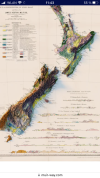
THE ORDNANCE SURVEY IN IRELAND IS COMMEMORATING THE BICENTENARY OF ITS FOUNDING IN 1824. PHOTOGRAPH: COURTESYOF TAILTE ÉIREANN
They tell stories, keep secrets and hold memories of places visited but long-forgotten. As an inspirational guiding light to exploring the landscape, they teem with life for walkers, cyclists and motorists. They help work out gradients and contours, the folds of valleys, locations of forests, lakes and rivers, the site of a deserted village, or lost harbour.
In short, maps offer the freedom to get lost and then find your way again.
This year the Ordnance Survey in Ireland is commemorating the bicentenary of its founding in 1824. Prior to partition, the OS was an all-Ireland body with its headquarters at Mountjoy House in Phoenix Park. But on January 1st, 1922, the OS of Northern Ireland was established in Belfast, while on April 1 st that year the OS of the Free State came into being, known as Ordnance Survey Ireland. On March 1 st, 2023, the OSI merged with the Property Registration Authority and the Valuation Office under a new State agency, Tailte Éireann, the “lands of Ireland”.
Originally founded in 1791, the organisation was set up to map the south coast of England over concern of invasion by Napoleon.
However, the work of the first survey in Ireland was initially to provide officials with the basis for a general valuation of the land. Later the six-inch maps found other applications with their remit becoming more complex than elsewhere.
The cross-disciplinary project incorporated folklore, literature, language, antiquities, and religion. It also extended to a parallel geological survey while detailed memoirs began in 1830.
Despite an official ban on any Irish involvement, the survey was forced to seek local expertise. This is where one of the key people came in: John O’Donovan, an Irish language scholar who worked on the survey and was later Professor of Celtic Studies at Queen’s University in Belfast, was tasked with the job. He was an authority on translation from Irish to English, determining the spelling and pronunciation, and suggesting anglicised versions of those names he documented.
Parts of the mapping process involved replacing ancient Gaelic place names with English ones. Vexed issues arose about aspects of Ireland’s toponymy with areas of disagreement between local authorities and mapmakers, while attempts were made to sabotage some measurements. Elements of this were showcased in Brian Friel’s tragicomedy Translations (1980), about colonialism, cultural identity, and erosion. The three-act play is set in 1833 in Ballybeg (translated from Baile Beag, or “small town”) a fictionalised place in Co Donegal, although several villages in Ireland are called Ballybeg.
Two centuries ago, surveyors tramped across shelterless bogland carrying a theodolite and chains, powerful lamps, clinometers and heliostats to control points at the tops of mountains. They plotted precise details recording variant place names in their field books and drawing hill sketches.
The artist and field geologist George Victor du Noyer – appointed as a topographical draughtsman – was employed by the OS to sketch significant features in the landscape and record the flora and fauna.
Fast-forward to the 21st century where smartphone apps, satnav, digital imagery, and the spatial data of the present day are a world removed from the methods of those first surveyors.
Today’s printed maps are decorated with a colour cover photograph, featuring perhaps a scenic coastal view, a beach or an aspect of antiquity. Spread a large OS sheet on the kitchen table and multilayered possibilities lie before you; open an app and you stare at a small screen and will struggle to find any romance in it.
The maps used by resolute hikers often reflect a personal history showing the inky zigzags of routes, hand-scrawled notes, compass bearings and scribbled telephone numbers.
Maps are power, offering knowledge and infinite suggestions to the mysteries of the countryside.
The information, stimulation and practical clues they provide are resources for writers, artists, musicians, storytellers and even diarists; in fact, one of the early surveyors, John Keegan, from Moate in Westmeath, kept a journal, A Young Irishman’s Diary, 1836-1847, published in 1928.
Apart from their obvious use in helping walkers locate the concrete trig pillars on mountain summits, the maps are invaluable in searching out quiet boreens.
A map is also a bond between strangers. Produce one in a café, pub, or on the street and you will draw the attention of locals wanting to help you find your way or point you, possibly, in the wrong direction.
Pore over the Discovery or Adventure series of maps and a hidden landscape comes alive with the thrill of anticipation: standing stones, promontory forts, ancient rock art carvings, holy wells, a packhorse bridge, or the location of cillíní – unbaptised children’s graves.
The map provides an itch and within seconds you are whisked to the outdoors, lost in the aesthetic pleasure of the curiosities of historical cartography. An hour later, like a drunken accordionist, you may well be wrestling to fold the map back into its crinkly concertina shape.
 
Oh yes, on the Via Podiensis a few days after LePuy, here is my friend climbing up a steep path. Did you say roots and rocks? 😅
View attachment 161536View attachment 161537

Oh yes, I remember such paths on the podiensis!

I had to use my hands quite a few times on some steeper paths uphill, with that giant backpack of mine and in sandals...

One particular hill, in '17, I crawled up in rain. It was pure mud. By the time I arrived up on the hill I must have looked like a pig that had taken a mud bath. Luckily, on the downhill part, a lightning storm started, and the rocky path down had become an ankle deep creek with nice, clear water to wash myself in! Lovely! The best part was that I realized later that I could have avoided all of that by walking a shortcut on a quiet backcountry road, all flat 🤣.

The climb up the hill after Cahors was downright scary to me. With a tiny daypack and /or mountain hiking experience I guess it is an easy walk in the park, with a wonderful view over Cahors. For this flat-pilgrim-highway-camino walker with a giant 15kg or so backpack, it was a near death experience.

In '22 I used the alternative path for pilgrims with horses and didn't regret it. Even though the alternative (on a quiet road) is longer, I arrived up on the hill before those who had taken the shorter official route, and without thinking every step that my backpack will pull me backwards and I'll fall to my death 🤣.
 
Last edited:
St James' Way - Self-guided 4-7 day Walking Packages, Reading to Southampton, 110 kms
I am really cheating now. I want to send this article so Rick sees it. I do think it could interest others.
@Kirkie, thank you for the love letter to topographical maps. I have a thing for maps. I even mentioned to a new neighbor this afternoon how the state has a website that allows one to overlay two topo maps from different years. In 1910 or so the brook that is several blocks away flowed through the land that our houses were built on. Maps can be fascinating.
 
A selection of Camino Jewellery
I didn't read every post here, but, I agree with the concept that "what we are used to is easy" however, having just done Le Puy-en-Velay to Lectoure, topography was viewed before hand (but not fully appreciated) BUT we were not expecting the actual terrain... the roots, the rocks and the narrow (barely a shoe wide) ruts we would be placing our feet in while walking. That too is an element in measuring "challenge" ... View attachment 161535
I think that super rocky terrain slows me down more than elevation gain.
 
THE ORDNANCE SURVEY IN IRELAND IS COMMEMORATING THE BICENTENARY OF ITS FOUNDING IN 1824
My favorite is the original maps of England and Wales by John Ogilby from 350 years ago which were featured in a TV doco in 2018 and included a (lost) Pilgrimage across Wales from Holywell (from the Holy Well Church) to St Davids in Pembrokeshire. I was so impressed I spent 2 months making a Web-App to try to "find" that same route using all the modern tools of Google. Here is the Web-App
I am also presently making a Web-App for another St Davids Pilgrim route, this one from Ireland.
 
a (lost) Pilgrimage across Wales from Holywell (from the Holy Well Church) to St Davids in Pembrokeshire
The major Welsh Way to Santiago cannot sadly be recreated fully, because it leads to point of embarkation that is no longer active -- so modern Welsh pilgrims wanting to walk from home would need to walk to a point on one of the English routes instead, and from there to one of the Channel ports.
 
The one from Galicia (the round) and the one from Castilla & Leon. Individually numbered and made by the same people that make the ones you see on your walk.
so modern Welsh pilgrims wanting to walk from home would need to walk to a point on one of the English routes instead, and from there to one of the Channel ports.
Or create their own route. I walked from my home near Swansea to Cardiff, followed the Wales Coast Path to Chepstow and crossed the Severn Bridge there. I then walked through Bristol and Bath and along the Kennet & Avon Canal to near Pewsey before turning south to cross the Channel from Portsmouth to St Malo.
 
I was given an example of how perceptions of difficulty vary with experience very recently when someone referred to the "mountain walking" on the Camino Ingles. Had never occurred to me that someone could see that particular route in such a light!
Thats a very good point……ones perspective being very much different🤔
 
St James' Way - Self-guided 4-7 day Walking Packages, Reading to Southampton, 110 kms
For me this a solid exhale that depending on terrain can be every step or every 2, 3, or 4 steps.
Yes! I start up a hill at 4 steps per breath and then “down shift” as needed.
I walked up a steep village road behind an old Portuguese woman. She had her head down, took short, slow steps and kept her pace all the way to the top. She’d probably been climbing that road her whole life. I followed her lead up every hill from then on!
 
The major Welsh Way to Santiago cannot sadly be recreated fully, because it leads to point of embarkation that is no longer active -- so modern Welsh pilgrims wanting to walk from home would need to walk to a point on one of the English routes instead, and from there to one of the Channel ports.
I am aware this is a Santiago forum but this thread is about a 200 year old map in Ireland so I ventured the 350 year old map in Wales which Griff has identified as an ancient pilgrimage route to St Davids (not Santiago) so sorry for the confusion but St Davids WAS a big item in those times and it was said 2 pilgrimages to St Davids were worth one to Rome (not sure what a Santiago one is worth - anyone know?)
 
I believe you are over simplifying. That said, the primary key here, imo, is everyone who walks a Camino is different and they come from varying environments.

I believe very few people walk 20-30km's a day for a month. Therefore, the distance is the first issue.

Many are not used to the type of terrain they encounter even if they have experience walking.

Unlike when you live in a known area with or without ups and downs and challenging terrain, the Camino is an unknown. What is around the corner, over the rise or in the next valley.

Picking the wrong shoes. Carrying too much weight. Not addressing hot spots. These are other contributing challenges that need to be addressed.

I agree pace is important and it takes many people quite a bit of time to find their own stride.

The primary issue for the majority of first Camino walkers, imo, is the unknown and it is challenging to prepare for that type of experience.
Thanks very much!
 
St James' Way - Self-guided 4-7 day Walking Packages, Reading to Southampton, 110 kms
I believe you are over simplifying. That said, the primary key here, imo, is everyone who walks a Camino is different and they come from varying environments.

I believe very few people walk 20-30km's a day for a month. Therefore, the distance is the first issue.

Many are not used to the type of terrain they encounter even if they have experience walking.

Unlike when you live in a known area with or without ups and downs and challenging terrain, the Camino is an unknown. What is around the corner, over the rise or in the next valley.

Picking the wrong shoes. Carrying too much weight. Not addressing hot spots. These are other contributing challenges that need to be addressed.

I agree pace is important and it takes many people quite a bit of time to find their own stride.

The primary issue for the majority of first Camino walkers, imo, is the unknown and it is challenging to prepare for that type of experience.
Your statement regarding pace is indeed very important especially the differing cadences. I have quite a high tempo compared to my younger brother, so I usually left him behind during our recently completed Camino Frances.
I found that walking at his pace was tiring, as I felt out of sync/rhythm and vice versa.
The phrase everyone's Camino is their own is so important! 😎🇳🇿
 
Last edited:
@PilgrimPillar, you’ve started a great thread, thanks!
Your map made me look for one of NZ- I feel our two beautiful countries have a lot in common ( although I’ve only visited / hiked in Norway twice so far). Clearly Norway has a few more mountains!
Our hiking trails often show hours rather than distance, because Altitude gains and terrain are more important than distance.

I’m currently following a bloke on the TA, two days ago they walked 17kms on fair Terrain in great weather, but with an altitude gain of 1500 metres (8.5 hours). Yesterday it was just 8.5km, with a gain of 250m, a decent of 1100m, rough terrain ( like @Camino Chrissy pictures but worse) in the pouring rain. It took them 5.5 hours. With full packs - tent, food, cooking gear etc. They’re fit - they’ve walked over 1500km so far.

People wonder why we like walking the Camino!

[ATTACH type="full" alt="25266CDA-5C98-4A6F-9B9D-8CB595C77255.png"]161787[/ATTACH]
 

Attachments

  • 25266CDA-5C98-4A6F-9B9D-8CB595C77255.png
    25266CDA-5C98-4A6F-9B9D-8CB595C77255.png
    2.5 MB · Views: 9
Last edited:
we have many generations of our forebears to thank for plotting out pathways through the countryside that both take advantage of the natural shapes of the landscape, and avoid those parts which present more difficult going.
So no Roman roads in Canberra then?

Before the Roman came to Rye or out to Severn strode,
The rolling English drunkard made the rolling English road.
A reeling road, a rolling road, that rambles round the shire,
And after him the parson ran, the sexton and the squire;
A merry road, a mazy road, and such as we did tread
The night we went to Birmingham by way of Beachy Head. (G.K.Chesterton, of course)
 
Last edited:
Technical backpack for day trips with backpack cover and internal compartment for the hydration bladder. Ideal daypack for excursions where we need a medium capacity backpack. The back with Air Flow System creates large air channels that will keep our back as cool as possible.

€83,-
@PilgrimPillar, you’ve started a great thread, thanks!
Your map made me look for one of NZ- I feel our two beautiful countries have a lot in common ( although I’ve only visited / hiked in Norway twice so far). Clearly Norway has a few more mountains!
Our hiking trails often show hours rather than distance, because Altitude gains and terrain are more important than distance.

I’m currently following a bloke on the TA, two days ago they walked 17kms on fair Terrain in great weather, but with an altitude gain of 1500 metres (8.5 hours). Yesterday it was just 8.5km, with a gain of 250m, a decent of 1100m, rough terrain ( like @Camino Chrissy pictures but worse) in the pouring rain. It took them 5.5 hours. With full packs - tent, food, cooking gear etc. They’re fit - they’ve walked over 1500km so far.

People wonder why we like walking the Camino!

[ATTACH type="full" alt="25266CDA-5C98-4A6F-9B9D-8CB595C77255.png"]161787[/ATTACH]
The Tararua Ranges, I presume?
 
@PilgrimPillar, you’ve started a great thread, thanks!
Your map made me look for one of NZ- I feel our two beautiful countries have a lot in common ( although I’ve only visited / hiked in Norway twice so far). Clearly Norway has a few more mountains!
Our hiking trails often show hours rather than distance, because Altitude gains and terrain are more important than distance.

I’m currently following a bloke on the TA, two days ago they walked 17kms on fair Terrain in great weather, but with an altitude gain of 1500 metres (8.5 hours). Yesterday it was just 8.5km, with a gain of 250m, a decent of 1100m, rough terrain ( like @Camino Chrissy pictures but worse) in the pouring rain. It took them 5.5 hours. With full packs - tent, food, cooking gear etc. They’re fit - they’ve walked over 1500km so far.

People wonder why we like walking the Camino!

[ATTACH type="full" alt="25266CDA-5C98-4A6F-9B9D-8CB595C77255.png"]161787[/ATTACH]
Crossing NZ is a dream of mine. Inspiration is there with videos portraying lush green scenery….🤔
 
3rd Edition. More content, training & pack guides avoid common mistakes, bed bugs etc
I didn't choose it randomly.
Of course not. There are around 30 countries in that map but hey, lets pick one that is flat that is not the Netherlands. Or Belgium. Or Luxembourg or any other other 12 flatter than Latvia. I asked a question about Russia, you introduced Latvia for no obvious reason and in a public forum that is random.
 
Of course not. There are around 30 countries in that map but hey, lets pick one that is flat that is not the Netherlands. Or Belgium. Or Luxembourg or any other other 12 flatter than Latvia. I asked a question about Russia, you introduced Latvia for no obvious reason and in a public forum that is random.
I'm going to suggest you don't really know what random means.
 
New Original Camino Gear Designed Especially with The Modern Peregrino In Mind!
My favorite is the original maps of England and Wales by John Ogilby from 350 years ago which were featured in a TV doco in 2018 and included a (lost) Pilgrimage across Wales from Holywell (from the Holy Well Church) to St Davids in Pembrokeshire. I was so impressed I spent 2 months making a Web-App to try to "find" that same route using all the modern tools of Google. Here is the Web-App
I am also presently making a Web-App for another St Davids Pilgrim route, this one from Ireland.
Thank you! Exceptional work. I am enjoying it very much.
 
Thank you! Exceptional work. I am enjoying it very much.
Thank you, but the downside is that Griff is a bit of a loose canon especially with his docos on the National Trust and he now seems to have fallen out with the BBC so his doco on this pilgrimage is suffering from Not Invented Here Syndrome and is no longer in their library, and the UTube trailer has also been removed and looks like Griff is down here in Australia doing yet another boring "Train Journey" gig.

I would love to explore this trail a bit more using the latest Google tools but unless there is some interest eg from Brit Pilgrim Trust I will not spend any more time on it
 
Ideal sleeping bag liner whether we want to add a thermal plus to our bag, or if we want to use it alone to sleep in shelters or hostels. Thanks to its mummy shape, it adapts perfectly to our body.

€46,-

Most read last week in this forum

We are leaving to do the whole Camino Frances in a week. I have two corns on my right foot that are becoming very painful - I have had them for years with little issue but over the last month with...
Have been walking my first Camino and loving it, until coming down with a nasty cold in Puente La Reina, with a bad headache, sore throat, deep chest congestion and developing cough. The...
I am a CPAP user, and would need to bring my machine as I need it at night during the Camino. I have a regular size Resmed (without the water chamber). My plan is - to pack it in the CPAP...
3 days ago, I developed a horrible shinsplint where I was barely walking--KT helped a little to get me through the day. So, I took a rest day and booked a nearby PT in pontevedra. Anna was able...
Hi all, just a quickie. My friend is near Burgos and needs a chairopractor to give his back a click 😳 Apparently he has it done when home in Canada (it straightens the spine )but doesn't know if...

❓How to ask a question

How to post a new question on the Camino Forum.

Forum Rules

Forum Rules

Camino Updates on YouTube

Camino Conversations

Most downloaded Resources

This site is run by Ivar at

in Santiago de Compostela.
This site participates in the Amazon Affiliate program, designed to provide a means for Ivar to earn fees by linking to Amazon
Official Camino Passport (Credential) | 2024 Camino Guides
Back
Top